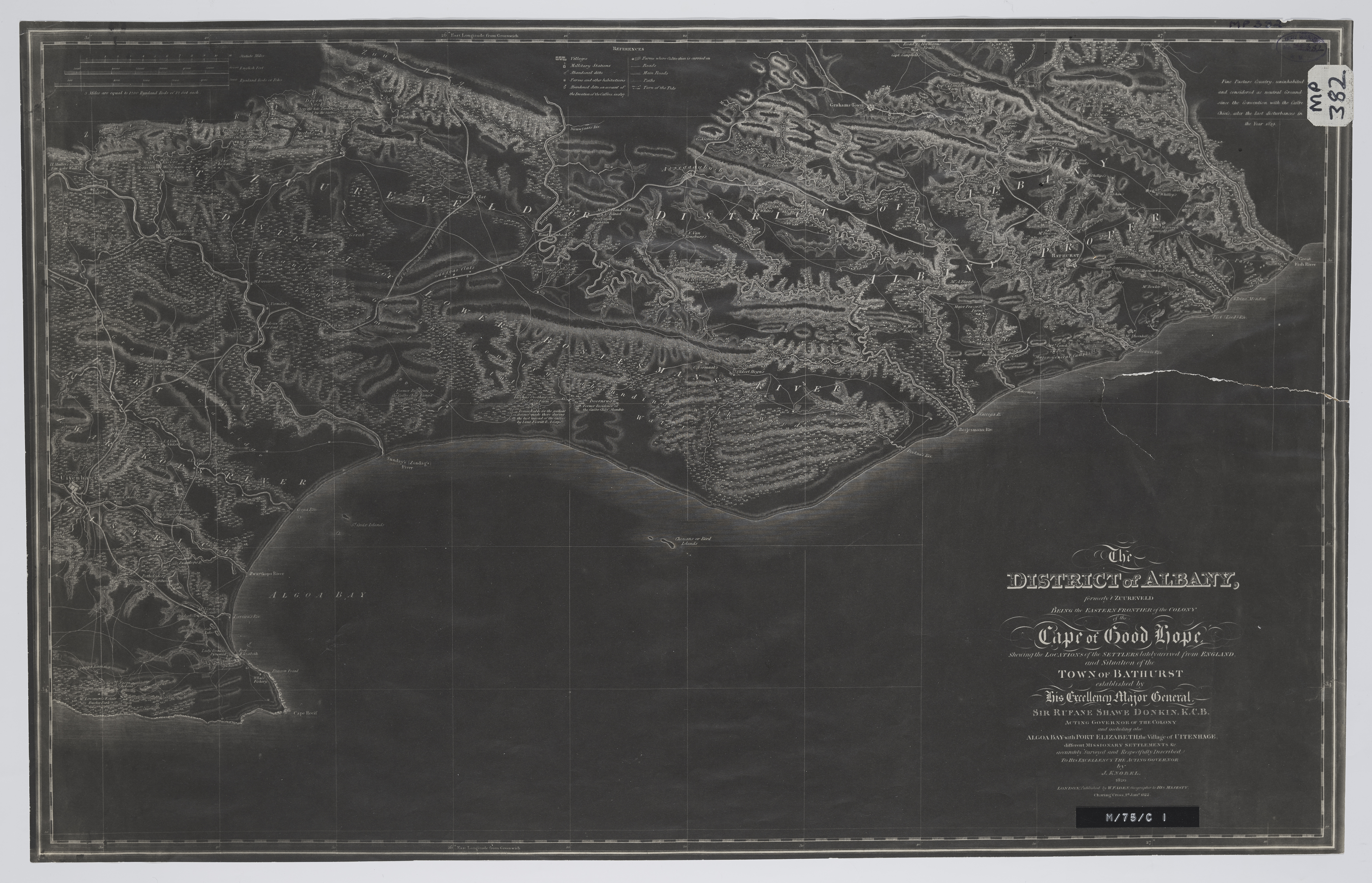
The district of Albany, formerly t'Zuureveld
Item
-
Alternative Title
-
The district of Albany, formerly t'Zuureveld, being the Eastern Frontier of the Colony of the Cape of Good Hope : shewing the locations of the settlers lately arrived from England and situation of the town of Bathurst established by His Excellency Sir Rufane Shawe Donkin, K.C.B., acting governor of the colony and including also Algoa Bay, Port Elizabeth, the village of Uitenhage, different missionary settlements etc., accurately surveyed and respectfully inscribed to his Excellency the Acting Governor
-
Date Issued
-
1822
-
Description
-
"Fine pasture country uninhabited and considered neutral ground".
-
Publisher
-
W. Faden
-
Type
-
cartographic
-
Genre
-
maps
-
Format
-
jpg
-
Extent
-
1 sheet, 60 x 38 cm
-
Language
-
English
-
Rights Holder
-
Knobel, J
-
Archive
-
Original held at Cory Library for Humanities Research, situated at Rhodes University.
-
Asset No.
-
MP382
-
Identifier
-
http://hdl.handle.net/10962/56858
-
useGuidelines
-
1 sheet, 60 x 38 cm