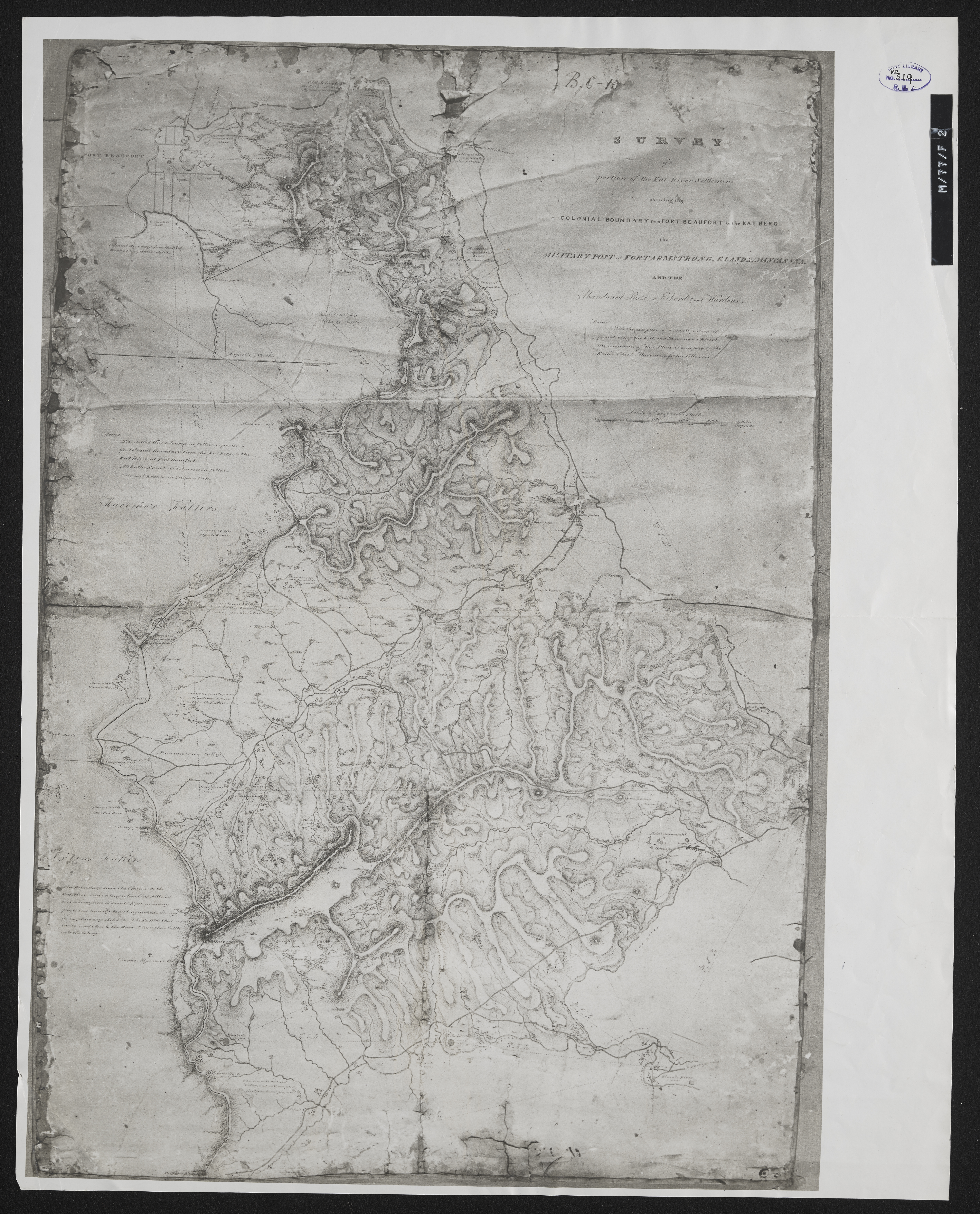
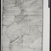
Survey of a portion of the Kat River Settlement shewing the colonial boundary from Fort Beaufort to the Kat Berg, the military post at Fort Armstrong, Elands [Post], Mancasana and the abandoned posts at Echardts and Warden's.
Item
-
Date Issued
-
1811-1878
-
Description
-
Survey of a portion of the Kat River Settlement shewing the colonial boundary from Fort Beaufort to the Kat Berg, the military post at Fort Armstrong, Elands [Post], Mancasana and the abandoned posts at Echardts and Warden's. Photograph of original.
-
Scale
-
1 inch = 1000 yards
-
Type
-
cartographic
-
Genre
-
maps
-
Format
-
jpg
-
Extent
-
1 sheet, 50 x 34 cm
-
Language
-
English
-
Archive
-
Original held at Cory Library for Humanities Research, situated at Rhodes University.
-
Asset No.
-
MP319
-
Identifier
-
http://hdl.handle.net/10962/115781
-
useGuidelines
-
Public Domain