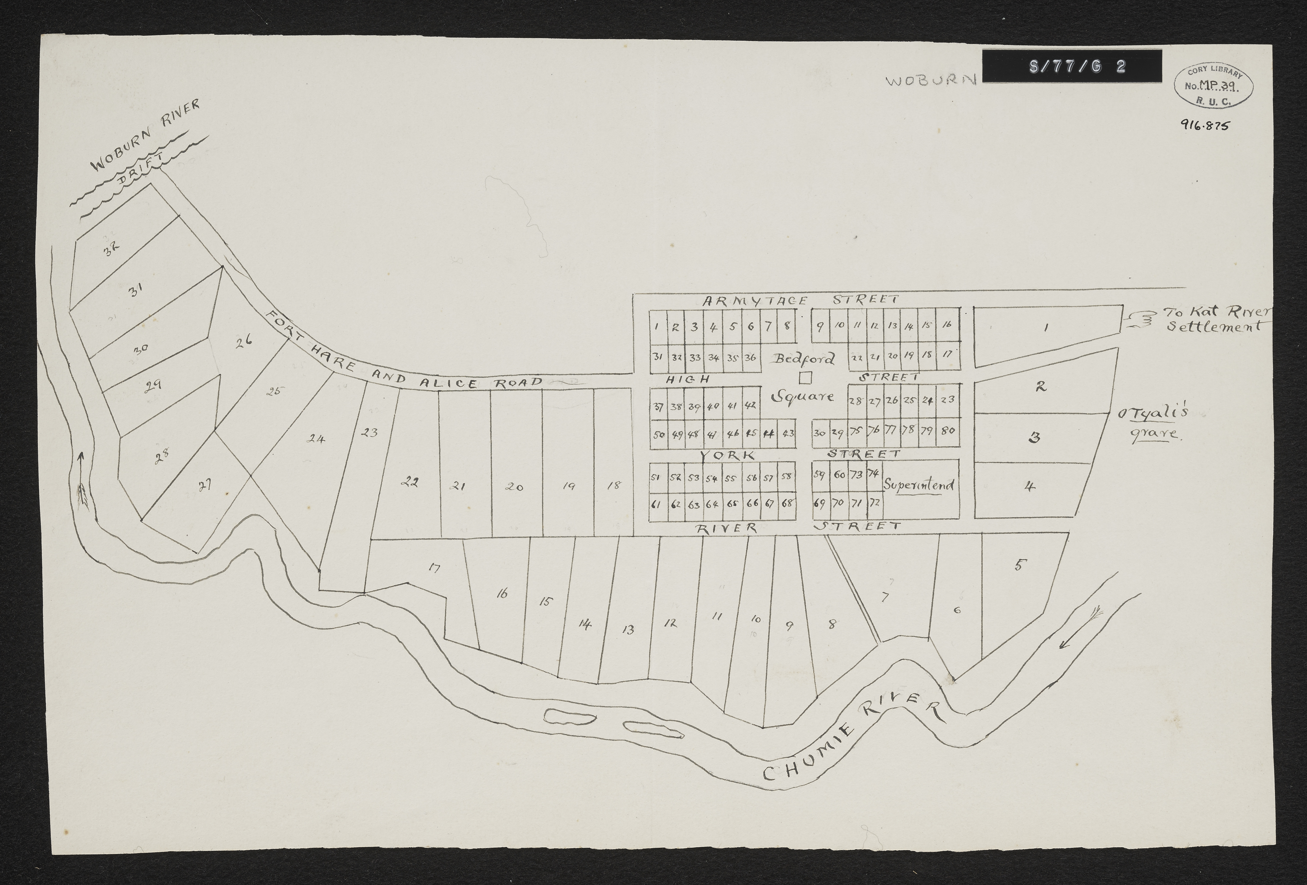
Woburn Military Village
Item
-
Date Issued
-
1848
-
Description
-
Woburn Military Village. No date on map but probably around 1848. Unsigned plan in some detail of the village, possibly as it was projected rather than as it actually appeared. Scale not stated. 1 sheet 14" x 9". Manuscript. From Sir George Cory's papers.
-
Type
-
cartographic
-
Genre
-
maps
-
Format
-
jpg
-
Extent
-
1 sheet, 14 x 9 in
-
Language
-
English
-
Archive
-
Original held at Cory Library for Humanities Research, situated at Rhodes University.
-
Asset No.
-
MP39
-
Identifier
-
http://hdl.handle.net/10962/104808
-
useGuidelines
-
Public Domain