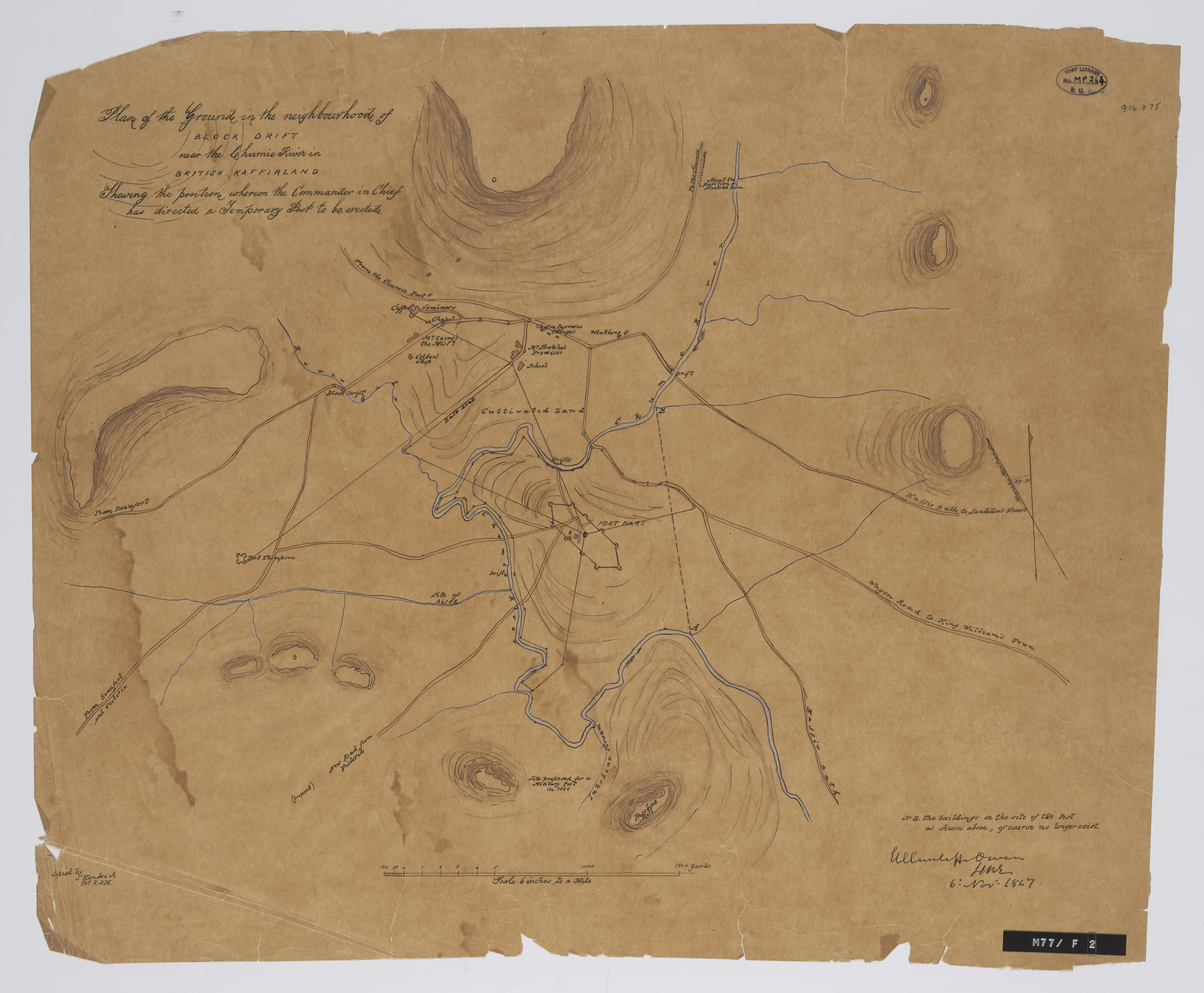
Plan of the ground in the neighbourhood of Block Drift near the Chumie River in Kaffirland : shewing the position whereon the commander in chief has directed a temporary post to be erected.
Item
-
Date Issued
-
1847
-
Type
-
cartographic
-
Genre
-
maps
-
Format
-
jpg
-
Extent
-
1 sheet, 16.5 x 19.5 in
-
Language
-
English
-
Rights Holder
-
Owen, H C C
-
Archive
-
Original held at Cory Library for Humanities Research, situated at Rhodes University.
-
Asset No.
-
MP264
-
Identifier
-
http://hdl.handle.net/10962/57421
-
useGuidelines
-
Public Domain