Free Church mission and Fort Hare : plan of the location and buildings
Item
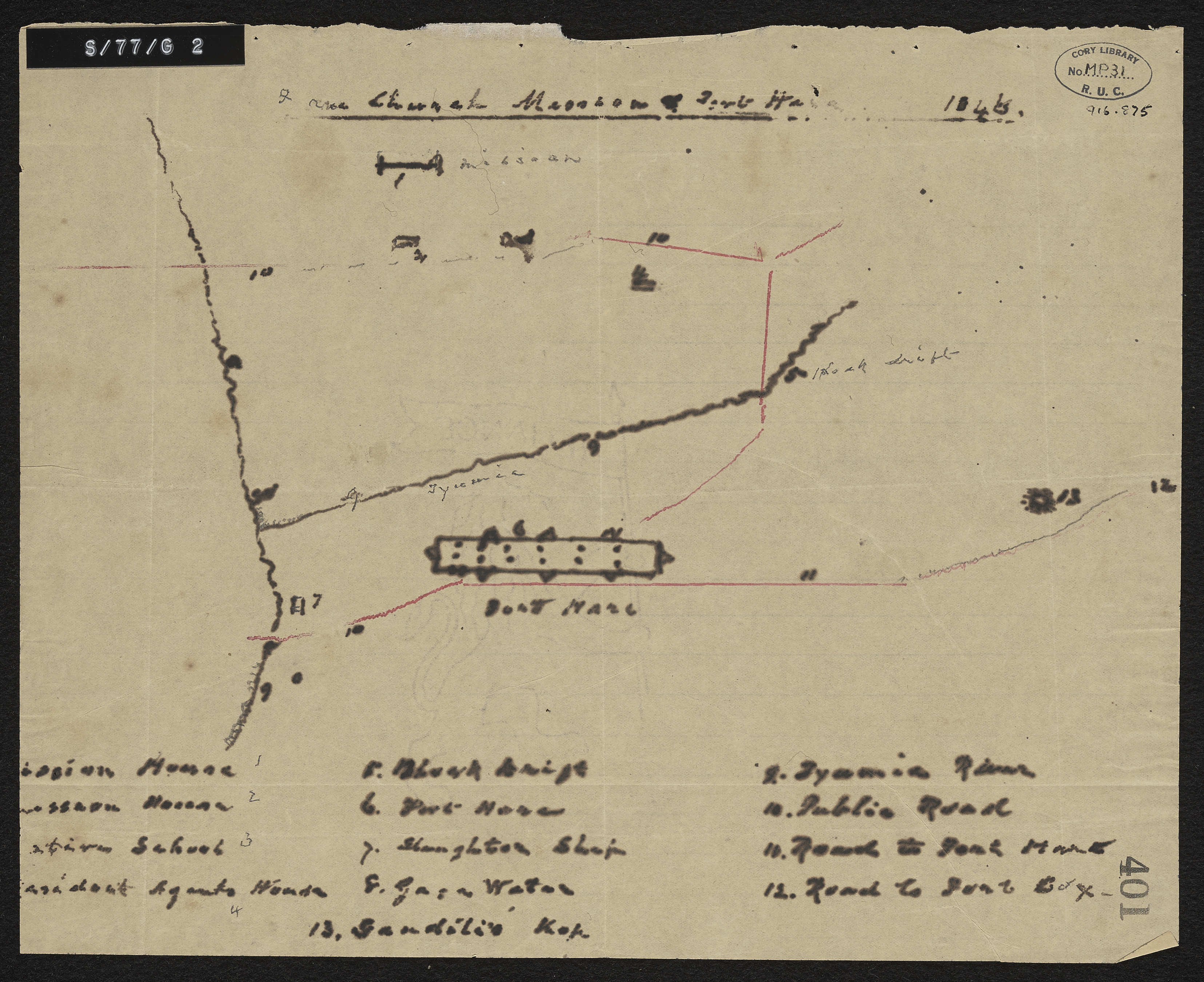
- Date Issued
- 1846
- Subject
- United Free Church of Scotland -- Missions -- Maps
- Missions -- South Africa -- Maps
- Fort Hare (South Africa) -- Maps
- Type
- cartographic
- Genre
- maps
- Format
- jpg
- Extent
- 1 sheet, 10.5 x 8.5 inches
- Language
- English
- Archive
- Original held at Cory Library for Humanities Research, situated at Rhodes University.
- Asset No.
- MP31
- Identifier
- http://hdl.handle.net/10962/57400
- useGuidelines
- Public Domain