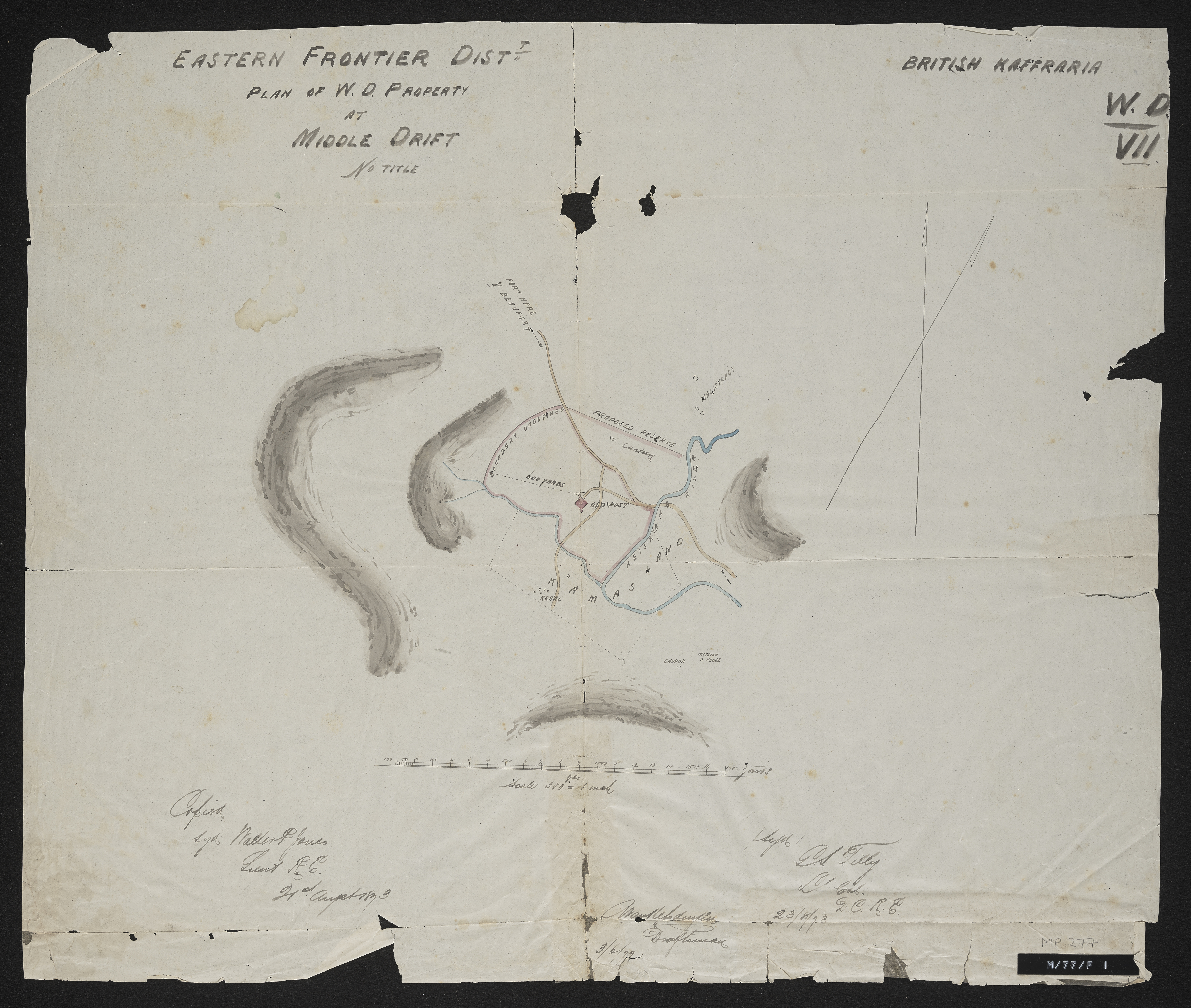
Eastern Frontier Dist. plan of W.D. property at Middle Drift,Eastern Frontier District plan of War Department property at Middle Drift
Item
-
Date Issued
-
1873
-
Description
-
Copied by Walter P. Jones, 21st August 1873. War Department number on map WD. VII.
-
Publisher
-
Great Britain. War Office
-
Type
-
cartographic
-
Genre
-
maps
-
Format
-
jpg
-
Extent
-
1 sheet, 15.5 x 30.5 inches
-
Language
-
English
-
Rights Holder
-
Great Britain. War Office,Jones, Walter P
-
Archive
-
Original held at Cory Library for Humanities Research, situated at Rhodes University.
-
Asset No.
-
MP277
-
Identifier
-
http://hdl.handle.net/10962/57204
-
useGuidelines
-
1 sheet, 15.5 x 30.5 inches