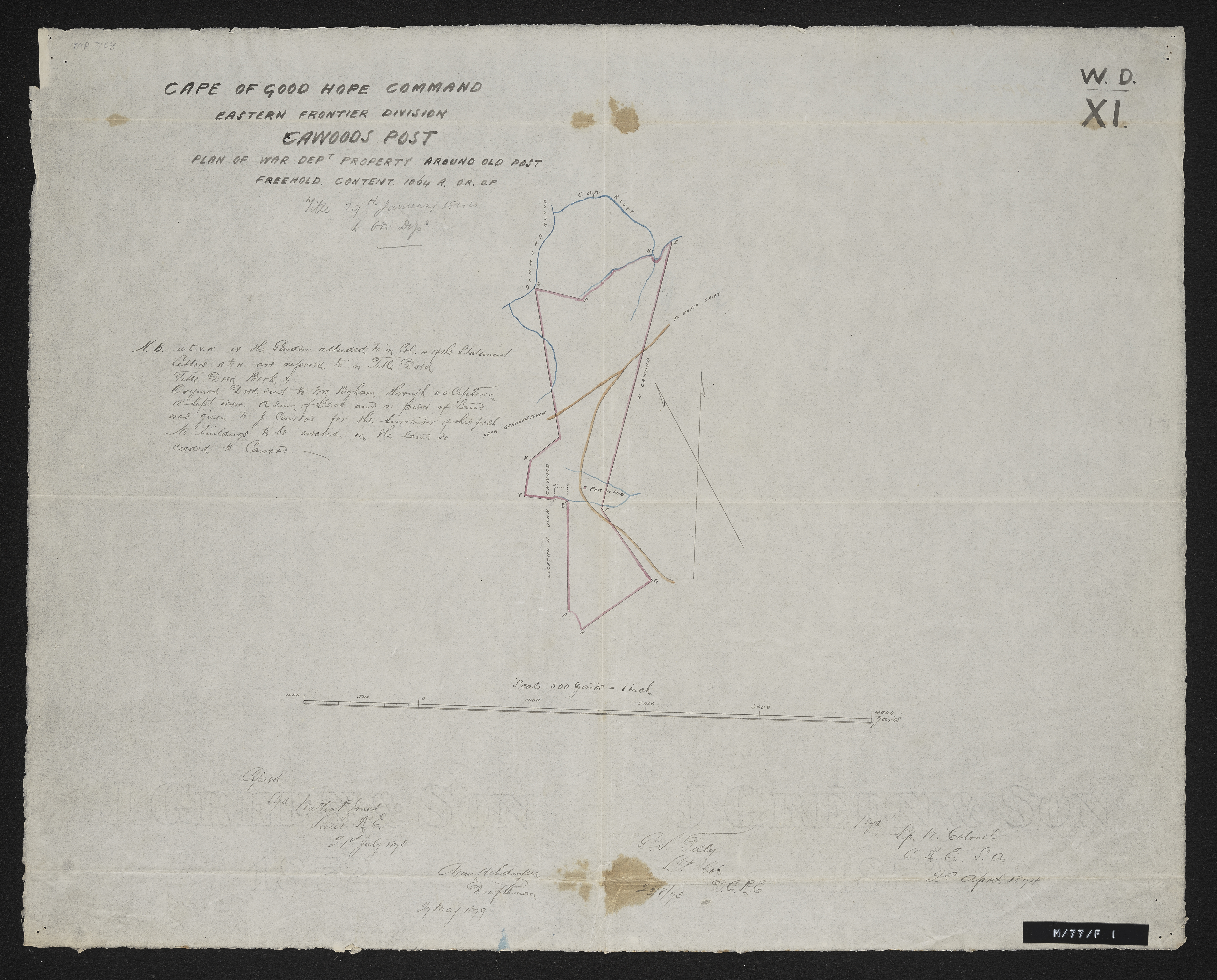
Cape of Good Hope Command Eastern Frontier Division - Cawood's Post: plan of War Department property around old post
Item
-
Date
-
1822
-
Description
-
"Fine pasture country uninhabited and considered neutral ground". Title 29th January 1944. Copied by Walter P. Jones, 21st July 1873.
-
Scale
-
500 yards = 1 inch
-
Coordinates
-
33°24.835'S, 26°55.743'E
-
Publisher
-
Great Britain. War Office
-
Geographic Scope
-
Near Bathurst, Eastern Cape
-
Time Span / Period
-
Late 1800's
-
Type
-
cartographic
-
Genre
-
maps
-
Format
-
jpg
-
Extent
-
1 sheet, 16 x 21 inches
-
Language
-
English
-
Rights Holder
-
Great Britain. War Office,Jones, Walter P
-
Archive
-
Original held at Cory Library for Humanities Research, situated at Rhodes University.
-
Asset No.
-
MP268
-
Identifier
-
http://hdl.handle.net/10962/57123
-
useGuidelines
-
1 sheet, 16 x 21 inches