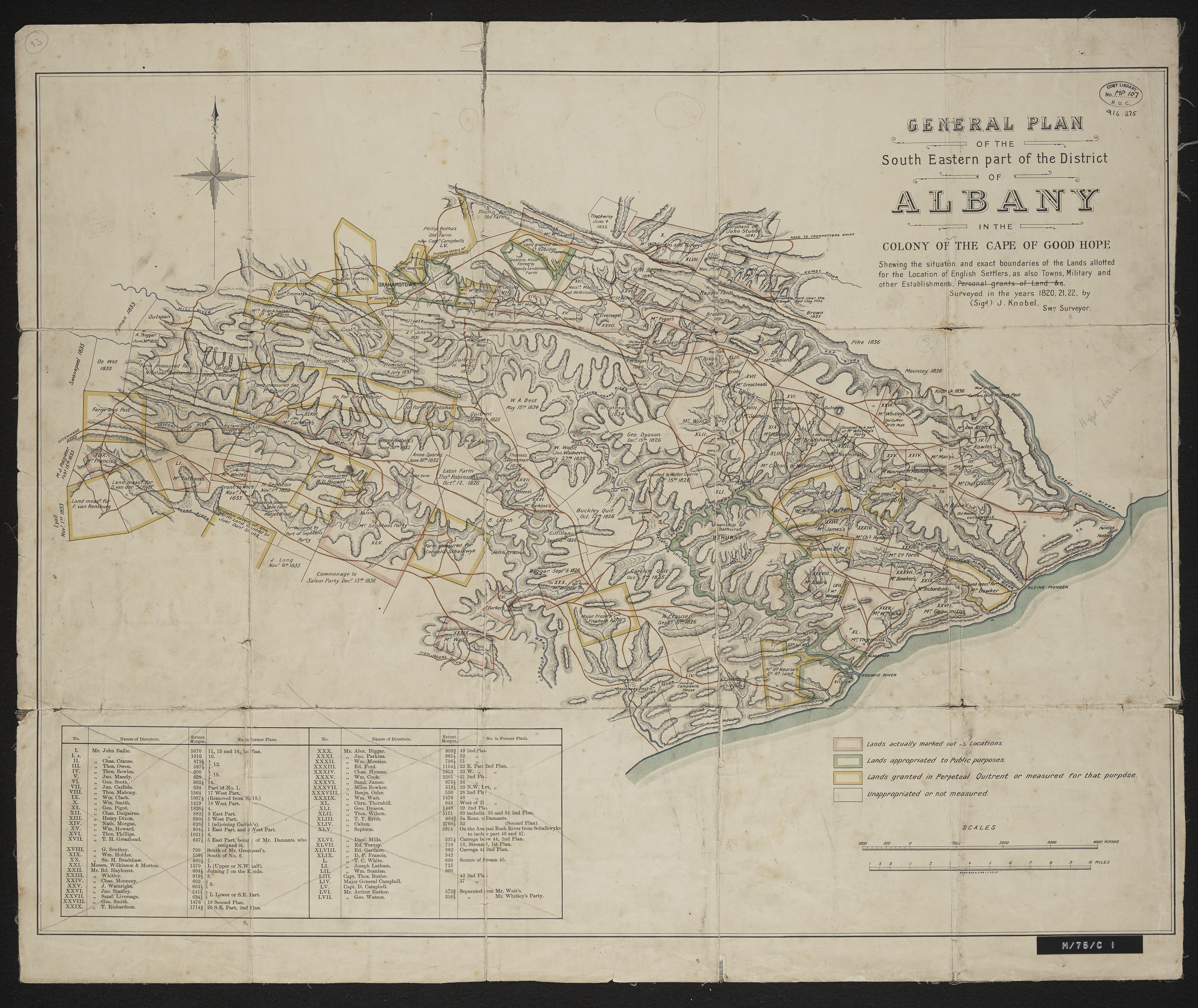
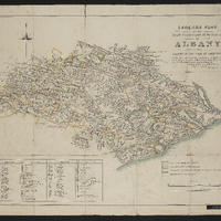
General plan of the South Eastern part of the district of Albany in the Colony of the Cape of Good Hope shewing the situation and exact boundaries of the lands allotted for the location of English Settlers as also towns, military and other establishments , personal grants of lands etc.
Item
-
Date Issued
-
1822
-
Publisher
-
Longman's, Green
-
Type
-
cartographic
-
Genre
-
maps
-
Format
-
jpg
-
Extent
-
1 sheet, 51 x 62 cm
-
Language
-
English
-
Rights Holder
-
Knobel, J
-
Archive
-
Original held at Cory Library for Humanities Research, situated at Rhodes University.
-
Asset No.
-
MP107
-
Identifier
-
http://hdl.handle.net/10962/55234
-
useGuidelines
-
1 sheet, 51 x 62 cm