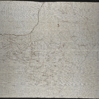
Missionary map of the Queenstown district showing Methodist, Anglican, Moravian, United Presbyterian and Free Church of Scotland stations
Item
-
Date Issued
-
18uu
-
Description
-
Missionary map of the Queenstown district showing Methodist, Anglican, Moravian, United Presbyterian and Free Church of Scotland stations.
-
Scale
-
1 inch = approximately 5 miles
-
Type
-
cartographic
-
Genre
-
maps
-
Format
-
jpg
-
Extent
-
1 sheet, 91 x 74.5 cm
-
Language
-
English
-
Archive
-
Original held at Cory Library for Humanities Research, situated at Rhodes University.
-
Asset No.
-
MP1452
-
Identifier
-
http://hdl.handle.net/10962/131006
-
useGuidelines
-
Public Domain