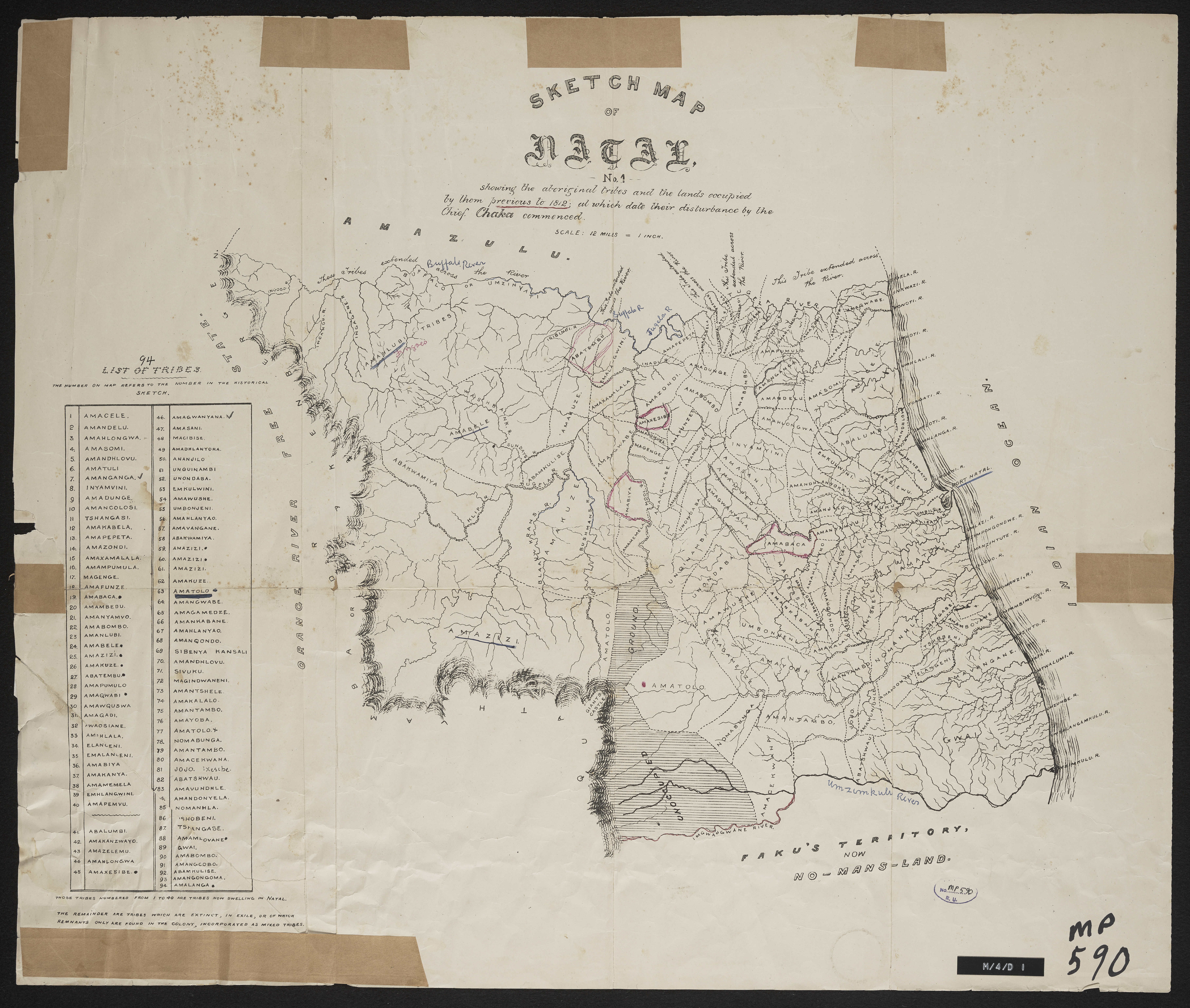
Sketch map of Natal No. 1
Item
-
Date Issued
-
1864
-
Description
-
Sketch map of Natal No. 1 showing the aboriginal tribes and the lands occupied by them previous to 1812, at which date their disturbance by the Chief Chaka commenced ; [1864]. Key contains a list of 94 tribes which originally occupied KwaZulu Natal.
-
Scale
-
1 inch = 12 miles
-
Type
-
cartographic
-
Genre
-
maps
-
Format
-
jpg
-
Extent
-
1 sheet, 60 x 50.5 cm
-
Language
-
English
-
Archive
-
Original held at Cory Library for Humanities Research, situated at Rhodes University.
-
Asset No.
-
MP590
-
Identifier
-
http://hdl.handle.net/10962/114094
-
useGuidelines
-
Public Domain