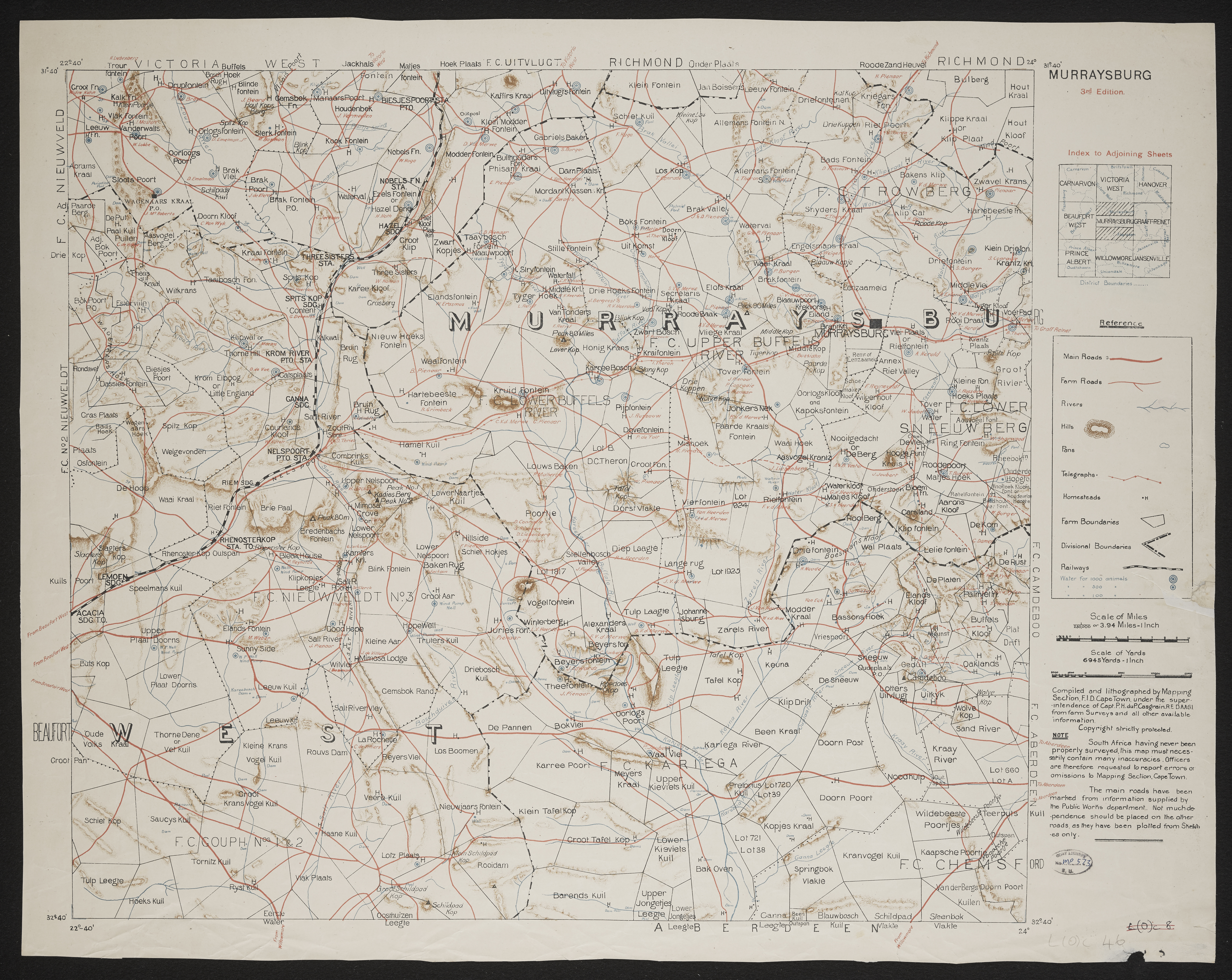
Murraysburg,Imperial map of South Africa : Murraysburg
Item
-
Date
-
1900
-
Description
-
[Imperial map of South Africa] : Murraysburg compiled and lithographed by Mapping Section F.I.D. Cape Town under the superintendance of Capt. P.H. Du P. Casgrain ... from farm surveys and all other available information, [Wood and Ortlepp] [1900].
-
Publisher
-
Wood and Ortlepp
-
Type
-
cartographic
-
Genre
-
maps
-
Format
-
jpg
-
Extent
-
1 color sheet, 49 cm x 63 cm
-
Language
-
English
-
Rights Holder
-
Casgrave, P H du P,Great Britain. War Office. Intelligence Division
-
Archive
-
Original held at Cory Library for Humanities Research, situated at Rhodes University.
-
Identifier
-
http://hdl.handle.net/10962/113280
-
useGuidelines
-
Public Domain