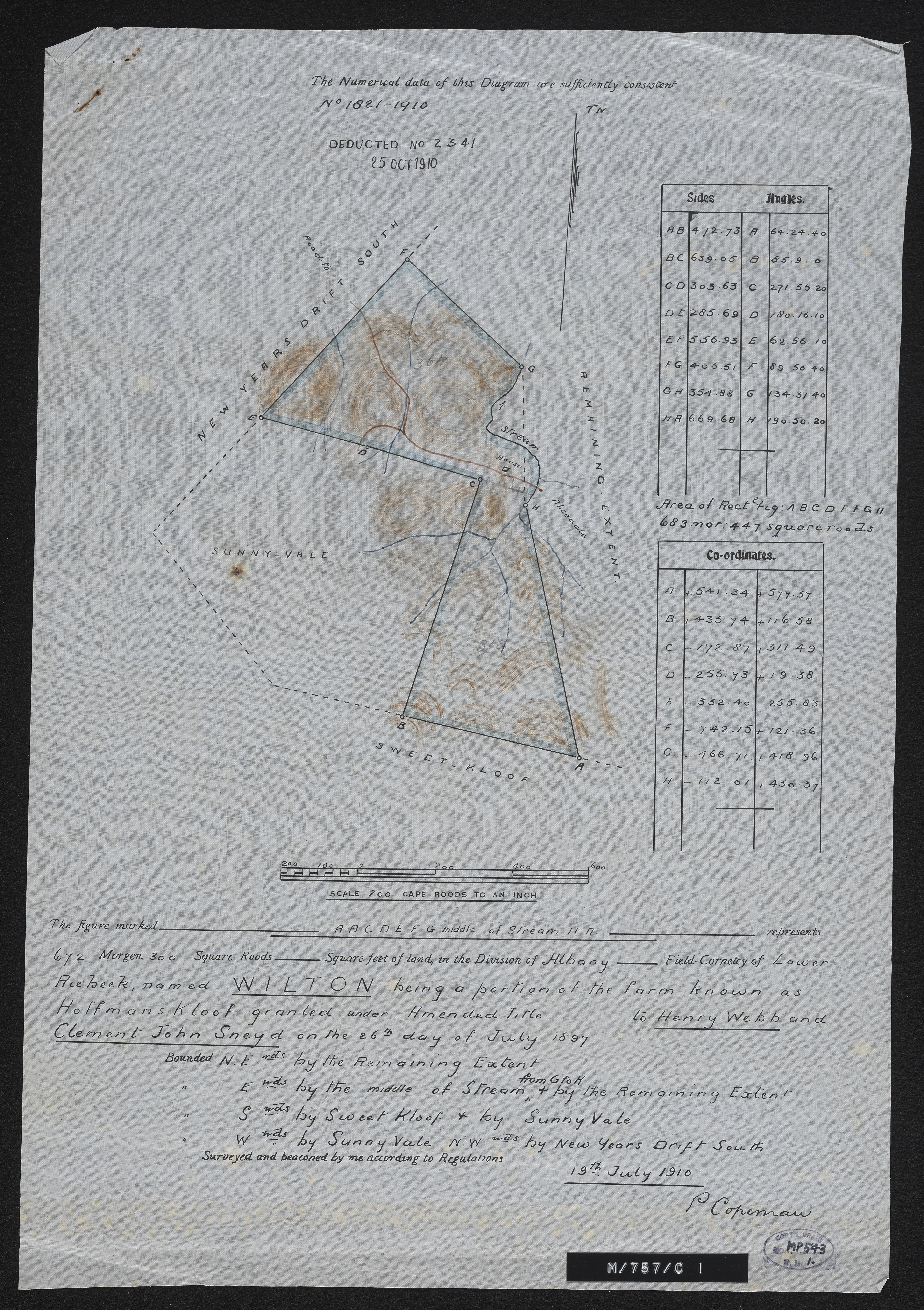
Diagram of the farm Wilton, being a portion of the farm known as Hoffman's Kloof
Item
-
Date
-
1910
-
Description
-
Diagram of the farm Wilton, being a portion of the farm known as Hoffman's Kloof, granted under amended title to Henry Webb and Clement John Sneyd on the 26th day of July 1897, surveyed and beaconed by me according to regulations 19th July 1910. P. Coperman. In the Division of Albany, Field Cornetcy of Lower Riebeek.
-
Scale
-
1 inch = 200 Cape roods
-
1 : 50000
-
Type
-
cartographic
-
Genre
-
maps
-
Format
-
jpg
-
Extent
-
1 sheet, 28 x 40.5 cm
-
Language
-
English
-
Rights Holder
-
Coperman, P
-
Archive
-
Original held at Cory Library for Humanities Research, situated at Rhodes University.
-
Asset No.
-
MP543.1
-
Identifier
-
http://hdl.handle.net/10962/112023
-
useGuidelines
-
Public Domain