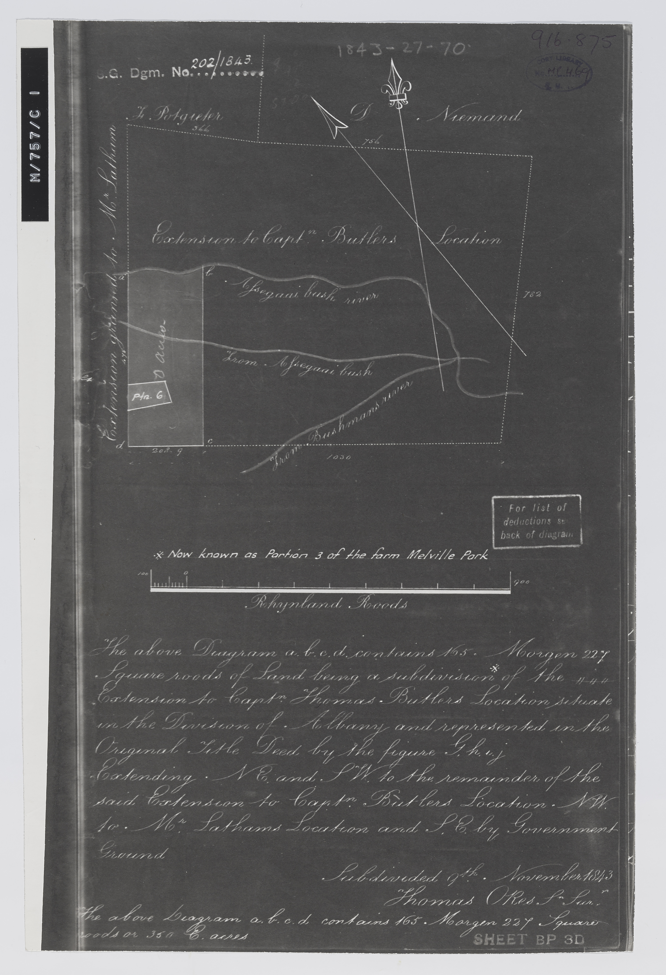
Melville Park Farm
Item
-
Date
-
1961
-
Description
-
Diagram of a subdivision of the extension to Capt Thomas Butler's location, now known as portion 3 of the farm Melville Park, situated in the division of Albany, subdivided 9th November 1843 [by] Thomas Okes. Photograph negative.
-
Scale
-
1 inch = 200 Rhynland roods
-
Publisher
-
Surveyor General's Office
-
Type
-
cartographic
-
Genre
-
maps
-
Format
-
jpg
-
Extent
-
1 sheet, 32 cm x 20 cm
-
Language
-
English
-
Rights Holder
-
Okes, Thomas
-
Archive
-
Original held at Cory Library for Humanities Research, situated at Rhodes University.
-
Asset No.
-
MP469
-
Identifier
-
http://hdl.handle.net/10962/109599
-
useGuidelines
-
Public Domain