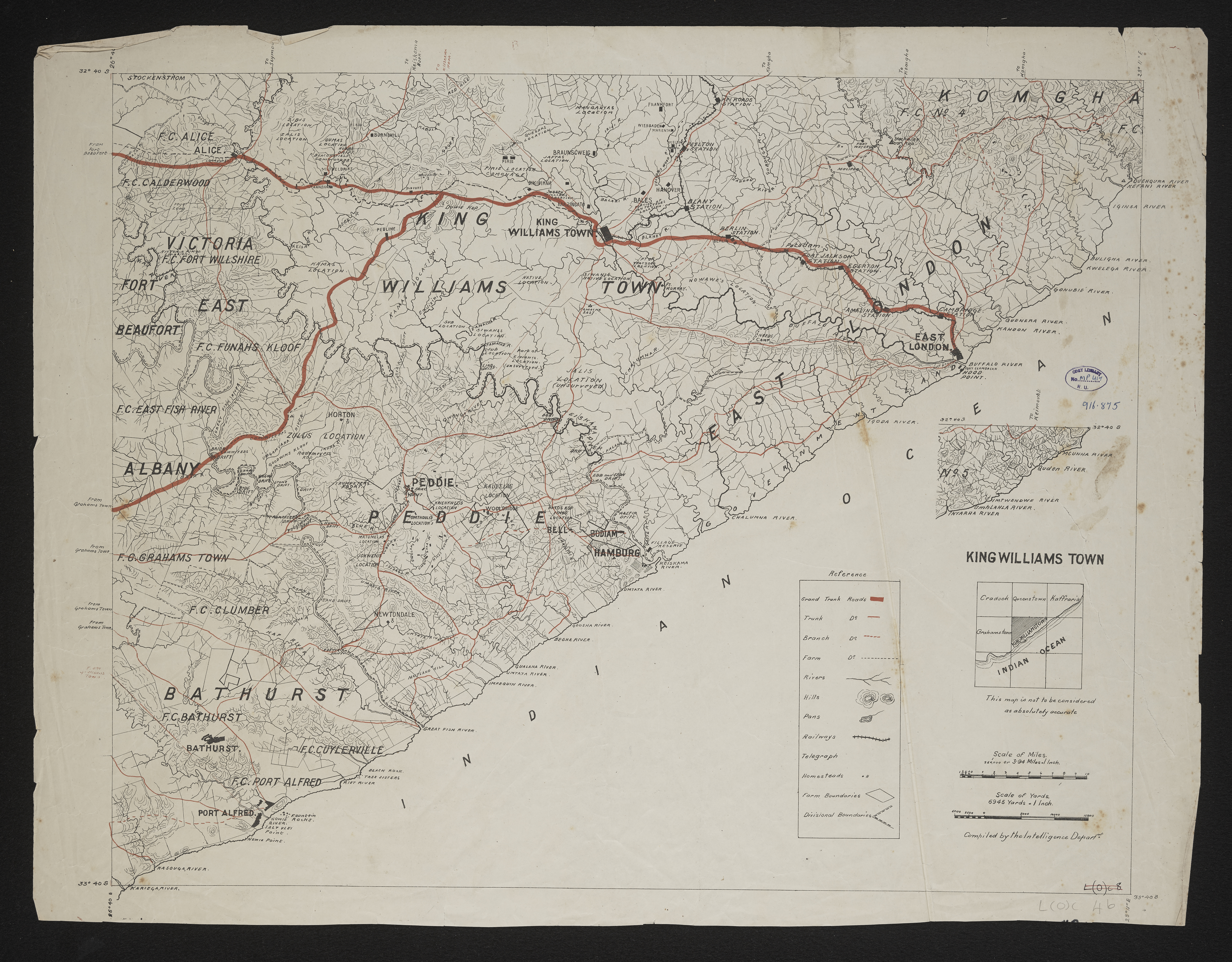
King William's Town,cartographic
Item
-
Date
-
1900
-
Description
-
[Imperial map of South Africa] : Kingwilliamstown compiled by the [British Military] Intelligence Department, 1900?
-
Scale
-
3.94 miles = 1 inch
-
Publisher
-
Great Britain. War Office. Intelligence Division
-
Type
-
cartographic
-
Genre
-
maps
-
Format
-
jpg
-
Extent
-
1 color sheet, 50 cm x 62 cm
-
Language
-
English
-
Rights Holder
-
Great Britain. War Office. Intelligence Division
-
Archive
-
Original held at Cory Library for Humanities Research, situated at Rhodes University.
-
Asset No.
-
MP417
-
Identifier
-
http://hdl.handle.net/10962/109469
-
useGuidelines
-
Public Domain