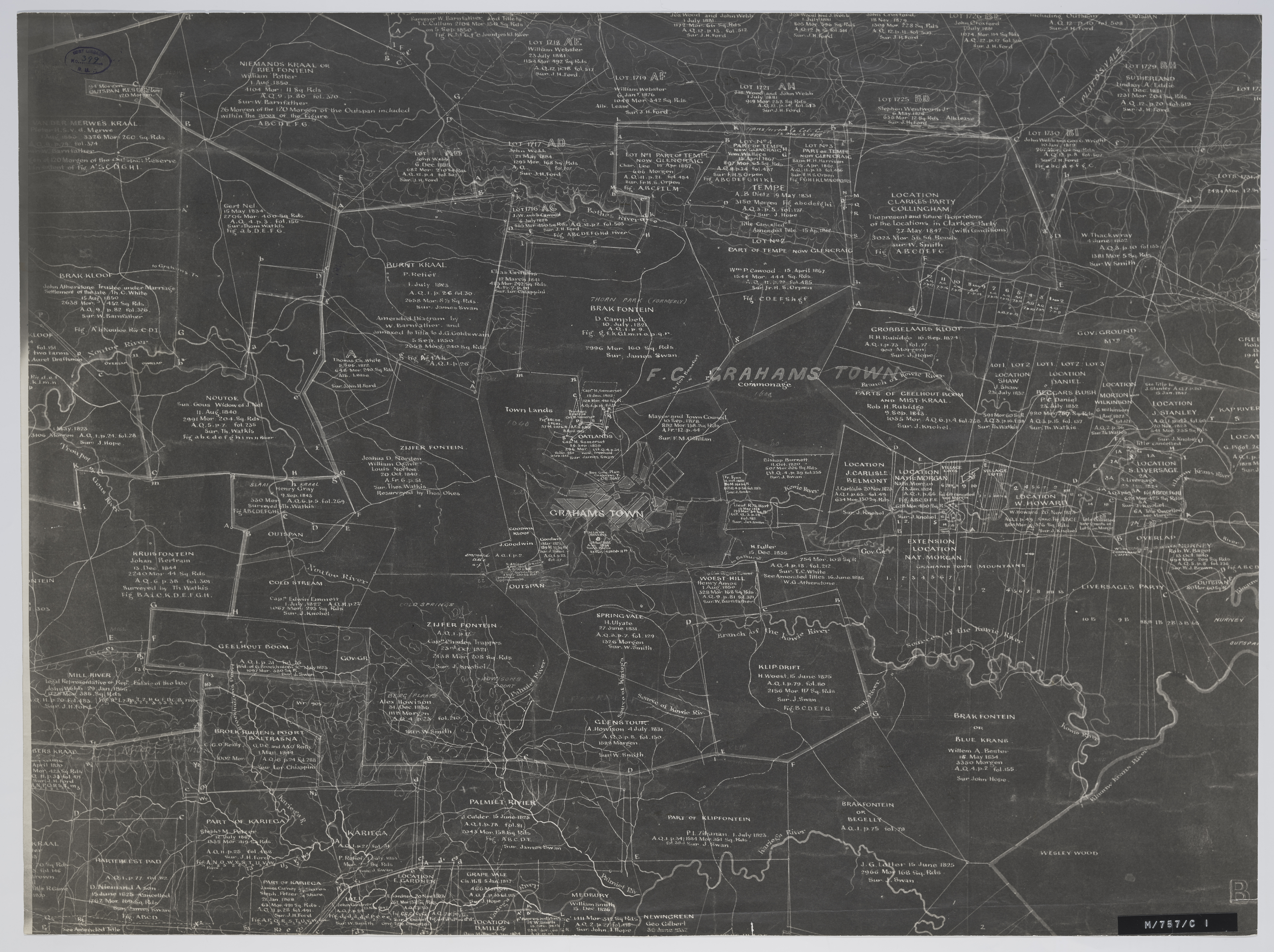
Grahamstown and surrounding farms
Item
-
Date Issued
-
1886
-
Description
-
Grahamstown and surrounding farms compiled from diagrams annexed to their respective grants in the Surveyor-General's Office; by D. Kryndow. Copy of original manuscript.
-
Scale
-
1 inch = 4 Cape roods
-
Publisher
-
Surveyor General
-
Type
-
cartographic
-
Genre
-
maps
-
Format
-
jpg
-
Extent
-
1 sheet, 45 x 61 cm
-
Language
-
English
-
Rights Holder
-
Kryndow, D.,Surveyor General
-
Archive
-
Original held at Cory Library for Humanities Research, situated at Rhodes University.
-
Asset No.
-
MP399
-
Identifier
-
http://hdl.handle.net/10962/109391
-
useGuidelines
-
Public Domain