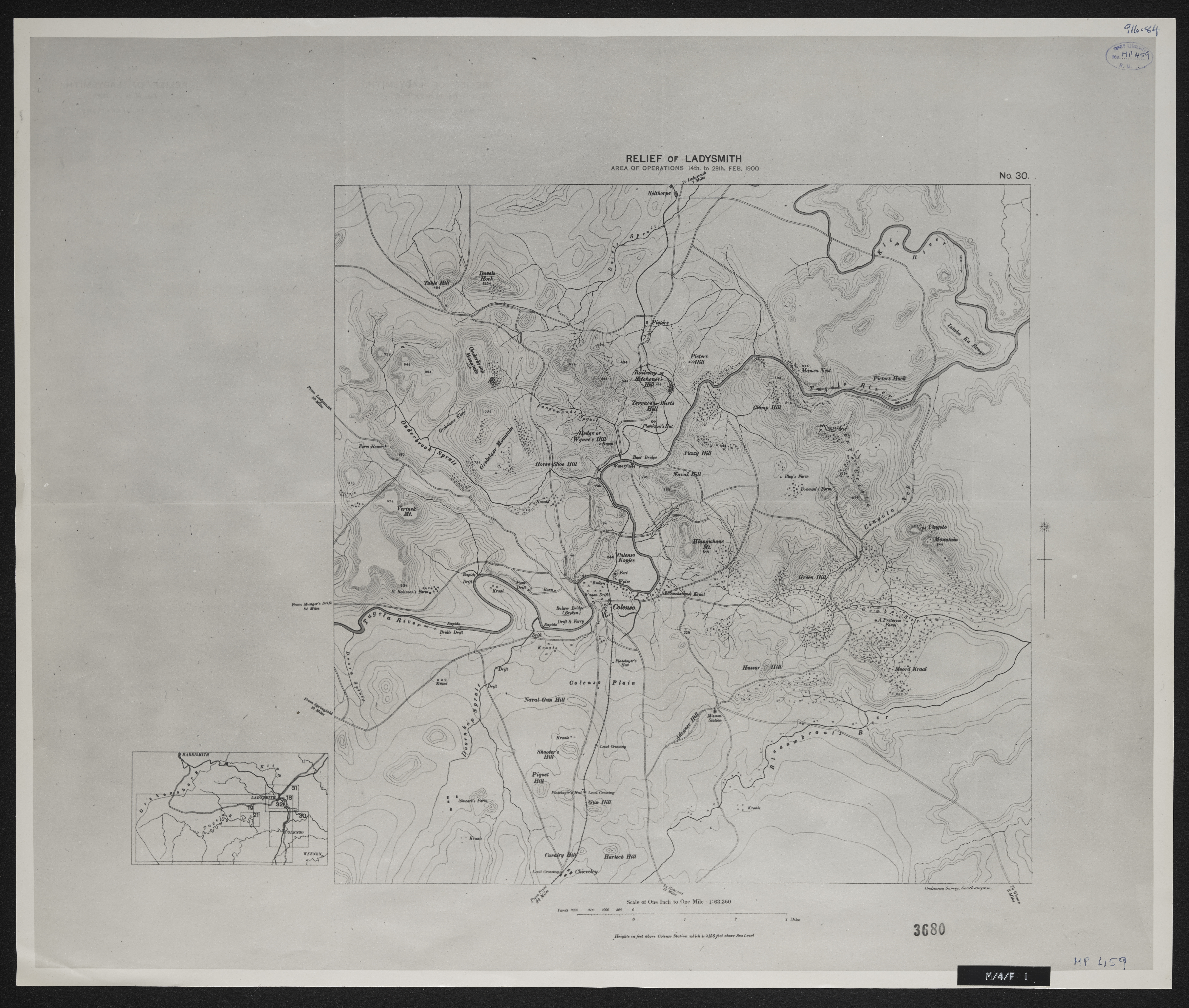
Relief of Ladysmith
Item
-
Date
-
1900
-
Description
-
Relief of Ladysmith : area of operations 14th to 28th February 1900 ; height in feet above Colenson station which is 3156 feet above sea level. Ordnance Survey, Southampton.
-
Scale
-
1 inch = 1 mile
-
Publisher
-
Ordnance Survey Southampton
-
Type
-
cartographic
-
Genre
-
maps
-
Format
-
jpg
-
Extent
-
1 sheet, 19 x 24 in
-
Language
-
English
-
Archive
-
Original held at Cory Library for Humanities Research, situated at Rhodes University.
-
Asset No.
-
MP459
-
Identifier
-
http://hdl.handle.net/10962/106299
-
useGuidelines
-
Public Domain