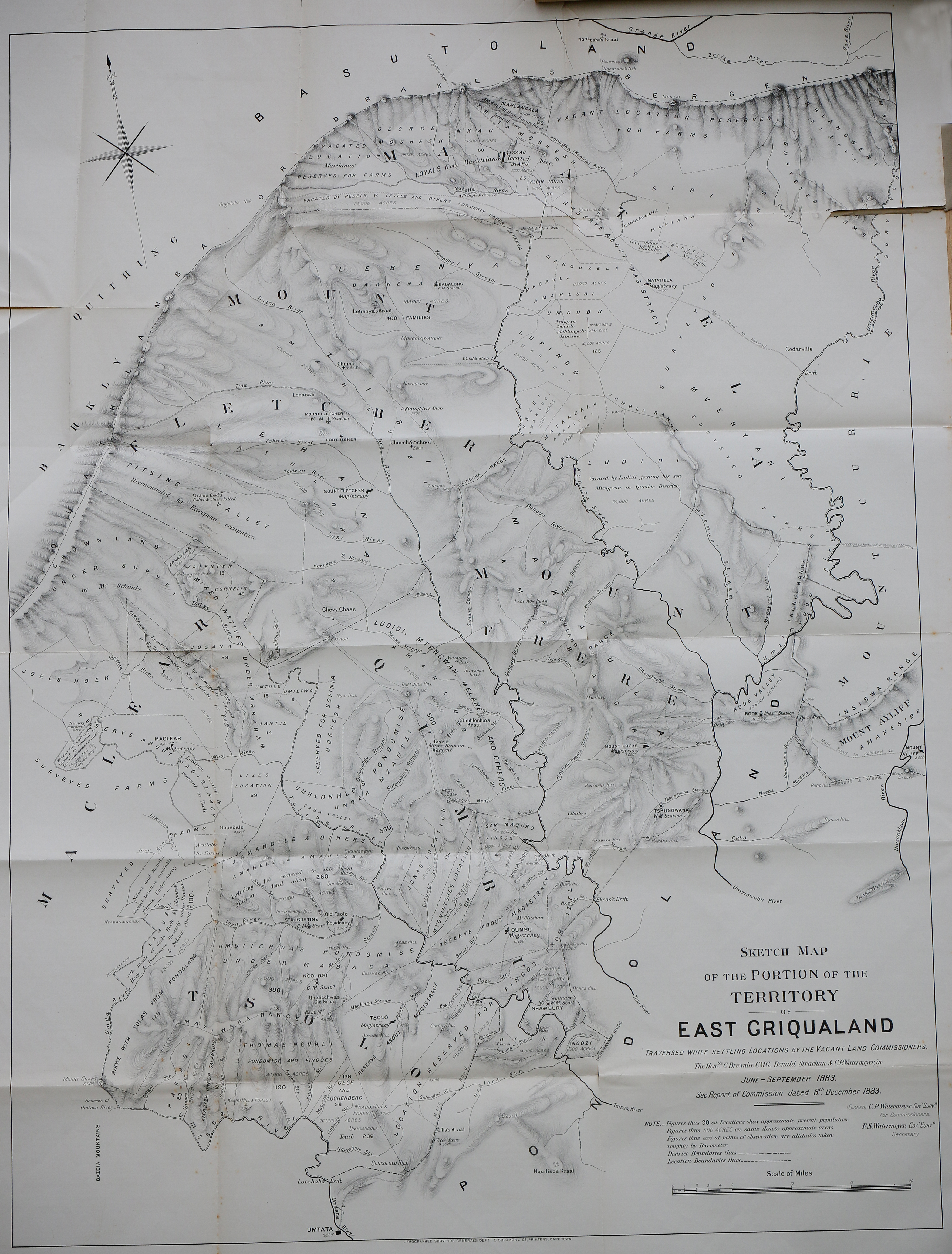
Sketch map of the portion of the territory of East Griqualand : traversed while settling locations by the vacant Land Commissioners
Item
-
Date Issued
-
1883
-
Description
-
Sketch map of the portion of the territory of East Griqualand : traversed while settling locations by the vacant Land Commissioners. The Hon. C. Brownlee, CMG Donald Strachan and CP Watermeyer in June-September 1883.
-
Creator
-
Brownlee, C,Strachan, Donald,Watermeyer, C P,Watermeyer, F S,Cape of Good Hope (Colony). Surveyor General,Surveyor General's Department,Saul Solomon & Co.
-
Type
-
cartographic
-
Genre
-
maps
-
Format
-
jpg
-
Extent
-
1 sheet
-
Language
-
English
-
Rights Holder
-
Brownlee, C,Strachan, Donald,Watermeyer, C P,Watermeyer, F S,Cape of Good Hope (Colony). Surveyor General,Surveyor General's Department,Saul Solomon & Co.
-
Archive
-
Original held at Cory Library for Humanities Research, situated at Rhodes University.
-
Identifier
-
http://hdl.handle.net/10962/62099
-
useGuidelines
-
Public Domain