Transkei,Imperial map of the Cape Colony
Item
-
Date
-
1901
-
Description
-
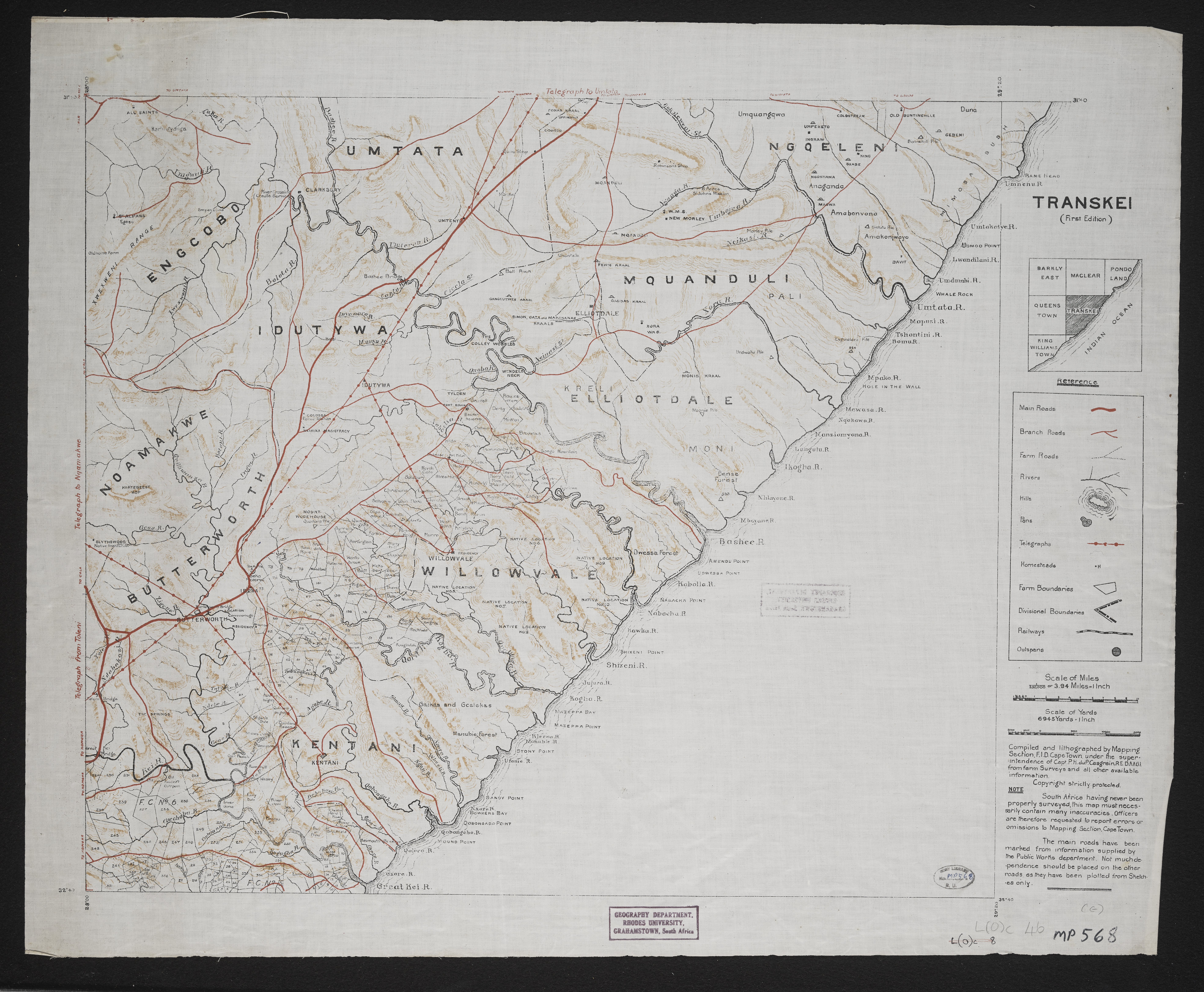
This map forms part of the Imperial map of the Cape Colony.,"South Africa having never been properly surveyed, this map must necessarily contain many inaccuracies." The map shows main roads, branch roads, farm roads, rivers, hills, pans, railways, telegraph lines, farm names, farm boundaries, divisional boundaries, outspans and homesteads in the Transkei region.Compiled and lithographed by Mapping Section, F.I.D., Cape Town, under the superintendence of P.H. du P. Casgrain from farm surveys and all other available information.
-
Publisher
-
Great Britain. War Office
-
Type
-
cartographic
-
Genre
-
maps
-
Format
-
jpg
-
Extent
-
1 sheet, 52 x 65 cm
-
Language
-
English
-
Rights Holder
-
Great Britain. Army. Field Intelligence Department,Casgrain, P H du P
-
Archive
-
Original held at Cory Library for Humanities Research, situated at Rhodes University.
-
Asset No.
-
MP568
-
Identifier
-
http://hdl.handle.net/10962/57336
-
useGuidelines
-
Public Domain