General plan of the triangulation of the southern part of the Cape Colony 1859.1862
Item
-
Date Issued
-
1863
-
Description
-
General plan of the triangulation of the southern part of the Cape Colony 1859.1862. W. Bailey, Captain Royal Engineers, Superintendant Trigonometrical Survey, 21 January 1863. A rough diagram has been constructed for the purpose of shewing the relative positions of the beacons erected and permanent objects observed in the course of the Triangulation and its connection with the stations of Sir T MacLear in the measurement of an arc of meridian. The diagram is tolerably accurate.
-
Publisher
-
Saul Solomon and Co.
-
Type
-
cartographic
-
Genre
-
maps
-
Format
-
jpg
-
Extent
-
15 sheets, 56 x 71 cm
-
Language
-
English
-
Rights Holder
-
Bailey, William, Captain
-
Archive
-
Original held at Cory Library for Humanities Research, situated at Rhodes University.
-
Asset No.
-
MP494
-
Identifier
-
http://hdl.handle.net/10962/121496
 vital_35108+SOURCE4+SOURCE4.0.jpeg
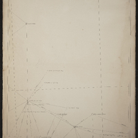 vital_35108+SOURCE5+SOURCE5.0.jpeg
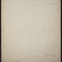 vital_35108+SOURCE6+SOURCE6.0.jpeg
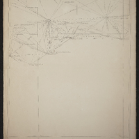 vital_35108+SOURCE7+SOURCE7.0.jpeg
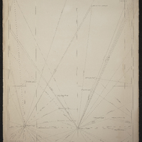 vital_35108+SOURCE8+SOURCE8.0.jpeg
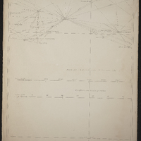 vital_35108+SOURCE9+SOURCE9.0.jpeg
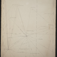 vital_35108+SOURCE10+SOURCE10.0.jpeg
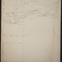 vital_35108+SOURCE11+SOURCE11.0.jpeg
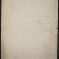 vital_35108+SOURCE12+SOURCE12.0.jpeg
 vital_35108+SOURCE13+SOURCE13.0.jpeg
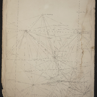 vital_35108+SOURCE14+SOURCE14.0.jpeg
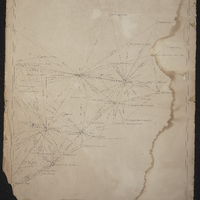 vital_35108+SOURCE15+SOURCE15.0.jpeg