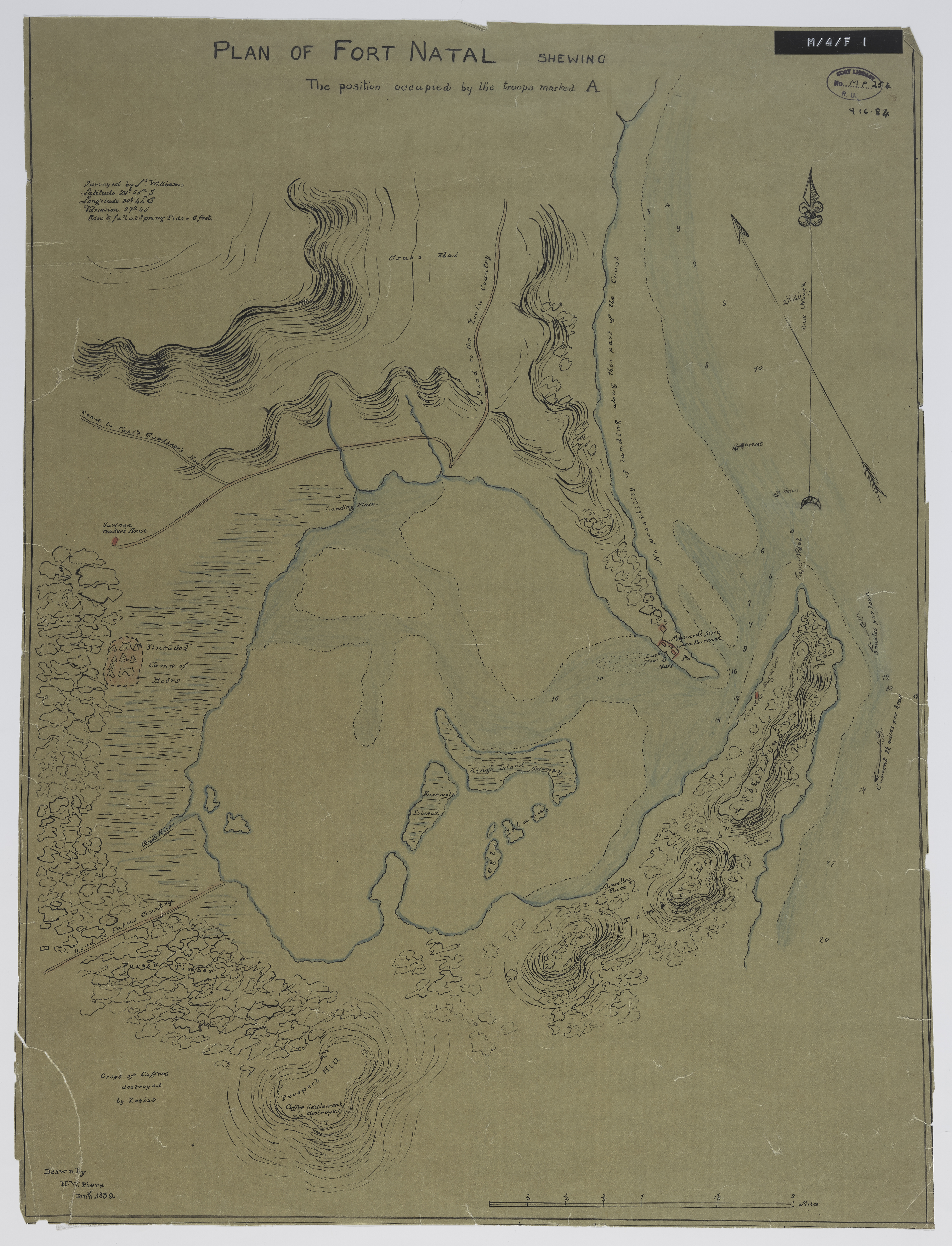
Plan of Fort Natal : shewing the position occupied by the troops marked A
Item
- Date Issued
- 1839
- Description
- Surveyed by Lt. Williams ; drawn by H.W. Piers, Jan. 1839.
- Creator
- Piers, H W
- Subject
- KwaZulu-Natal (South Africa) -- History -- 1843 -- Maps
- Natal Bay (South Africa) -- Maps
- Military Maps
- Type
- cartographic
- Genre
- maps
- Format
- jpg
- Extent
- 1 sheet, 19 x 15 inches
- Language
- English
- Rights Holder
- Piers, H W
- Archive
- Original held at Cory Library for Humanities Research, situated at Rhodes University.
- Asset No.
- MP254
- Identifier
- http://hdl.handle.net/10962/57285
- useGuidelines
- 1 sheet, 19 x 15 inches
- Item sets
- Pre 1910 Maps