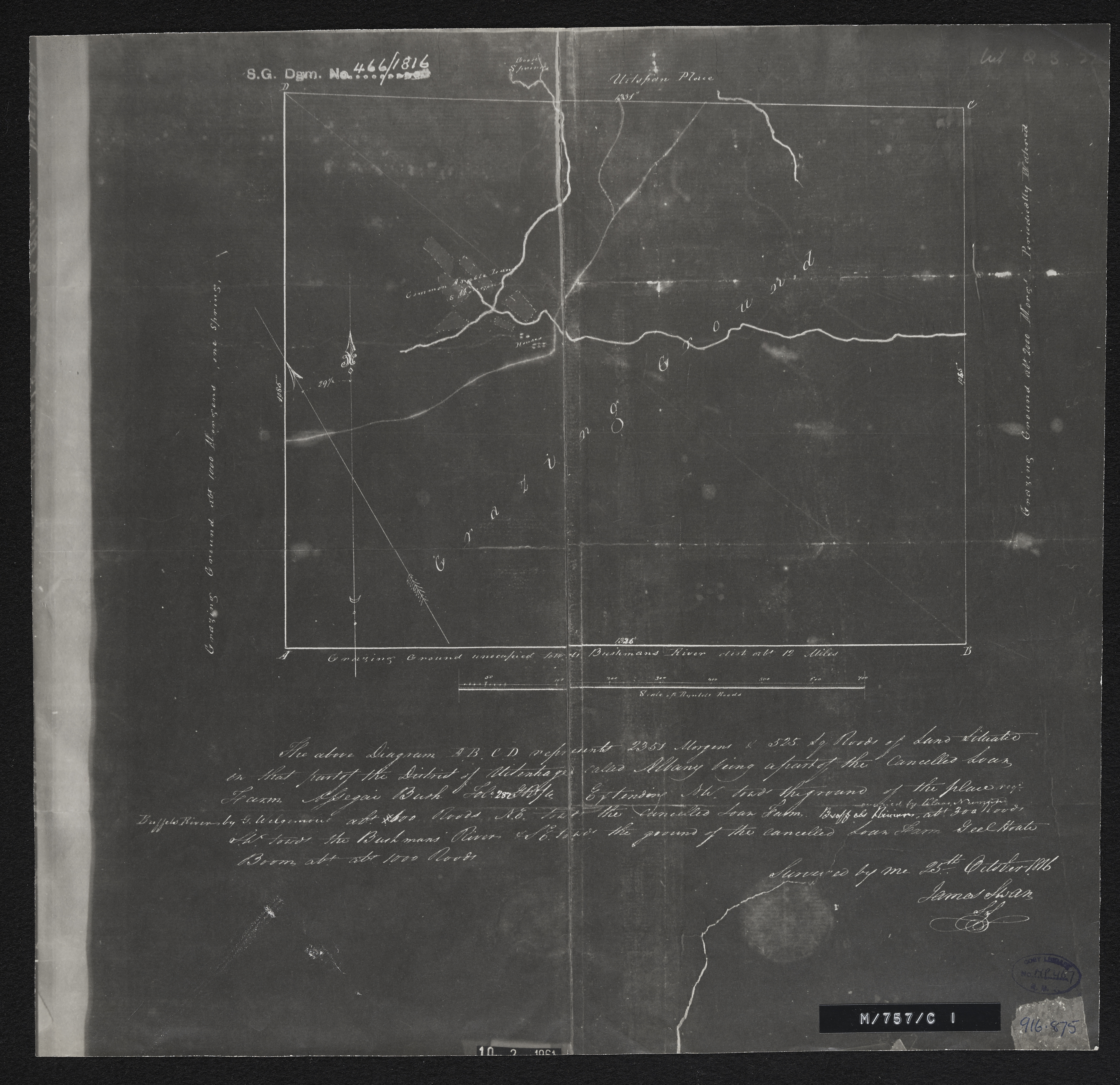
Diagram of a part of the cancelled loan farm Assegaai Bush situated in that part of the disctrict of Uitenhage called Albany
Item
- Date Issued
- 1816
- Creator
- Barket, Edward
- Subject
- Cape of Good Hope (South Africa) -- Maps
- Assegaai Bush (Farm) -- Cape of Good Hope (Colony) -- Maps
- Albany (South Africa) -- Maps
- Type
- cartographic
- Genre
- maps
- Format
- jpg
- Extent
- 1 sheet, 13 x 13 in
- Language
- English
- Rights Holder
- Barket, Edward
- Archive
- Original held at Cory Library for Humanities Research, situated at Rhodes University.
- Asset No.
- MP467
- Identifier
- http://hdl.handle.net/10962/56783
- useGuidelines
- 1 sheet, 13 x 13 in
- Item sets
- Pre 1910 Maps