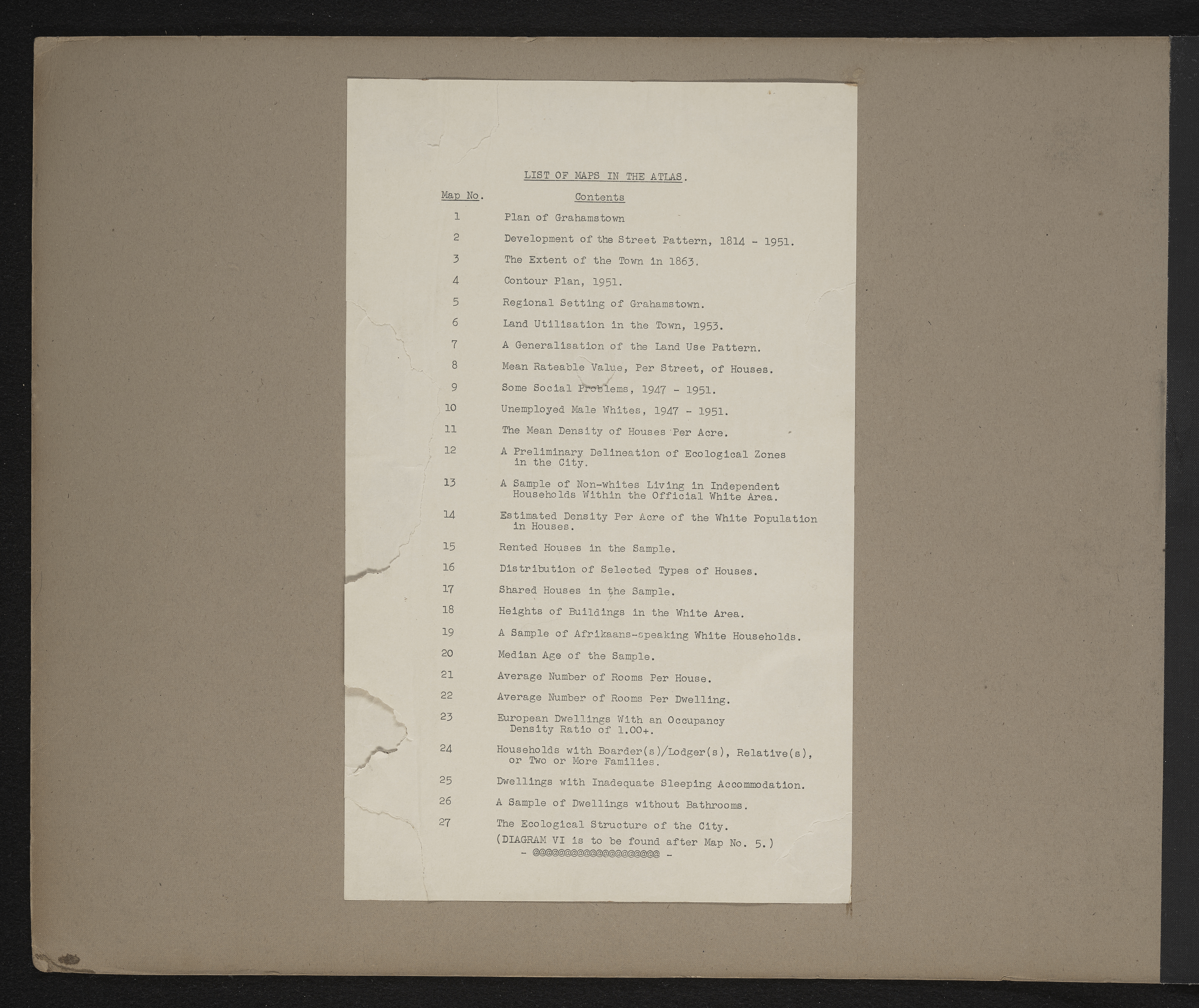
List of maps in the atlas, Grahamstown : a socio-ecological study of a small South African town
Item
-
Date
-
1957
-
Description
-
List of maps in the map album accompanying the thesis by Hilstan Lett Watts, "Grahamstown : a socio-ecological study of a small South African town", Rhodes University thesis, 1957.
-
Publisher
-
Hilstan Lett Watts
-
Type
-
cartographic
-
Genre
-
maps
-
Format
-
jpg
-
Extent
-
1 sheet 58 x 38 cm
-
Language
-
English
-
Rights Holder
-
Watts, Hilstan Lett, 1929-
-
Archive
-
Original held at Cory Library for Humanities Research, situated at Rhodes University.
-
Asset No.
-
T654_list
-
Identifier
-
http://hdl.handle.net/10962/121361