1910 - pre-1994 Map Collection
Item set
- Alternative Title
- Cory Library Historical Map Collection
- Description
-
This digital collection comprises 119 historical maps housed in the Cory Library for Humanities Research at Rhodes University, dating from 1910 up to the early 1990s. The maps encompass a wide range of geographical and thematic materials, including urban plans, railway networks, regional studies, survey charts, and specialised maps used for planning and statistical purposes. Key map types include standard railway maps of South Africa, municipal plans (such as early Grahamstown and Port Alfred layouts), topographic and aeronautical charts, and maps associated with academic theses and regional planning documents.
The maps reflect major socio-economic, infrastructural, and administrative developments in South Africa and its Eastern Cape region over eight decades. They are invaluable resources for researchers working in urban history, transportation history, regional planning, colonial and post-colonial studies, and environmental change. This collection supports investigation into historical spatial relationships, transportation networks, and settlement patterns across different periods of the 20th century. - Date Issued
- 1910 - 1994
- Language
- English
- Type
- Collection
- Format
- Digital Images (various scans) - Various map scales and projections
- Spatial Coverage
- South Africa
- Temporal Coverage
- 20th Century (1910 – pre-1994)
Items
-
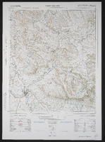
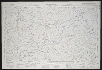 3120 Williston, South Africa 1:25000 sheet. Compiled and drawn in 1960 by the Trigonometric Survey Office. Magisterial districts as at February 1961. T.S.O. 404/961. (Saamgestel in 1960 en geteken in 1960 deur die Driehokesmatings Kantoor.)
 -
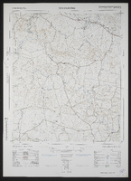
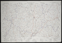 3122 Victoria West, South Africa 1:25000 sheet. Compiled and drawn in 1960 by the Trigonometric Survey Office. Magisterial districts as at February 1961. T.S.O. 404/962. (Saamgestel in 1960 en geteken in 1960 deur die Driehokesmatings Kantoor.)
 -
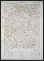
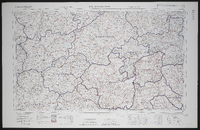 3126 Queenstown, South Africa 1:25000 sheet. Compiled and drawn in 1960 by the Trigonometric Survey Office. Magisterial districts as at March 1966. T.S.O. 404/964. (Saamgestel in 1960 en geteken in 1960 deur die Driehokesmatings Kantoor.)
 -
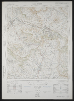
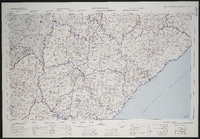 3128 Umtata, South Africa 1:25000 sheet. Compiled and drawn in 1960 by the Trigonometric Survey Office. Magisterial districts as at May 1960. T.S.O. 404/965. (Saamgestel in 1960 en geteken in 1960 deur die Driehokesmatings Kantoor.)
 -
 3220 Sutherland, South Africa 1:25000 sheet. Compiled and drawn in 1960 by the Trigonometric Survey Office. Magisterial districts as at November 1960. T.S.O. 404/967. (Saamgestel in 1960 en geteken in 1960 deur die Driehokesmatings Kantoor.)
 -
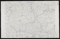
 3226AB Tarkastad. South Africa 1:50000 sheet. Air photography 1954. Field survey 1965. Drawn by the Trigonometric Survey in 1966. T.S.O. 200/2641. (Lugfotografie 1943. Veldopmeting 1945. Saamgestel en geteken in 1953 deur die Driehokesmatings Kantoor.) First edition
 -
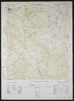
 3226AC Baviaansrivier, South Africa 1:25000 sheet. Air photography 1954. Surveyed in 1965 and drawn in 1966 by the Trigonometrical Survey Office. Lugfotografie 1954. Opgemeet 1965 en geteken in 1966 deur die Driehoeksmeting Kantoor. T.S.O. 200/2665.
 -
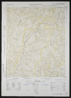
 3226AD Spring Valley, South Africa 1:50000 sheet. Air photography 1954. Surveyed in 1954 and drawn in 1965 by the Trigonometrical Survey Office. Revised in 1966. Lugfotografie 1954. Opgemeet 1954 en geteken in 1965 deur die Driehoeksmeting Kantoor Hersien in 1966. T.S.O. 200/2639. First edition.
 -
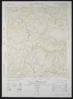
 3226BA Poplar Grove, South Africa 1:50000 sheet. Air photography 1954. Surveyed in 1965 and drawn in 1966 by the Trigonometrical Survey Office. Lugfotografie 1954. Opgemeet 1965 en geteken in 1966 deur die Driehoeksmeting Kantoor. T.S.O. 200/2586.
 -
 3226BC Hackney, South Africa 1:50000 sheet. Air photography 1954. Surveyed in 1964 and drawn in 1966 by the Trigonometrical Survey Office. Lugfotografie 1954. Opgemeet 1964 en geteken in 1966 deur die Driehoeksmeting Kantoor. T.S.O. 200/2616.
 -
 3226BD Fairford, South Africa 1:50000 sheet. Air photography 1956. Surveyed in 1965 and drawn in 1966 by the Trigonometrical Survey Office. Lugfotografie 1956. Opgemeet 1965 en geteken in 1966 deur die Driehoeksmeting Kantoor. T.S.O. 200/2590. First edition
 -
 3226CA Bedford, South Africa 1:50000 sheet. Air photography 1949 and 1950. Surveyed in 1965 and drawn in 1966 by the Trigonometrical Survey Office.
 -
 3226CB Adelaide, South Africa 1:50000 sheet. Air photography 1949 and 1950. Surveyed in 1965 and drawn in 1966 by the Trigonometrical Survey Office. Lugfotografie 1949 and 1950. Opgemeet 1965 en geteken in 1966 deur die Driehoeksmeting Kantoor. T.S.O. 200/2575. First edition
 -
 3226CD Kroomie, South Africa 1:50000 sheet. Air photography 1949 and 1950. Surveyed in 1964 and drawn in 1966 by the Trigonometrical Survey Office. Lugfotografie 1949 and 1950. Opgemeet 1964 en geteken in 1965 deur die Driehoeksmeting Kantoor. T.S.O. 200/2523. Cadastral information supplied by the Surveyor General, Cape. First edition
 -
 3226DC Healdtown, South Africa 1:50000 sheet. Air photography 1950. Surveyed in 1964 and drawn in 1966 by the Trigonometrical Survey Office. Lugfotografie 1950. Opgemeet 1964 en geteken in 1965 deur die Driehoeksmeting Kantoor. T.S.O. 200/2418. First edition
 -
 3226DB Seymour, South Africa 1:50000 sheet. Air photography 1949. Surveyed in 1964 and drawn in 1965 by the Trigonometrical Survey Office. Lugfotografie 1949. Opgemeet 1964 en geteken in 1965 deur die Driehoeksmeting Kantoor. T.S.O. 200/2420. First edition
 -
 3226DD Alice, South Africa 1:50000 sheet. Air photography 1949. Surveyed in 1956 and drawn in 1960 by the Trigonometric Survey Office. T.S.O. 200/1471. (Lugfotogafie 1949, Opgemeet in 1956 en geteken in 1960 deur die Driehokesmatings Kantoor.) First edition.
 -
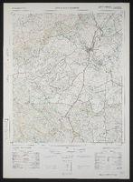
 3227AC Cathcart, South Africa 1:50000 sheet. Air photography 1956. Surveyed and drawn in 1963 by the Trigonometrical Survey Office. T.S.O. 200/2021.
 -
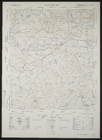
 3227AD Toise, South Africa 1:50000 sheet. Air photography 1956. Surveyed and drawn in 1964 by the Trigonometrical Survey Office. Lugfotografie 1956. Opgemeet en geteken in 1964 deur die Driehoeksmeting Kantoor. T.S.O. 200/2033. Cadastral information supplied by the Surveyor Genera, Cape. First edition
 -
 3227BC Bolo, South Africa 1:50000 sheet. Air photography 1950. Surveyed in 1956 and drawn in 1961 by the Trigonometrical Survey Office. Lugfotografie 1950. Opgemeet in 1956 en geteken in 1961 deur die Driehoeksmeting Kantoor. T.S.O. 200/1512. Kadastrale inligting verskaf deur die Landmeter-Generaal, Kaap. First edition
 -
 3227BD Toleni, South Africa 1:50000 sheet. Air photography 1950. Surveyed in 1951 and drawn in 1963 by the Trigonometrical Survey Office. Lugfotografie 1950. Opgemeet in 1951 en geteken in 1963 deur die Driehoeksmeting Kantoor. T.S.O. 200/1804. Cadastral information supplied by the Surveyor General, Cape. First edition
 -
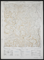
 3227CA Keiskammahoek, South Africa 1:50000 sheet. Air photography 1949. Surveyed in 1954 and drawn in 1959 by the Trigonometrical Survey Office. Cadastral information supplied by the Surveyor-General, Cape and the Department of Native Affairs.
 -
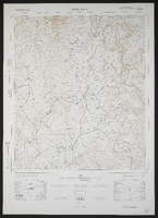
 3227CB Stutterheim, South Africa 1:50000 sheet. Air photography 1953. Surveyed in 1959 and drawn in 1963 by the Trigonometrical Survey Office. Lugfotografie 1953. Opgemeet in 1959 en geteken in 1963 deur die Driehoeksmeting Kantoor. T.S.O. 200/1612. Cadastral information supplied by the Surveyor-General, Cape and the Department of Bantu Administration and Development. First edition
 -
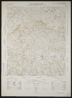
 3227CC Debe Nek, South Africa 1:50000 sheet. Air photography 1949. Surveyed in 1956 and drawn in 1959 by the Trigonometrical Survey Office. Lugfotografie 1949. Opgemeet in 1956 en geteken in 1959 deur die Driehoeksmeting Kantoor. T.S.O. 200/1343. Kadastrale inligting verskaf deur die Landmeter, Kaap, en die Department van Naturellesake. First edition
 -
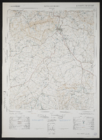
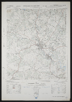 3227CD King William's Town, South Africa 1:50000 sheet. Air photography 1964. Surveyed in 1971 and drawn in 1972 by the Trigonometrical Survey Office.