Grahamstown : estimated density per acre of the white population in houses, Grahamstown : a socio-ecological study of a small South African town
Item
-
Date
-
1957
-
Description
-
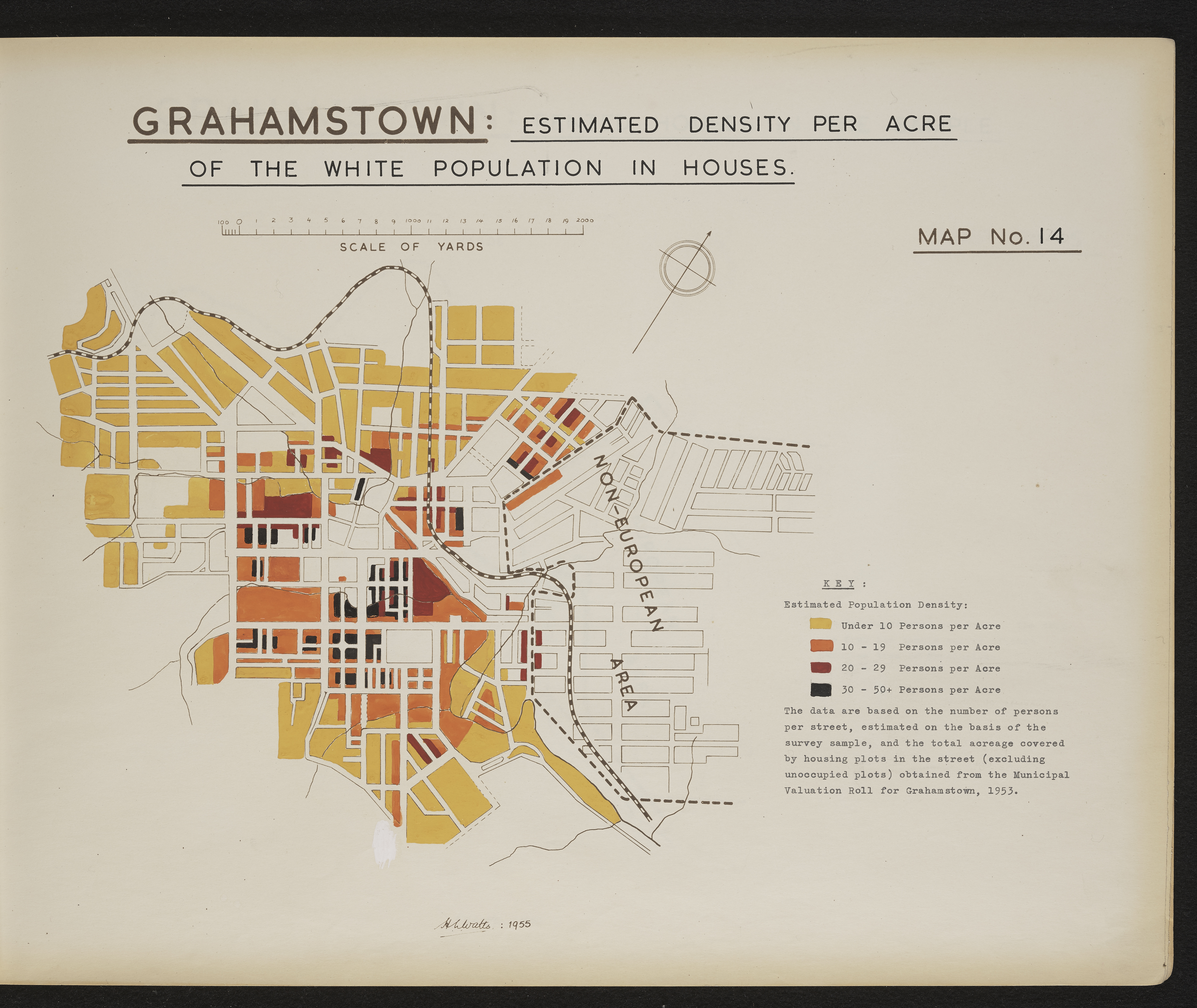
Map 14 in the map album accompanying the thesis by Hilstan Lett Watts, "Grahamstown : a socio-ecological study of a small South African town", Rhodes University thesis, 1957. Map signed 1955. The data are based on number of persons per street, estimated on the basis of the survey sample, and the total acreage covered by housing plots in the street (excluding unoccupied plots) obtained from the municipal valuation roll for Grahamstown, 1953.
-
Scale
-
2 cm = 2000 yards
-
Publisher
-
Hilstan Lett Watts
-
Geographic Scope
-
30.5595° S, 22.9375° E
-
Type
-
cartographic
-
Genre
-
maps
-
Format
-
jpg
-
Extent
-
1 sheet 58 x 38 cm
-
Language
-
English
-
Rights Holder
-
Watts, Hilstan Lett, 1929-
-
Archive
-
Original held at Cory Library for Humanities Research, situated at Rhodes University.
-
Asset No.
-
T654_14
-
Identifier
-
http://hdl.handle.net/10962/121149