Grahamstown : a sample of nonwhites living in independent households within the official white area, Grahamstown : a socio-ecological study of a small South African town
Item
-
Date
-
1957
-
Description
-
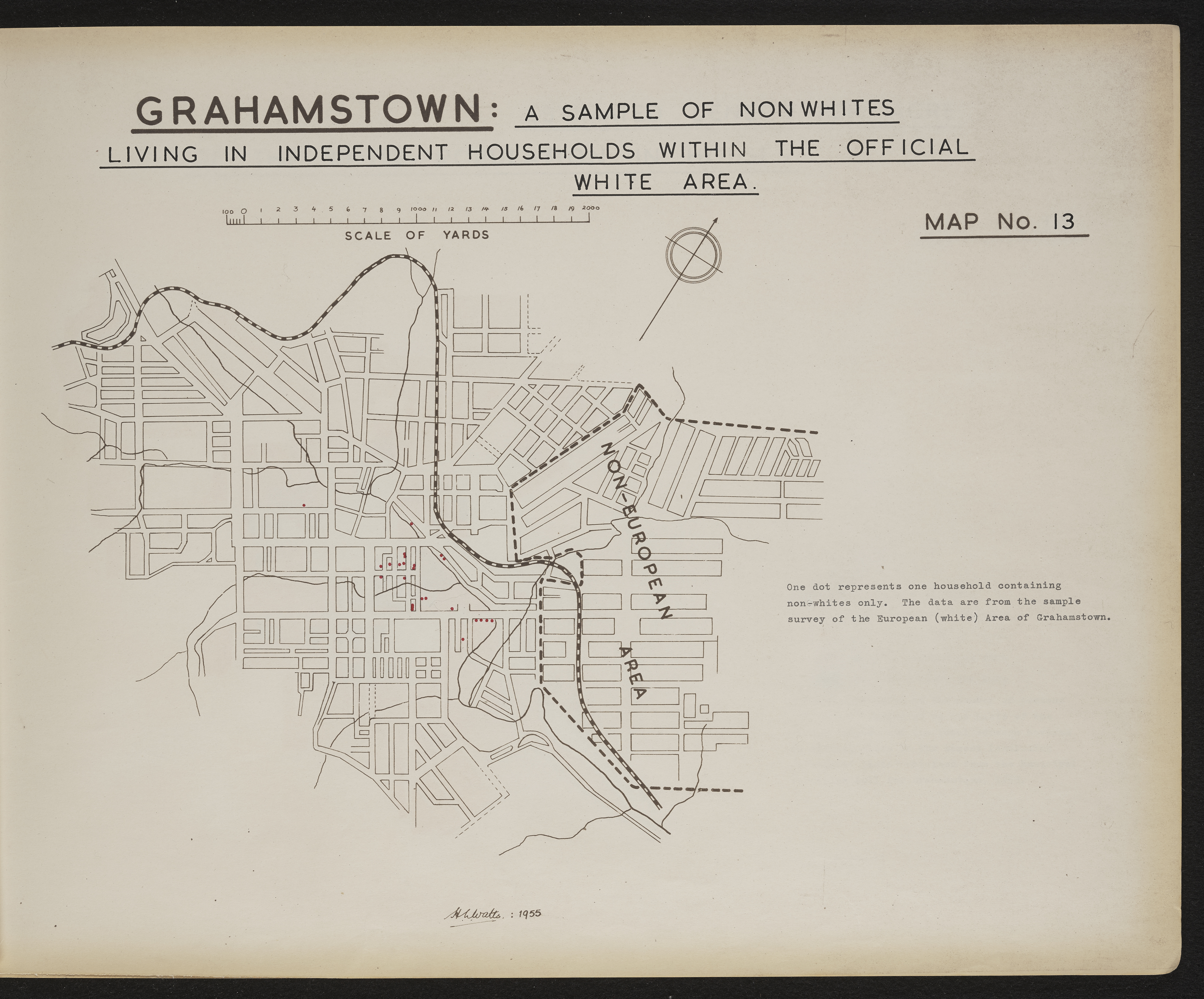
Map 13 in the map album accompanying the thesis by Hilstan Lett Watts, "Grahamstown : a socio-ecological study of a small South African town", Rhodes University thesis, 1957. Map signed 1955. The data are from the sample survey of the European (white) area of Grahamstown.
-
Scale
-
2 cm = 2000 yards
-
Publisher
-
Hilstan Lett Watts
-
Geographic Scope
-
30.5595° S, 22.9375° E
-
Type
-
cartographic
-
Genre
-
maps
-
Format
-
jpg
-
Extent
-
1 sheet 58 x 38 cm
-
Language
-
English
-
Rights Holder
-
Watts, Hilstan Lett, 1929-
-
Archive
-
Original held at Cory Library for Humanities Research, situated at Rhodes University.
-
Asset No.
-
T654_13
-
Identifier
-
http://hdl.handle.net/10962/120809