Grahamstown : mean rateable value, per street, of houses, Grahamstown : a socio-ecological study of a small South African town
Item
-
Date
-
1957
-
Description
-
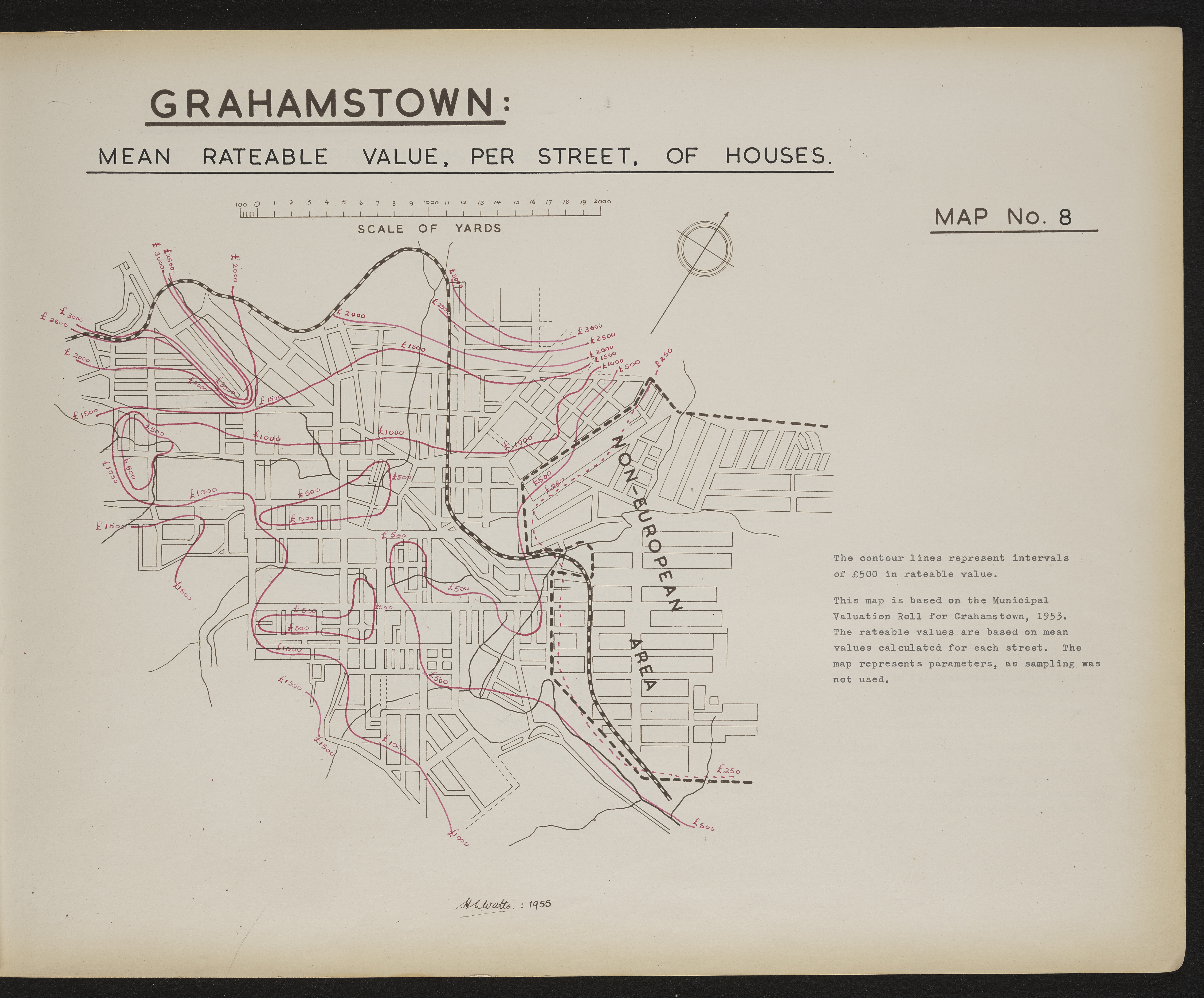
Map 8 in the map album accompanying the thesis by Hilstan Lett Watts, "Grahamstown : a socio-ecological study of a small South African town", Rhodes University thesis, 1957. Map signed 1955. This map is based on the Municipal Valuation Roll for Grahamstown, 1953. The rateable values are based on mean values calculated for each street. The map represents parameters as sampling was not used.
-
Scale
-
2 cm = 2000 yards
-
Publisher
-
Hilstan Lett Watts
-
Geographic Scope
-
30.5595° S, 22.9375° E
-
Type
-
cartographic
-
Genre
-
maps
-
Format
-
jpg
-
Extent
-
1 sheet 58 x 38 cm
-
Language
-
English
-
Rights Holder
-
Watts, Hilstan Lett, 1929-
-
Archive
-
Original held at Cory Library for Humanities Research, situated at Rhodes University.
-
Asset No.
-
T654_8
-
Identifier
-
http://hdl.handle.net/10962/120726