Plan of Grahamstown, Grahamstown : a socio-ecological study of a small South African town
Item
-
Date
-
1957
-
Description
-
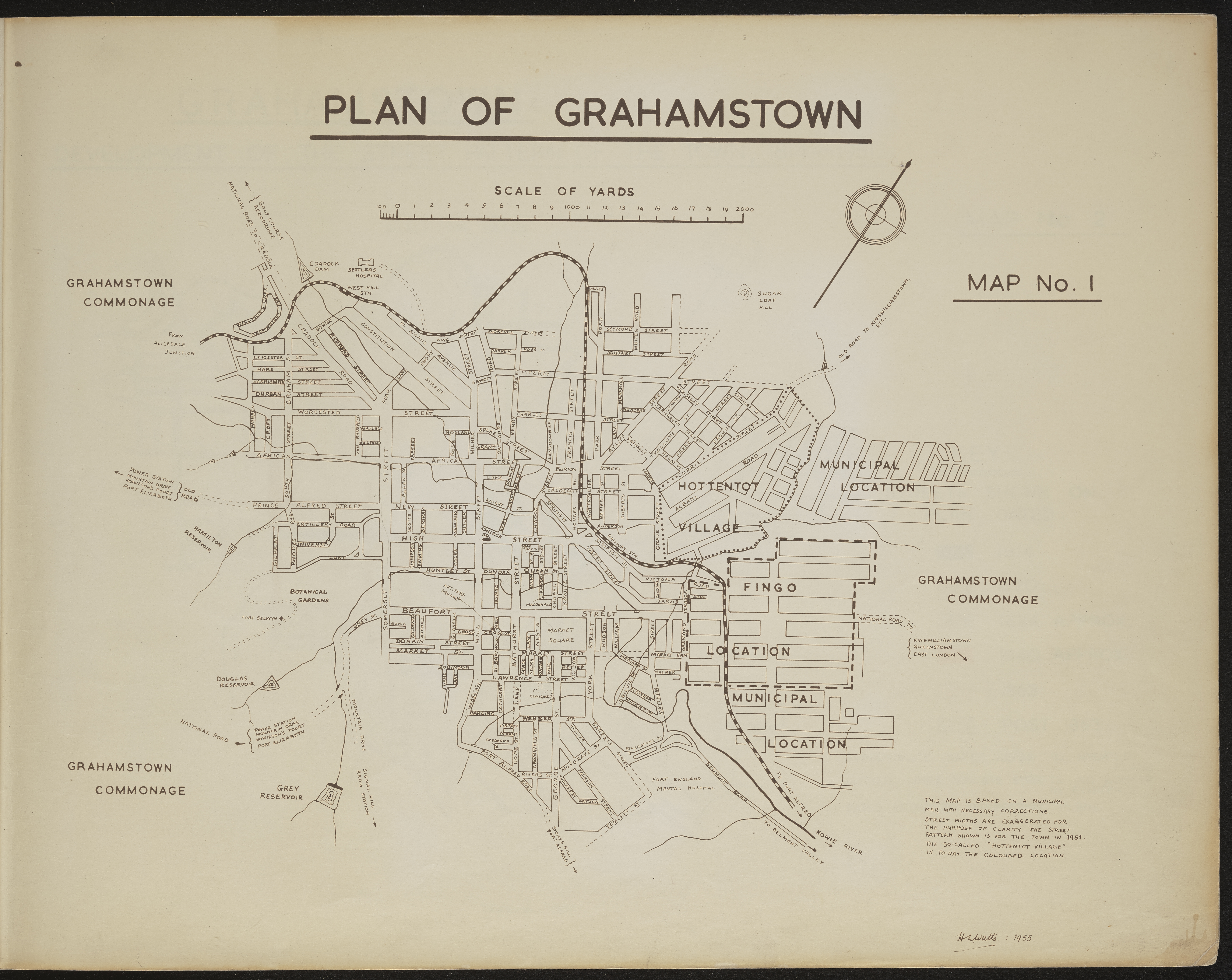
Map 1 in the map album accompanying the thesis by Hilstan Lett Watts, "Grahamstown : a socio-ecological study of a small South African town", Rhodes University thesis, 1957. Map signed 1955. This map is based on a municipal map, with necessary corrections. Street widths are exaggerated for the purpose of clarity. The street pattern shown is for the town in 1951. The so-called "Hottentot Village" is today the Coloured location.
-
Scale
-
2 cm = 2000 yards
-
Publisher
-
Hilstan Lett Watts
-
Geographic Scope
-
30.5595° S, 22.9375° E
-
Type
-
cartographic
-
Genre
-
maps
-
Format
-
jpg
-
Extent
-
1 sheet 58 x 38 cm
-
Language
-
English
-
Rights Holder
-
Watts, Hilstan Lett, 1929-
-
Archive
-
Original held at Cory Library for Humanities Research, situated at Rhodes University.
-
Asset No.
-
T654_1
-
Identifier
-
http://hdl.handle.net/10962/120569