Plan of territories formerly known as Kaffraria proper
Item
-
Date Issued
-
1884
-
Description
-
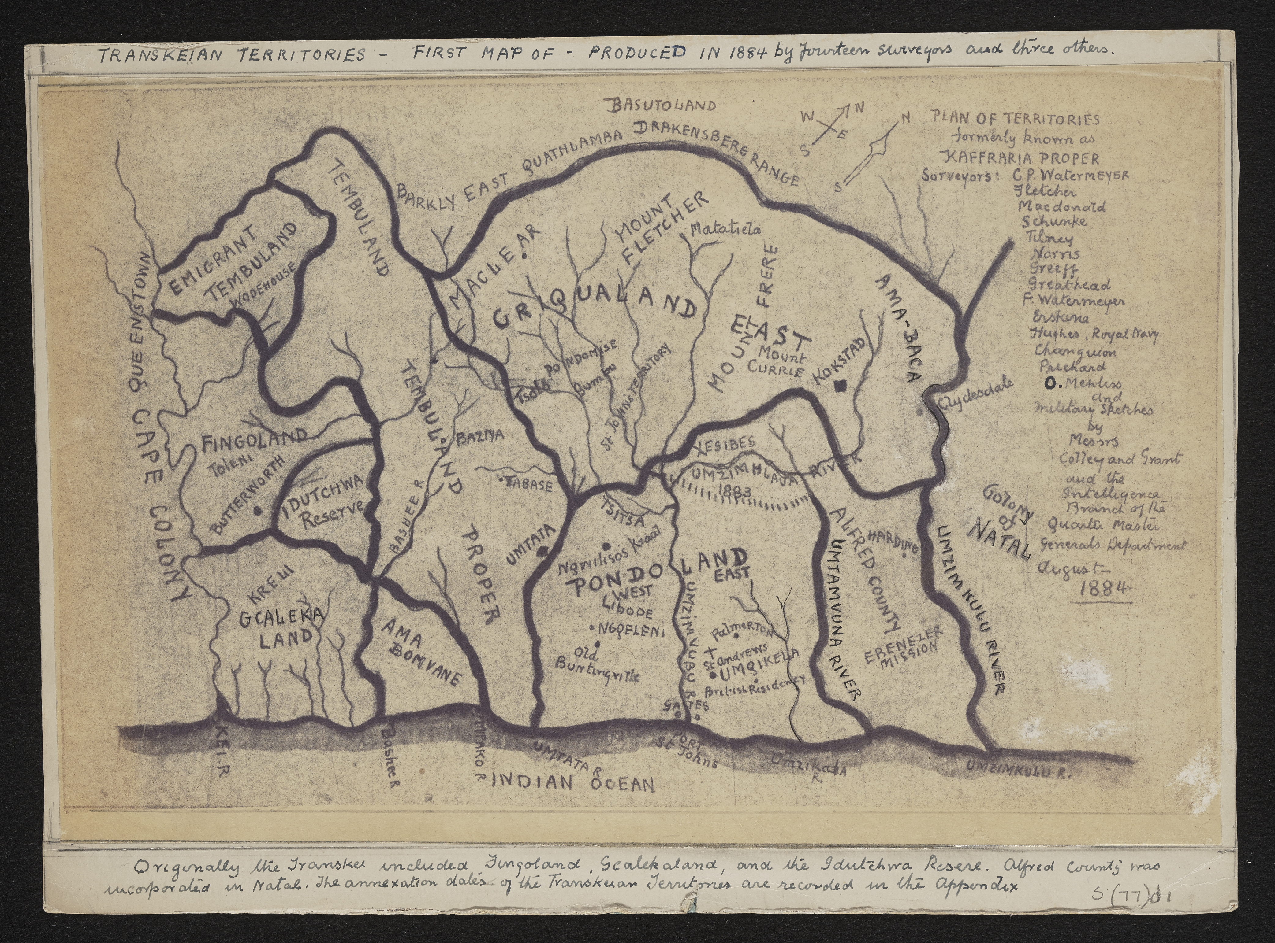
Plan of Territories formerly known as Kaffraria proper: simplified handdrawn copy of the 1884 map of the territories formerly known as Kaffraria, with additional information inserted by Alfred William Burton. Surveyors C.P. Watermeyer; Fletcher ; MacDonald, Schunke, Tilney, Norris, Greeff, Greathead, F. Watermeyer; Erskine, Hughes R.N., Changuion, Pritchard and O. Mehliss, and military sketches by Messrs Colley and Grant and the Intelligence Branch of the Quartermaster General's Department. Photocopy stuck on card. Transkeian territories. First produced in 1884 by 14 surveyors and 3 others.See MP 307, L (77) d 1 for the original map by fourteen surveyors and Military sketches.
-
Type
-
cartographic
-
Genre
-
maps
-
Format
-
jpg
-
Extent
-
1 sheet ; 33 x 25 cm.
-
Language
-
English
-
Rights Holder
-
Burton, Alfred William
-
Archive
-
Original held at Cory Library for Humanities Research, situated at Rhodes University.
-
Asset No.
-
MP1877
-
Identifier
-
http://hdl.handle.net/10962/115759