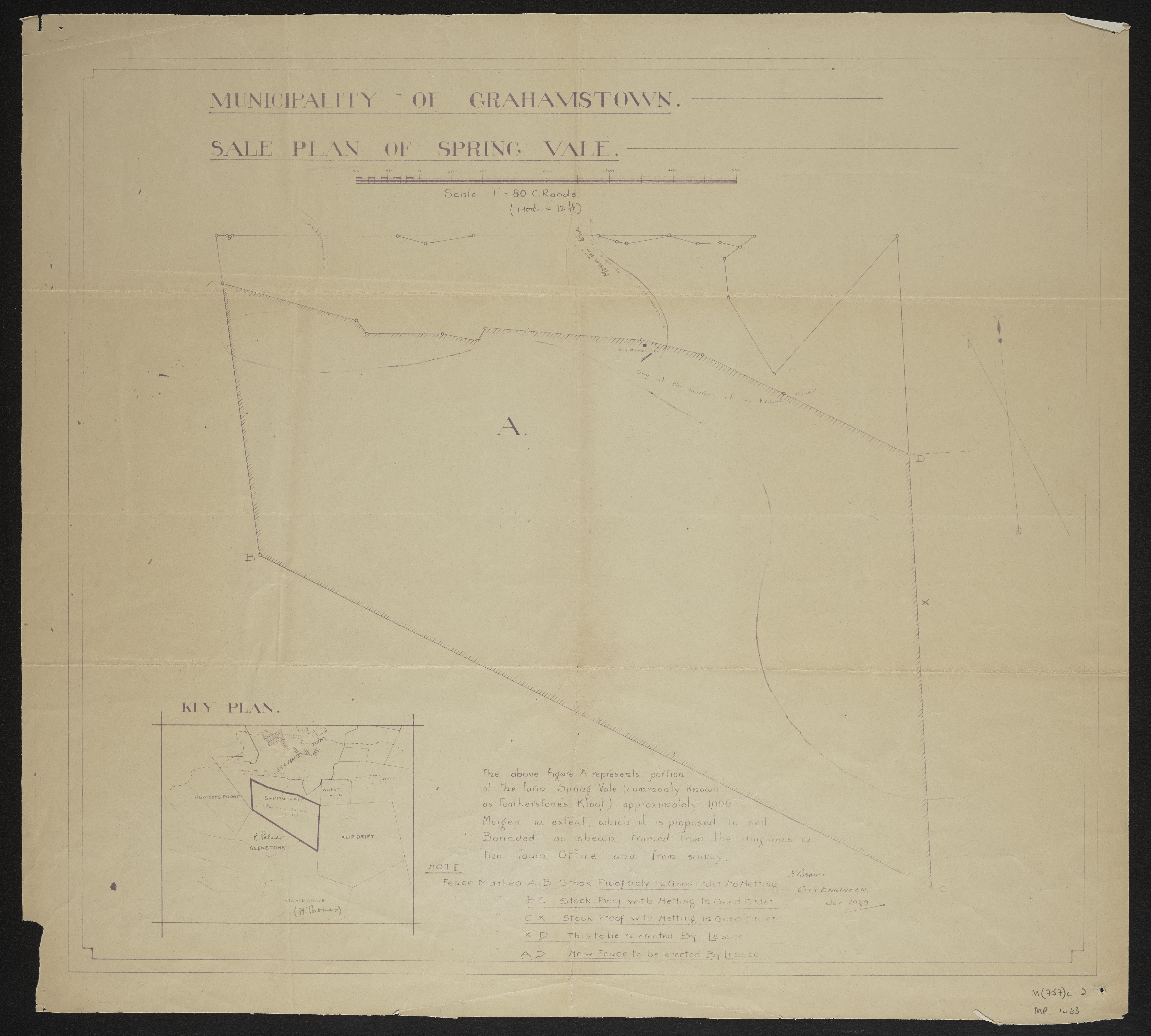
Sale plan of a portion of the farm Spring Vale commonly known as Featherstone's Kloof
Item
-
Date
-
1929
-
Description
-
Sale plan of a portion of the farm Spring Vale commonly known as Featherstone's Kloof.R. Brown, City Enginner, Oct. 1929.
-
Scale
-
1 inch = 80 Cape feet
-
Publisher
-
Grahamstown City Engineer's Department
-
Geographic Scope
-
30.5595° S, 22.9375° E
-
Type
-
cartographic
-
Genre
-
maps
-
Format
-
jpg
-
Extent
-
1 sheet 55 x 51 cm
-
Language
-
English
-
Rights Holder
-
Brown, R
-
Archive
-
Original held at Cory Library for Humanities Research, situated at Rhodes University.
-
Asset No.
-
MP1463
-
Identifier
-
http://hdl.handle.net/10962/115027