Lovedale, Alice, South Africa 1:50000 sheet
Item
-
Date
-
1956
-
Description
-
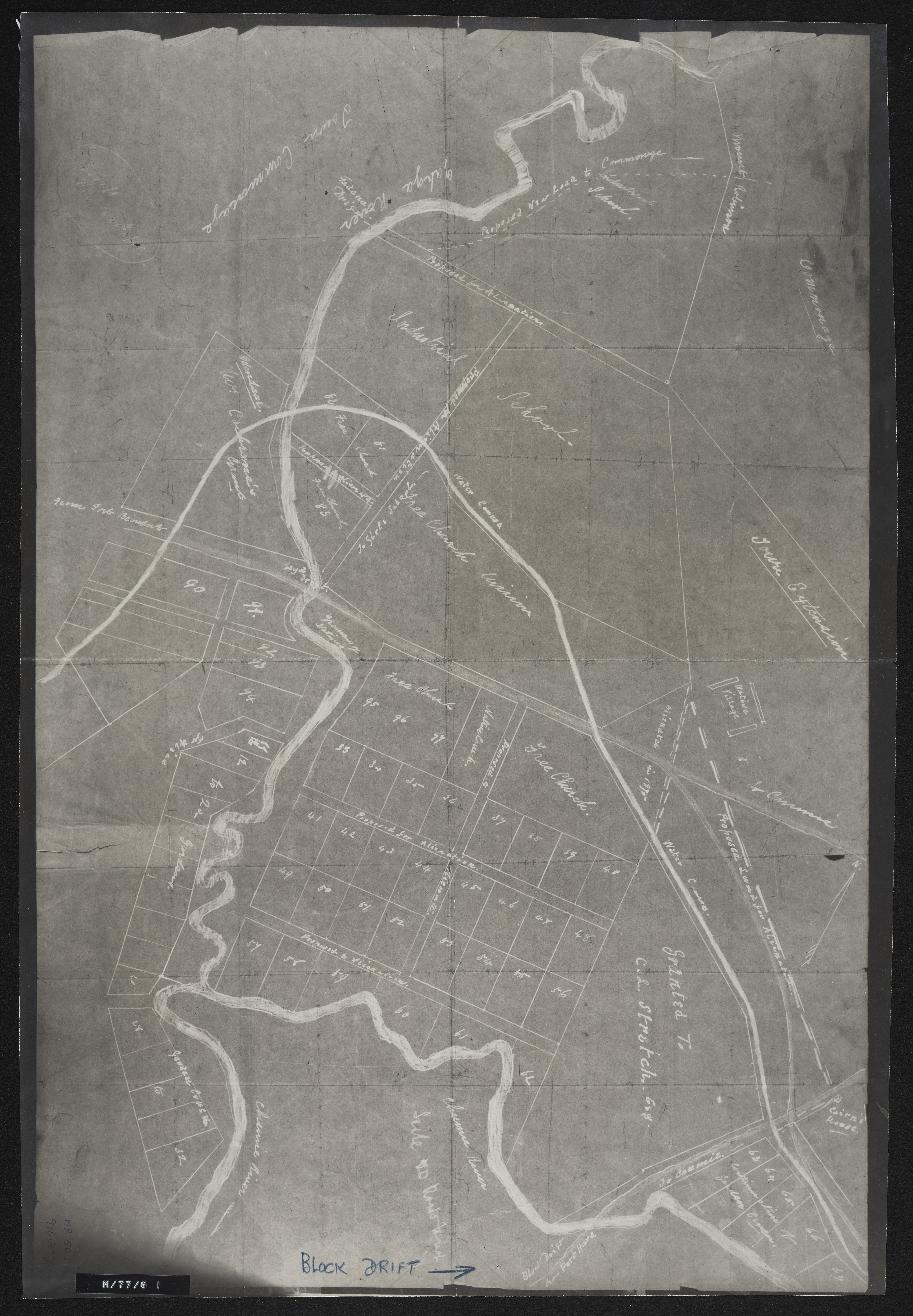
Plan of land around Lovedale; some of it marked for "alienation" - owners of some property shown. (Negative) Photograph of origincal manuscript, 1875.
-
Scale
-
1 inch = 20 feet
-
Publisher
-
South Africa. Surveyor General
-
Geographic Scope
-
30.5595° S, 22.9375° E
-
Type
-
cartographic
-
Genre
-
maps
-
Format
-
jpg
-
Extent
-
1 sheet 40.5 x 31 cm
-
Language
-
English
-
Rights Holder
-
South Africa. Surveyor General's Office
-
Archive
-
Original held at Cory Library for Humanities Research, situated at Rhodes University.
-
Asset No.
-
MP476
-
Identifier
-
http://hdl.handle.net/10962/109943