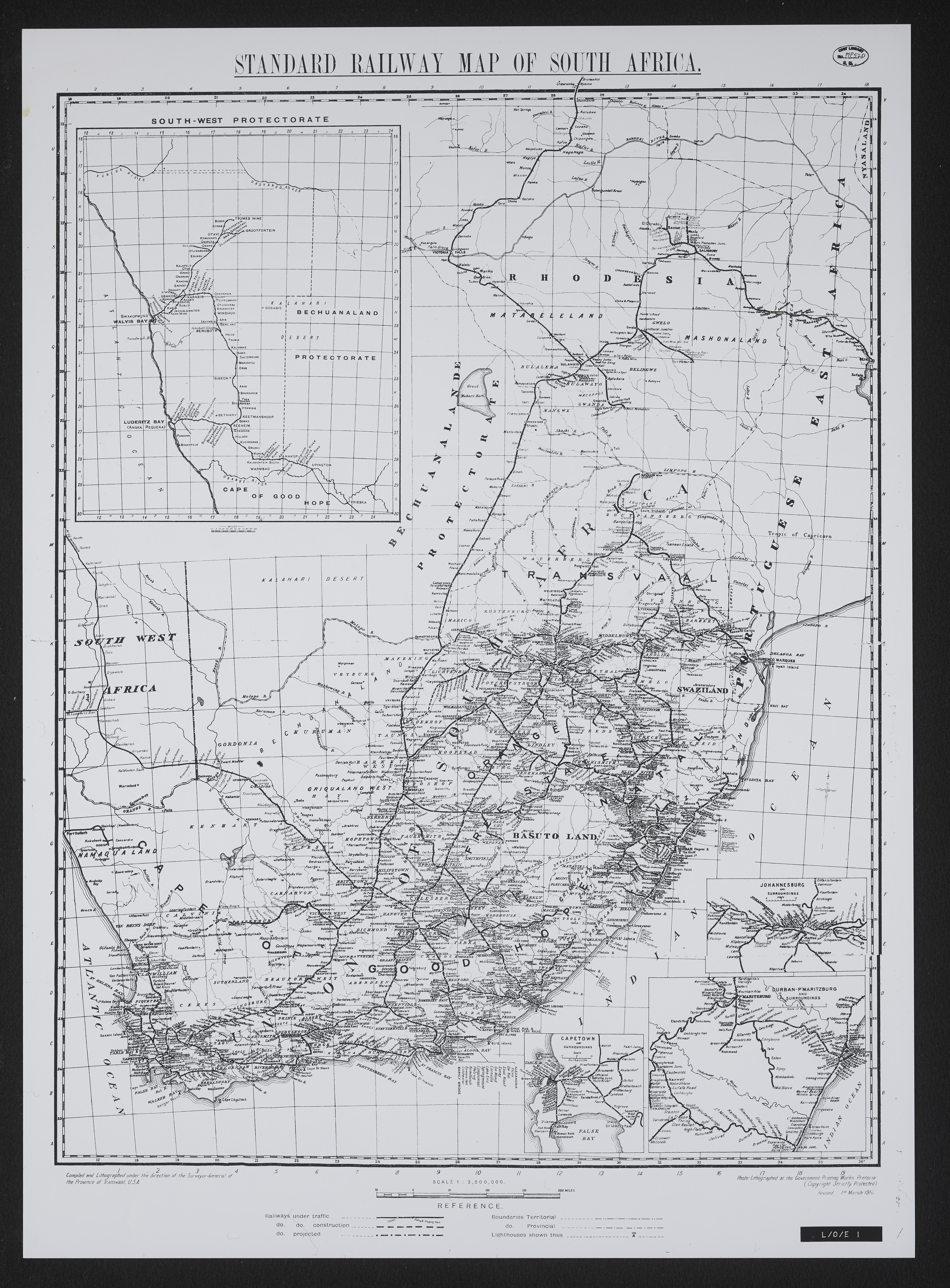
Standard railway map of South Africa
Item
-
Date
-
1916
-
Description
-
Photo-lithographed at the Government Printing Works, Pretoria.Revised 1 March 1916.
-
Scale
-
1: 3,500,000
-
Publisher
-
Government Printing Works
-
Geographic Scope
-
30.5595° S, 22.9375° E
-
Type
-
cartographic
-
Genre
-
maps
-
Format
-
jpg
-
Extent
-
1 sheet 27 x 20 in
-
Language
-
English
-
Rights Holder
-
Surveyor General
-
Archive
-
Original held at Cory Library for Humanities Research, situated at Rhodes University.
-
Asset No.
-
MP520
-
Identifier
-
http://hdl.handle.net/10962/106383