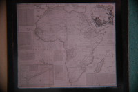
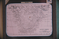
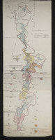
Lithographed by James Wyld, geographer to the Queen 457 Strand, 11 & 12 Charing Cross S.W. and 2 Royal Exchange E.C.,1849. Note: the position of the military posts are marked by a red circle, and the present colonial boundary is marked with a red tint. Copy of the original.
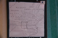
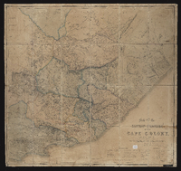
Map of the Eastern frontier of the Cape Colony, compiled by Henry Hall, a draughtsman to the Royal engineers, Cape Town, from military and other surveys, and dedicated by permission to J.F. Burgoyne. Published London, Edward Stanford.
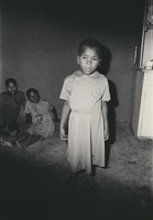
A series of photographs showing views of forced removal of communities from Klipfontein farm, near Kenton-on-sea, and other areas, to Glenmore in 1979. These photographs were accumulated by Ben Maclennan when he worked as a journalist for Eaastern Province Herald, covering the move, and when he wrote the book "Glenmore : the story of a forced romoval"