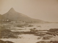
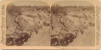
A photograph showing views of Lion's Head and Three Anchor Bay in Sea Point, Cape Colony, 1891. The photograph was probably taken by someone who did a tour of Cape Town in 1891. Inscription: "To dear Ethel, from Joe, Xmas 1891"
List of maps in the map album accompanying the thesis by Hilstan Lett Watts, "Grahamstown : a socio-ecological study of a small South African town", Rhodes University thesis, 1957.
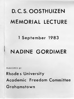
In this influential address, Nobel Laureate Nadine Gordimer reflects on the "interregnum"—the period between the dying of the old apartheid order and the birth of a new, yet-to-be-defined society. She examines the role of the white writer and intellectual in a revolutionary context, the "ugly creation" of institutionalized racism, and the urgent need for a new South African identity beyond race and class.
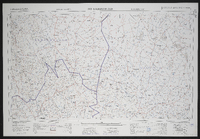
3018 Loeriesfontein, South Africa 1:25000 sheet. Compiled and drawn in 1961 by the Trigonometric Survey Office. Magisterial districts as at May 1961. T.S.O. 404/953. (Saamgestel en geteken in 1960 deur die Driehokesmatings Kantoor.)
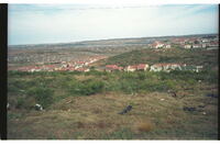
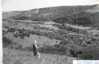
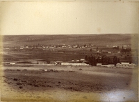
Nice houses in centre photo overlooking urban sprawl beyond. Bethelsdorp Saltpan near top of photo, thinned out original veld in foreground in which Sanseviera plants thrive. More good type homes behind photographer.
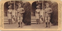
A series of photographs showing views of forced removal of communities from Klipfontein farm, near Kenton-on-sea, and other areas, to Glenmore in 1979. These photographs were accumulated by Ben Maclennan when he worked as a journalist for Eastern Province Herald, covering the move, and when he wrote the book "Glenmore : the story of a forced romoval" This photograph shows Mr Louis Koch, appointed Chief Director of the Cape Midlands Administration Board, and Mr B. Zondani together with other two white men. It is not clear where they are standing, possibly infront of the Grahamstown High Court