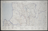
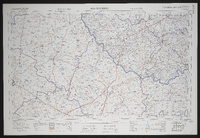
3218 Clanwilliam, South Africa 1:25000 sheet. Compiled and drawn in 1960 by the Trigonometric Survey Office. Magisterial districts as at June 1967. T.S.O. 404/966. (Saamgestel en geteken in 1960 deur die Driehokesmatings Kantoor.)
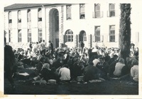
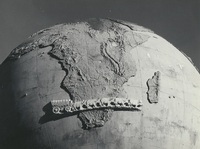
The Karel Landman Monument in the Sundays River Valley Rural, Eastern Cape, was designed by Gerard Moerdyk and built by the Lupini Brothers. It was unveiled on 16 December 1939 by W A L Landman. It honours Karel Landman who farmed in this area until 1837 when he became a leader in the Great Trek. He led a party of 180 Trekkers and their servants on a trek of 885 kilometres into Natal where he was prominent in several battles with the Zulus and he was second in command of the Boer forces at the pivotal battle of Blood River. The commemoration of Karel Landman and his trek, in this 3m globe with an ox wagon traversing it, was an initiative of the National Party and the councils of the Dutch Reformed Church in two neighbouring villages, Alexandria and Paterson. Legend has it that the councils could not agree which village should 'host’ the monument, so it was placed on this remote koppie overlooking the surrounding countryside, between the two villages.,F G Butler (donor)
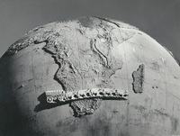
The Karel Landman Monument in the Sundays River Valley Rural, Eastern Cape, was designed by Gerard Moerdyk and built by the Lupini Brothers. It was unveiled on 16 December 1939 by W A L Landman. It honours Karel Landman who farmed in this area until 1837 when he became a leader in the Great Trek. He led a party of 180 Trekkers and their servants on a trek of 885 kilometres into Natal where he was prominent in several battles with the Zulus and he was second in command of the Boer forces at the pivotal battle of Blood River. The commemoration of Karel Landman and his trek, in this 3m globe with an ox wagon traversing it, was an initiative of the National Party and the councils of the Dutch Reformed Church in two neighbouring villages, Alexandria and Paterson. Legend has it that the councils could not agree which village should 'host’ the monument, so it was placed on this remote koppie overlooking the surrounding countryside, between the two villages.,F G Butler (donor)
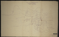
3025 Colesberg, South Africa 1:25000 sheet. Compiled and drawn in 1959 by the Trigonometric Survey Office. Magisterial districts as at January 1964. T.S.O. 404/956. (Saamgestel in 1959 en geteken in 1959 deur die Driehokesmatings Kantoor.)