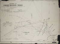
Boundary of Griqualand West (MP416d)compiled by the Surveyor General's records from the surveys in progress by Mr. Surveyor J.H. Ford and from personal observation. Boundary beaconed by Mr.Surveyor Ford, recommended by Colonel Mosey, and approved MM Aby. Lithographed and printed by W.A. Richards and Son, Cape Town. Plan attached to the Griqualand West Northern Boundary Commission (MP416e), dated June 21, 1883 ; Boundary recommended the lines ST and TU, S. Melvill, 4th July 1883.
Album relating to the Zulu people of Zululand in the Natal Province during the years 1930-31 and 1934, taken at various places, including Chads College, Ladysmith; Springfield, Mooirivier; the Leytown Pohams House ("Hemrock"), Nottingham Road; Umlazi Mission; Etalaneni; Kwamagwaza; on the way to Biyela : mainly photographs, some original, some photocopies, with descriptive text in some cases / photographer unknown. 50 Photographs in one album : b+w (some sepia), 22 cm x 10 cm or less.
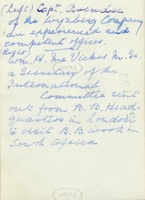
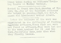
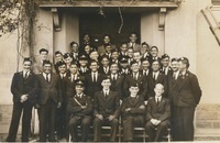
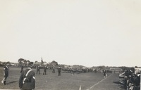
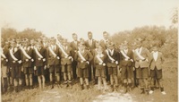
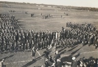
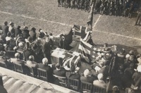
Written on flap of envelope: "Snaps taken on the occasion of a parade of the B.B. Battalion on Young's Field, Wynberg during the visit of Mr. McVicker from London"
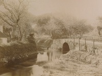
Photograph showing a view of Liesbeeck River bridge in Mowbray Cape Town, 1891. The photograph was probably taken by someone who did a tour of Cape Town in 1891. Inscription: "To dear Ethel, from Joe, Xmas 1891"