Grahamstown, Eastern Cape, South Africa
Item set
- Alternative Title
- Grahamstown, Cape Colony
- Creator
-
Cory Library for Humanities Research
- Role Relationship - Role
- en compiler
- Description
- A curated digital collection documenting the history of Grahamstown (Makhanda). This set includes historical photographs, maps, architectural plans, and civic records. Key themes include the 1820 Settler heritage, Victorian-era development, local religious institutions, and the socio-political evolution of the town within the Eastern Cape.
- Type
- Collection
- Subject
- Grahamstown (South Africa) -- History
- Makhanda (South Africa) -- History
- Architecture -- South Africa -- Grahamstown
- Eastern Cape -- Local History
- Temporal Coverage
- 19th Century to 20th Century
Items
-
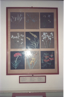 Display Sister Jeannie's flower paintings in foyer. A gift from Sisters of the Community of the Resurrection, per kind favour, the Curator, Tony Dold. (the white spot is a light reflection).
 -
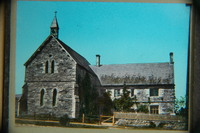
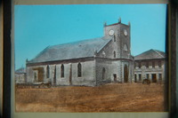 North west view of St. George’s Church in circa 1865.
 -
-
-
-
-
-
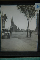
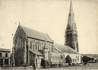 Cathedral in High Street, Grahamstown.,Gold Fields of South Africa Ltd. (donor)
 -
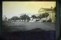
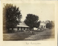 Although only inscribed 'Street. Grahamstown' on the mount, this is in fact a photograph of The Oaks, a cottage in Somerset Street, taken by Dr. W.G. Atherstone. It shows six little boys playing in the foreground, with Renfrew House to the extreme right.
 -
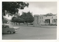
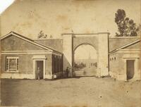 Photograph of two men in front of the Drostdy Arch, entrance to Rhodes University, in Grahamstown, South Africa. The Rhodes University clock tower is visible in the background.
 -
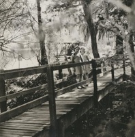 Photograph of two young girls (possibly Ann and Elizabeth Kerr) on a wooden bridge over Kowie Ditch in the Grahamstown Botanical Gardens,Leila Kerr (Linington) (Donor)
 -
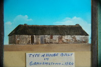 Old Guard House in High Street, Grahamstown. Part of Scott's Barracks. It was pulled down in 1824.
 -
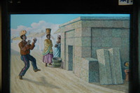
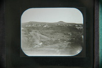
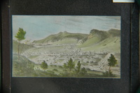
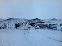 Facebook post (dated 22 February 2021) by Gareth Angelbeck: "A reproduction of a pen-and-ink sketch by W. Guybon Atherstone from the steps of the Drostdy looking down High Street, dated 3 May 1830. The three-storied building at the corner of High Street (now Major Frasiers) is known to have been built by Pieter Retief. All subsequent illustrations show it with two stories only, and the alteration must have taken place several decades before the advent of photography. The sketch also shows an open water furrow, leading from the bottom right corner to the top of High Street. This was the public water supply of the town in 1830, which was led to open tanks at various points in the town. Colonel Graham's mimosa tree is shown, in the middle of High Street, a short distance from St. George's Church (later, the Cathedral). This tree, marking the traditional spot where the decision to found Grahamstown was made on 14 August 1812, was destroyed in a gale in 1844. (Ref- Grahamstown in Early Photographs, F van der Riet, David Philip pub, CT, 1974)."
 -
 Added to the lantern slide collection by Dr Charles GE Cory, son of Sir George Cory.
 -
-
-
-
-
 This image is held at the Cory Library for Humanities Research at Rhodes University. For further information contact cory@ru.ac.za. The digitisation of this image was made possible through a generous grant received from the Andrew W. Mellon Foundation 2014-2017.
 -
-