On the krans in the background are at least 32 nests of black-headed Herons yet, on top of the krans is a thicket of tall Euphorbias on which the birds could have built comfortably more in conformity with their usual habit of nesting in trees.
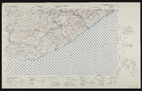
3326 East London, South Africa 1:25000 sheet. Compiled and drawn in 1961 by the Trigonometric Survey Office. Magesterial districts as at November 1960. T.S.O. 404/977. (Saamgestel in 1960 en geteken in 1960 deur die Driehokesmatings Kantoor.)
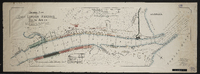
Inspection of telegraph line - G. McKay, East London to Potsdam - C. Brownlee, King Williams Town to Potsdam; [comp. by G. McKay?].Scale not stated. 1 sheet 14½" x 22". Manuscript; may be dated "1868".
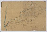
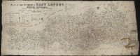
Plan of the division of East London, British Kaffraria, taken from general plans framed by D. Macdonald, A. E. Murray, E.T. Cooper, H.E.R. Bright, J.X. Merriman, J. Powell, E. Griffiths, W.D. Dumbleton, C. Watermeyer, H. Bryant, Lieutenant Colley, C.A. Smith and C.J. Gray, Government Surveyors; Compiled by C. Neumann Thomas, Surveyor General's Office, Cape Town, 1867. Scale 1" = 4000 Cape Roods. 1 sheet 30" x 72". Showing Field Cornetcy areas and Leased Lots.
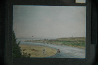
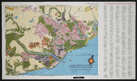
Tourist map of East London showing places of interest. Produced by the East London Publicity Association in conjunction with Shell South Africa (Pty) Limited. Compiled and drawn by B. L. Walton, October 1955.