Cory Map Collections
Item set
- Title
- Cory Map Collections
- Description
-
The Cory Map Collections form one of the most comprehensive cartographic repositories in Southern Africa. Curated by the Cory Library for Historical Research at Rhodes University, the collection is a vital resource for understanding the evolving spatial, political, and social boundaries of the Eastern Cape and the broader subcontinent.
The maps range from early 16th-century European depictions of the African continent to highly detailed 19th-century military surveys of the Eastern Cape frontier. They document the progress of colonial settlement, the demarcation of mission stations, the layout of frontier forts, and the development of early South African infrastructure like post offices and post-war schools. - Language
- English
- Afrikaans
- Temporal Coverage
- c. 1540 – 1980
- Cartographics - Scale
- Varies (from 1:5,000 for town plans to 1:1,000,000 for regional maps
- Format
- Vellum, linen-backed paper, and modern digital surrogates
Items
-
-
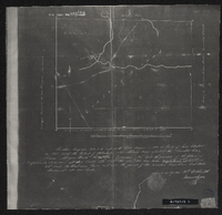
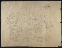
 In the Division of Albany, Field Cornetcy of Lower Riebeek.
 -
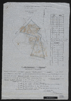
 Diagram of the farm Wilton, being a portion of the farm known as Hoffman's Kloof, granted under amended title to Henry Webb and Clement John Sneyd on the 26th day of July 1897, surveyed and beaconed by me according to regulations 19th July 1910. P. Coperman. In the Division of Albany, Field Cornetcy of Lower Riebeek.
 -
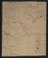
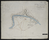
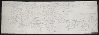 Albany sheet no. 6. Details of Sephton's party, Clarke's party, Morgan's party, Howard's party and Liversage's party.
 -
 An incomplete series of sheets in 10 sections (laminated working copy) MP 390-394.
 -
 Details of Sephton's party, Clarke's party, Morgan's party, Howard's party and Liversage's party. C. Neumann Thomas, compiler ; [Cape Town, Surveyor General's Office].
 -
 Albany sheet no. 6. Details of Sephton's party, Clarke's party, Morgan's party, Howard's party and Liversage's party.
 -
-
-

-
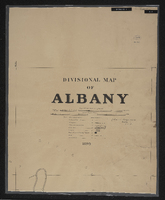
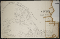 Divisional map of Vryburg, 1900, compiled by J. Fleming ; scale 2000 Cape roods = 1 inch ; 3 sheets.
 -
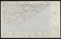 3326 East London, South Africa 1:25000 sheet. Compiled and drawn in 1961 by the Trigonometric Survey Office. Magesterial districts as at November 1960. T.S.O. 404/977. (Saamgestel in 1960 en geteken in 1960 deur die Driehokesmatings Kantoor.)
 -
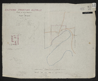
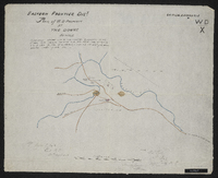
 Copied by Walter P. Jones, 21st July 1873. War Department number on map WD. X
 -
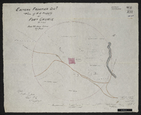
 Copied by Walter P. Jones, 23rd July 1873. War Department number on map WD. X
 -
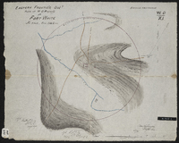
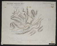
 Copied by Walter P. Jones, 17th July 1873. War Department number on map WD. VII
 -
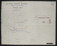
 Title 29th January 1944. Copied by Walter P. Jones, 21st August 1873. War Department number on map WD. XIII.
 -
 Copied by Walter P. Jones, 18th August 1873. War Department number on map WD. IV.
 -
 Copied by Walter P. Jones, 23rd July 1873. War Department number on map WD. XI.
 -
 Copied by Walter P. Jones, 19th August 1873. War Department number on map WD. VI.
 -
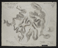
 Copied by Walter P. Jones, 23rd July 1873.War Department number on map WD. XIII.
 -
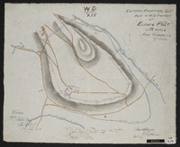
 Copied by Walter P. Jones, 18th August 1873. War Department number on map WD. XIV.
 -
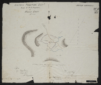 Copied by Walter P. Jones, 21st August 1873. War Department number on map WD. VII.
 -
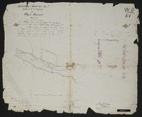 Copied by Walter P. Jones, 23rd July 1873. War Department number on map WD. XV.
 -
 Copied by Walter P. Jones, 20th August 1873. War Department number on map WD. IX.
 -
 Copied by Walter P. Jones, 20th August 1873. provisionally handed over to the colonial government 5th April 1873, pending sanction from war office vide letter to v.s. of state for war of 12th March 1873, with H.E. the commander of the forces approval thereon on the same date. War Department number on map WD. X.