Cory Map Collections
Item set
- Title
- Cory Map Collections
- Description
-
The Cory Map Collections form one of the most comprehensive cartographic repositories in Southern Africa. Curated by the Cory Library for Historical Research at Rhodes University, the collection is a vital resource for understanding the evolving spatial, political, and social boundaries of the Eastern Cape and the broader subcontinent.
The maps range from early 16th-century European depictions of the African continent to highly detailed 19th-century military surveys of the Eastern Cape frontier. They document the progress of colonial settlement, the demarcation of mission stations, the layout of frontier forts, and the development of early South African infrastructure like post offices and post-war schools. - Language
- English
- Afrikaans
- Temporal Coverage
- c. 1540 – 1980
- Cartographics - Scale
- Varies (from 1:5,000 for town plans to 1:1,000,000 for regional maps
- Format
- Vellum, linen-backed paper, and modern digital surrogates
Items
-
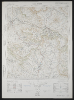
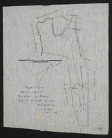 Surveyed by T. Knobel, 1821.
 -
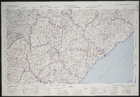
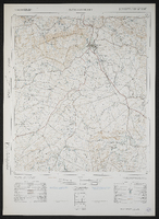
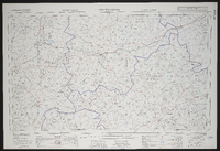 3120 Williston, South Africa 1:25000 sheet. Compiled and drawn in 1960 by the Trigonometric Survey Office. Magisterial districts as at February 1961. T.S.O. 404/961. (Saamgestel in 1960 en geteken in 1960 deur die Driehokesmatings Kantoor.)
 -
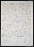
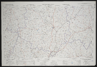 3122 Victoria West, South Africa 1:25000 sheet. Compiled and drawn in 1960 by the Trigonometric Survey Office. Magisterial districts as at February 1961. T.S.O. 404/962. (Saamgestel in 1960 en geteken in 1960 deur die Driehokesmatings Kantoor.)
 -
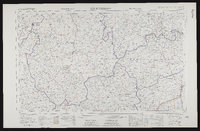
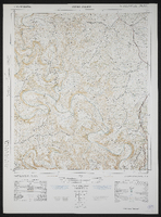
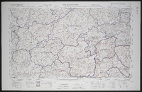 3126 Queenstown, South Africa 1:25000 sheet. Compiled and drawn in 1960 by the Trigonometric Survey Office. Magisterial districts as at March 1966. T.S.O. 404/964. (Saamgestel in 1960 en geteken in 1960 deur die Driehokesmatings Kantoor.)
 -
 3128 Umtata, South Africa 1:25000 sheet. Compiled and drawn in 1960 by the Trigonometric Survey Office. Magisterial districts as at May 1960. T.S.O. 404/965. (Saamgestel in 1960 en geteken in 1960 deur die Driehokesmatings Kantoor.)
 -
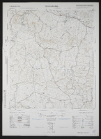
 3220 Sutherland, South Africa 1:25000 sheet. Compiled and drawn in 1960 by the Trigonometric Survey Office. Magisterial districts as at November 1960. T.S.O. 404/967. (Saamgestel in 1960 en geteken in 1960 deur die Driehokesmatings Kantoor.)
 -
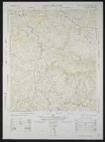
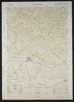
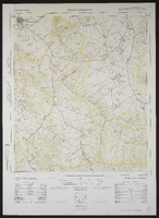 3226AB Tarkastad. South Africa 1:50000 sheet. Air photography 1954. Field survey 1965. Drawn by the Trigonometric Survey in 1966. T.S.O. 200/2641. (Lugfotografie 1943. Veldopmeting 1945. Saamgestel en geteken in 1953 deur die Driehokesmatings Kantoor.) First edition
 -
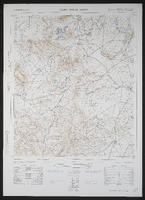
 3226AC Baviaansrivier, South Africa 1:25000 sheet. Air photography 1954. Surveyed in 1965 and drawn in 1966 by the Trigonometrical Survey Office. Lugfotografie 1954. Opgemeet 1965 en geteken in 1966 deur die Driehoeksmeting Kantoor. T.S.O. 200/2665.
 -
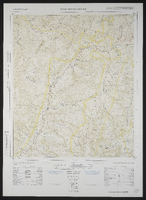
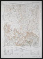
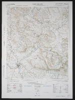
 3226AD Spring Valley, South Africa 1:50000 sheet. Air photography 1954. Surveyed in 1954 and drawn in 1965 by the Trigonometrical Survey Office. Revised in 1966. Lugfotografie 1954. Opgemeet 1954 en geteken in 1965 deur die Driehoeksmeting Kantoor Hersien in 1966. T.S.O. 200/2639. First edition.
 -
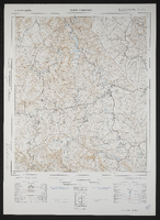
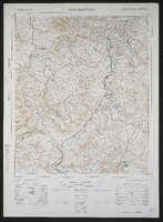
 3226BA Poplar Grove, South Africa 1:50000 sheet. Air photography 1954. Surveyed in 1965 and drawn in 1966 by the Trigonometrical Survey Office. Lugfotografie 1954. Opgemeet 1965 en geteken in 1966 deur die Driehoeksmeting Kantoor. T.S.O. 200/2586.
 -
 3226BC Hackney, South Africa 1:50000 sheet. Air photography 1954. Surveyed in 1964 and drawn in 1966 by the Trigonometrical Survey Office. Lugfotografie 1954. Opgemeet 1964 en geteken in 1966 deur die Driehoeksmeting Kantoor. T.S.O. 200/2616.
 -
 3226BD Fairford, South Africa 1:50000 sheet. Air photography 1956. Surveyed in 1965 and drawn in 1966 by the Trigonometrical Survey Office. Lugfotografie 1956. Opgemeet 1965 en geteken in 1966 deur die Driehoeksmeting Kantoor. T.S.O. 200/2590. First edition
 -
 3226CA Bedford, South Africa 1:50000 sheet. Air photography 1949 and 1950. Surveyed in 1965 and drawn in 1966 by the Trigonometrical Survey Office.
 -
 3226CB Adelaide, South Africa 1:50000 sheet. Air photography 1949 and 1950. Surveyed in 1965 and drawn in 1966 by the Trigonometrical Survey Office. Lugfotografie 1949 and 1950. Opgemeet 1965 en geteken in 1966 deur die Driehoeksmeting Kantoor. T.S.O. 200/2575. First edition
 -
 3226CD Kroomie, South Africa 1:50000 sheet. Air photography 1949 and 1950. Surveyed in 1964 and drawn in 1966 by the Trigonometrical Survey Office. Lugfotografie 1949 and 1950. Opgemeet 1964 en geteken in 1965 deur die Driehoeksmeting Kantoor. T.S.O. 200/2523. Cadastral information supplied by the Surveyor General, Cape. First edition
 -
 3226DC Healdtown, South Africa 1:50000 sheet. Air photography 1950. Surveyed in 1964 and drawn in 1966 by the Trigonometrical Survey Office. Lugfotografie 1950. Opgemeet 1964 en geteken in 1965 deur die Driehoeksmeting Kantoor. T.S.O. 200/2418. First edition
 -
 3226DB Seymour, South Africa 1:50000 sheet. Air photography 1949. Surveyed in 1964 and drawn in 1965 by the Trigonometrical Survey Office. Lugfotografie 1949. Opgemeet 1964 en geteken in 1965 deur die Driehoeksmeting Kantoor. T.S.O. 200/2420. First edition
 -
 3226DD Alice, South Africa 1:50000 sheet. Air photography 1949. Surveyed in 1956 and drawn in 1960 by the Trigonometric Survey Office. T.S.O. 200/1471. (Lugfotogafie 1949, Opgemeet in 1956 en geteken in 1960 deur die Driehokesmatings Kantoor.) First edition.
 -
 3227AC Cathcart, South Africa 1:50000 sheet. Air photography 1956. Surveyed and drawn in 1963 by the Trigonometrical Survey Office. T.S.O. 200/2021.
 -
 3227AD Toise, South Africa 1:50000 sheet. Air photography 1956. Surveyed and drawn in 1964 by the Trigonometrical Survey Office. Lugfotografie 1956. Opgemeet en geteken in 1964 deur die Driehoeksmeting Kantoor. T.S.O. 200/2033. Cadastral information supplied by the Surveyor Genera, Cape. First edition
 -
 3227BC Bolo, South Africa 1:50000 sheet. Air photography 1950. Surveyed in 1956 and drawn in 1961 by the Trigonometrical Survey Office. Lugfotografie 1950. Opgemeet in 1956 en geteken in 1961 deur die Driehoeksmeting Kantoor. T.S.O. 200/1512. Kadastrale inligting verskaf deur die Landmeter-Generaal, Kaap. First edition
 -
 3227BD Toleni, South Africa 1:50000 sheet. Air photography 1950. Surveyed in 1951 and drawn in 1963 by the Trigonometrical Survey Office. Lugfotografie 1950. Opgemeet in 1951 en geteken in 1963 deur die Driehoeksmeting Kantoor. T.S.O. 200/1804. Cadastral information supplied by the Surveyor General, Cape. First edition
 -
 3227CA Keiskammahoek, South Africa 1:50000 sheet. Air photography 1949. Surveyed in 1954 and drawn in 1959 by the Trigonometrical Survey Office. Cadastral information supplied by the Surveyor-General, Cape and the Department of Native Affairs.
 -
 3227CB Stutterheim, South Africa 1:50000 sheet. Air photography 1953. Surveyed in 1959 and drawn in 1963 by the Trigonometrical Survey Office. Lugfotografie 1953. Opgemeet in 1959 en geteken in 1963 deur die Driehoeksmeting Kantoor. T.S.O. 200/1612. Cadastral information supplied by the Surveyor-General, Cape and the Department of Bantu Administration and Development. First edition
 -
 3227CC Debe Nek, South Africa 1:50000 sheet. Air photography 1949. Surveyed in 1956 and drawn in 1959 by the Trigonometrical Survey Office. Lugfotografie 1949. Opgemeet in 1956 en geteken in 1959 deur die Driehoeksmeting Kantoor. T.S.O. 200/1343. Kadastrale inligting verskaf deur die Landmeter, Kaap, en die Department van Naturellesake. First edition