The Frontier Collections
Item set
- Title
- The Frontier Collections
- Description
-
The Frontier Collections are a curated collection of archival materials that document the turbulent and formative era of the Eastern Cape frontier. Spanning the late 18th to the early 20th century, these collections provide a multi-perspective view of the Frontier Wars (Xhosa Wars), the establishment of colonial administration, and the subsequent growth of settler infrastructure.
The collection is particularly noted for its focus on the "Frontier Country"—the region surrounding Makhanda (Grahamstown)—detailing the interplay between British settlers, Boer trekkers, and the Xhosa kingdoms. - Language
- English
- isiXhosa
- Type
- Collection
- Subject
- Frontier Wars
- 1820 Settlers
- Military History
- Colonial Architecture
- Xhosa History
- Urban Development
- Spatial Coverage
- Eastern Cape, South Africa (formerly the Cape Colony frontier)
- Temporal Coverage
- c. 1779 – 1910
- Format
- Manuscripts
- Lantern slides
- Cartographic materials
Items
-
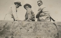 Photograph of three young men sitting on the pier
 -
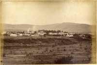
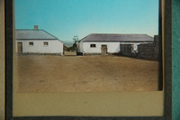
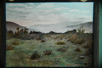
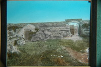
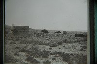
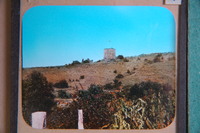 Fort Armstrong (originally known as Camp Adelaide) was built in 1836 to protect the Kat River Settlement. After suffering capture and bombardment in the 8th Frontier war (1851), it was never used again.,Fort Armstrong was built in 1836, on the Kat River.
 -
 Fort Armstrong (originally known as Camp Adelaide) was built in 1836 to protect the Kat River Settlement. After suffering capture and bombardment in the 8th Frontier war (1851), it was never used again.,Fort Armstrong was built in 1836, on the Kat River.
 -
 The note on the back reads: “Cory: The Rise of S Africa. Vol III. P.188. Fort Armstrong”.
 -
-
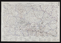 3226 Fort Beaufort, South Africa 1:25000 topo-cadastral sheet, Suid Afrika 1 : 25000 topo-kadastrale vel, cadastral information supplied by the Surveyors General Office. TSO 404/970. Compiled and drawn in 1960 by the Trigonometrical Survey Office.
 -
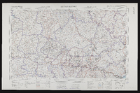 3226 Fort Beaufort, South Africa 1:25000 sheet. Compiled and drawn in 1960 by the Trigonometric Survey Office. Magisterial districts as at March 1965. T.S.O. 404/970. (Saamgestel en geteken in 1960 deur die Driehokesmatings Kantoor.)
 -
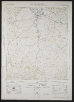 3226 Fort Beaufort, South Africa 1:50000 topo-cadastral sheet, Suid Afrika 1 : 50000 topo-kadastrale vel, Kadastrale informasie verskaf deur die Landmeter-Generaal, Kaap. TSO 200/1737. Air photography 1949. Surveyed in 1961 and drawn in 1962 by the Trigonometrical Survey Office. Lugfotografie 1949. Opgemeet 1961 en geteken in 1962 deur die Driehoeksmeting Kantoor. First edition.
 -
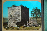
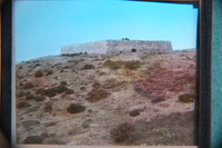
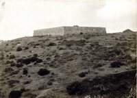
 Fort Brown, built by Andrew Geddes Bain in 1836 on a site previously known as Hermanus Kraal.
 -
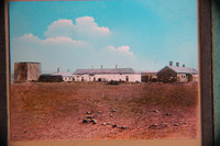 Fort Brown, built by Andrew Geddes Bain in 1836 on a site previously known as Hermanus Kraal.
 -
 Fort Brown, built by Andrew Geddes Bain in 1836 on a site previously known as Hermanus Kraal.
 -
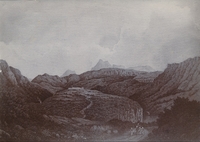
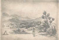 Photographic copies of two drawings of Fort Cox in ca 1850 by C E A, one showing the encampment of a regiment with a Xhosa man, woman and baby and the other showing buildings, tents, Xhosa people and wagons.
 -
 Photographic copies of two drawings of Fort Cox in ca 1850 by C E A, one showing the encampment of a regiment with a Xhosa man, woman and baby and the other showing buildings, tents, Xhosa people and wagons.
 -
-
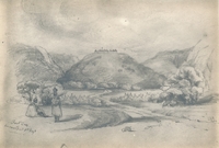
 Fort Cox from painting by Colonel Grant
 -
-
-
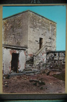
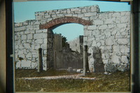 Port Elizabeth: Fort Frederick, built 1798.
 -
 Port Elizabeth: Fort Frederick, built 1798.
 -
 Port Elizabeth: Fort Frederick, built 1798.
 -
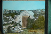
 Port Elizabeth: Fort Frederick, built 1798. View showing entrance gate from the inside, with powder magazine to the left, and steps leading up to the sentries' walk.
 -
 Port Elizabeth: Fort Frederick, built 1798.
 -
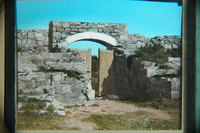
 Port Elizabeth: Fort Frederick, built 1798. View inside the Fort showing powder magazine and steps to the sentries' walk.
 -
 The note on the back reads: “Fort Frederick. Port Elizabeth”.
 -
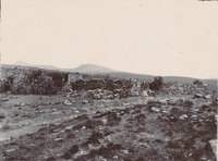
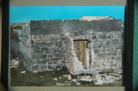
 Showing the magazine and the remaining wall of the fort.