Pre 1910 Maps
Item set
- Title
- Pre 1910 Maps
- Alternative Title
- Cory Library Historical Map Collection
- Description
-
This digital collection comprises 95 historical maps and plans created before 1910, drawn from the cartographic holdings of the Cory Library for Humanities Research at Rhodes University. The maps encompass a range of colonial-era topographic surveys, military sketches, regional cartographic representations, and early colonial settlement plans, covering parts of Southern Africa, particularly the Eastern Cape, Cape Colony, and adjacent territories. The collection includes manuscript plans and lithographed maps, many of which were compiled under the auspices of colonial government departments, military engineers, and early surveyors. It reflects early geographical knowledge and spatial organisation during the 19th century and the period just before the turn of the 20th century, including maps of military engagements (e.g., Spion Kop, 1900), indigenous territories, settlement expansions, and early infrastructural landscapes.
digitalarchives.ru.ac.za
These pre-1910 maps are vital resources for historians, geographers, archaeologists, and researchers interested in colonial cartography, frontier history, military history, settlement patterns, indigenous landscapes and early colonial administration in South Africa. Each map provides unique insights into historical spatial understandings and territorial control at a formative stage in South African cartographic history. - Language
- English
- Type
- Collection
- Format
- Digital Images (various scans) - Various map scales and projections
- Spatial Coverage
- Southern Africa (includes Cape Colony divisions, Transkei, Natal region, etc.)
- Temporal Coverage
- 19th century – very early 20th century (pre-1910)
- Relation
- Part of the Cory Map Collection; Related to other map sets such as 1910-pre-1994 Maps
- Extent
- 95 map items (digital)
Items
-
-
 Sketch map of Natal No. 1 showing the aboriginal tribes and the lands occupied by them previous to 1812, at which date their disturbance by the Chief Chaka commenced ; [1864]. Key contains a list of 94 tribes which originally occupied KwaZulu Natal.
 -
-
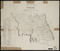
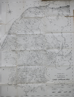 Sketch map of the portion of the territory of East Griqualand : traversed while settling locations by the vacant Land Commissioners. The Hon. C. Brownlee, CMG Donald Strachan and CP Watermeyer in June-September 1883.
 -
 Ordered by the House of Commons to be printed 12th July 1837.
 -
 Sketch of Fort Beaufort; approved by J. Hare and Chas. Bell A.S.G. ; no scale
 -
 Signed by Charles Bell (Assistant Surveyor General.
 -
-
-

-
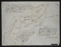 Sketch of the lands, the property of the Free Church and Charles Stretch as the grant appeared when Caffraria was invaded by the British troops on 9th of April 1846; [drawn by] C.L. Stretch.
 -
 Copied by Walter P. Jones, 23rd July 1873.
 -
-
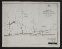
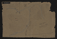
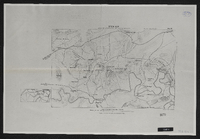 Spion Kop : area of operations Jan 17th to 26th 1900.
 -
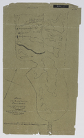
 Survey of a portion of the Kat River Settlement shewing the colonial boundary from Fort Beaufort to the Kat Berg, the military post at Fort Armstrong, Elands [Post], Mancasana and the abandoned posts at Echardts and Warden's. Photograph of original.
 -
 "Fine pasture country uninhabited and considered neutral ground".
 -
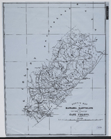
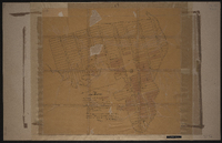
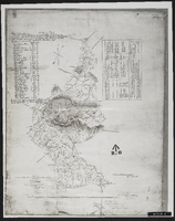
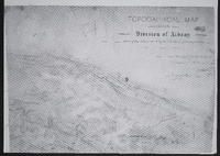 Topographical map of the division of Albany shewing the area covered by the 1st section of the triangulation. Surveyed for the Colonial [Office] by me Ernest ...
 -
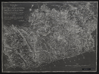
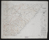 This map forms part of the Imperial map of the Cape Colony.,"South Africa having never been properly surveyed, this map must necessarily contain many inaccuracies." The map shows main roads, branch roads, farm roads, rivers, hills, pans, railways, telegraph lines, farm names, farm boundaries, divisional boundaries, outspans and homesteads in the Transkei region.Compiled and lithographed by Mapping Section, F.I.D., Cape Town, under the superintendence of P.H. du P. Casgrain from farm surveys and all other available information.
 -
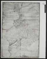
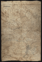 Transvaal, compiled and lithographed at the Intelligence Dept., Horse Guards, January 1881.
 -
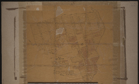
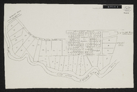 Woburn Military Village. No date on map but probably around 1848. Unsigned plan in some detail of the village, possibly as it was projected rather than as it actually appeared. Scale not stated. 1 sheet 14" x 9". Manuscript. From Sir George Cory's papers.