Pre 1910 Maps
Item set
- Title
- Pre 1910 Maps
- Alternative Title
- Cory Library Historical Map Collection
- Description
-
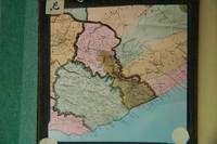
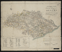
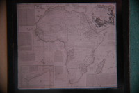
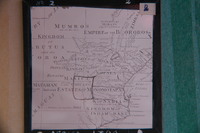
This digital collection comprises 95 historical maps and plans created before 1910, drawn from the cartographic holdings of the Cory Library for Humanities Research at Rhodes University. The maps encompass a range of colonial-era topographic surveys, military sketches, regional cartographic representations, and early colonial settlement plans, covering parts of Southern Africa, particularly the Eastern Cape, Cape Colony, and adjacent territories. The collection includes manuscript plans and lithographed maps, many of which were compiled under the auspices of colonial government departments, military engineers, and early surveyors. It reflects early geographical knowledge and spatial organisation during the 19th century and the period just before the turn of the 20th century, including maps of military engagements (e.g., Spion Kop, 1900), indigenous territories, settlement expansions, and early infrastructural landscapes.
digitalarchives.ru.ac.za
These pre-1910 maps are vital resources for historians, geographers, archaeologists, and researchers interested in colonial cartography, frontier history, military history, settlement patterns, indigenous landscapes and early colonial administration in South Africa. Each map provides unique insights into historical spatial understandings and territorial control at a formative stage in South African cartographic history. - Language
- English
- Type
- Collection
- Format
- Digital Images (various scans) - Various map scales and projections
- Spatial Coverage
- Southern Africa (includes Cape Colony divisions, Transkei, Natal region, etc.)
- Temporal Coverage
- 19th century – very early 20th century (pre-1910)
- Relation
- Part of the Cory Map Collection; Related to other map sets such as 1910-pre-1994 Maps
- Extent
- 95 map items (digital)
Items
-
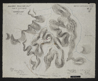
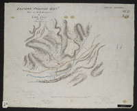 Copied by Walter P. Jones, 18th August 1873. War Department number on map WD. XIV.
 -
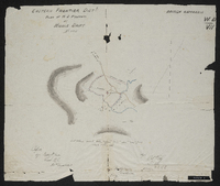 Copied by Walter P. Jones, 21st August 1873. War Department number on map WD. VII.
 -
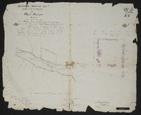 Copied by Walter P. Jones, 23rd July 1873. War Department number on map WD. XV.
 -
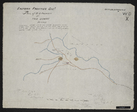
 Copied by Walter P. Jones, 20th August 1873. War Department number on map WD. IX.
 -
 Copied by Walter P. Jones, 20th August 1873. provisionally handed over to the colonial government 5th April 1873, pending sanction from war office vide letter to v.s. of state for war of 12th March 1873, with H.E. the commander of the forces approval thereon on the same date. War Department number on map WD. X.
 -
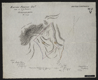 Copied by Walter P. Jones, 19th August 1873. War Department number on map WD. V.
 -
-

-
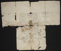 Free Church mission and Fort Hare : plan of the location and buildings. Not a clear document.
 -
 Free Church mission and Fort Hare : plan of the location and buildings. Not a clear document.
 -
 Farms: Carel's Rust, Springvale or Zuur Kloof, Procter's Fontein, Assegaai Bush, J.D.P. Francis' Farm, Komga. Granted 1833-1835.
 -
-
-
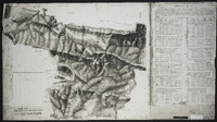
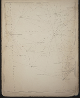 General plan of the triangulation of the southern part of the Cape Colony 1859.1862. W. Bailey, Captain Royal Engineers, Superintendant Trigonometrical Survey, 21 January 1863. A rough diagram has been constructed for the purpose of shewing the relative positions of the beacons erected and permanent objects observed in the course of the Triangulation and its connection with the stations of Sir T MacLear in the measurement of an arc of meridian. The diagram is tolerably accurate.
 -
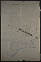
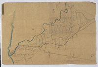
 Grahamstown and surrounding farms compiled from diagrams annexed to their respective grants in the Surveyor-General's Office; by D. Kryndow. Copy of original manuscript.
 -
 Griqualand West Northern Boundary Commission, Appendix map C, Filed among the Griqua government records, Colesberg, 1863. Surveyor General Office 1881. Filed by David Arnot, Griqua Secretary, agent and representative of the chief Waterboer and government at Colesberg in letter to his excellency Sir P.E. Wodehouse, her Britannic Majesty's high commissioner for South Africa.
 -
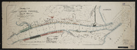
 Inspection of telegraph line - G. McKay, East London to Potsdam - C. Brownlee, King Williams Town to Potsdam; [comp. by G. McKay?].Scale not stated. 1 sheet 14½" x 22". Manuscript; may be dated "1868".
 -
-
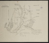
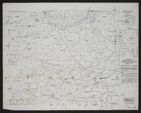
 [Imperial map of South Africa] : Kingwilliamstown compiled by the [British Military] Intelligence Department, 1900?
 -
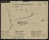
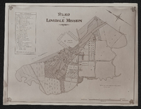 Plan of Lovedale Mission 1902. Photograph.
 -
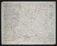 [Imperial map of South Africa] : Maclear compiled and lithographed by Mapping Section F.I.D. Cape Town under the superintendance of Capt. P.H. Du P. Casgrain ... from farm surveys and all other available information, [Wood and Ortlepp] [1900].
 -
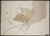 Attached to Report of the commissioners appointed to inquire into the question of the northern boundary of Griqualand West : with minutes of evidence, minutes of proceedings, map and plans, Cape of Good Hope Ministerial Department of Crown Lands and Public Works.
 -
-
-