C.J. Skead Photograph Collection
Item set
- Title
- C.J. Skead Photograph Collection
- Creator
- Skead, C. J. (Cuthbert John)
- Description
-
The Jack (Cuthbert John) Skead Collection comprises a substantial body of photographic material that documents the natural environments, vegetation types, and ecological habitats of the Eastern Cape and the wider southern African region. The photographs—taken over several decades—capture landscapes, plant communities, wetlands, forests, grasslands, and other habitat formations that were central to Skead’s extensive research interests. Many images also document environmental change, land use patterns, and field sites associated with his ornithological and botanical studies.
The collection provides a valuable visual record for researchers working in the fields of environmental history, ecology, biogeography, conservation, and Eastern Cape natural heritage. The photographs complement Skead’s published and unpublished work held at Cory Library, including field notes, correspondence, and research manuscripts. - Language
- English
- Provenance
- Materials received from the Skead Family.
- Type
- Collection
- Genre
- Photographs
- Subject
- South Africa--Addo Elephant National Park
- Addo Elephant National Park (South Africa)
- Natual history -- South Africa -- Eastern Cape
- Vegetation -- South Africa -- Eastern Cape
- Habitats -- South Africa -- Eastern Cape
- Ecology -- South Africa -- Eastern Cape
- Landscape photography -- South Africa
- Photograph collections
- Environmental change -- South Africa -- Eastern Cape
- Biogeography -- South Africa
- Eastern Cape (South Africa) -- Photographs
- Albany District (South Africa) -- Photographs
- Skead, C. J. (Cuthbert John), 1912–2006
Items
-
 Untitled image.
 -
 Untitled image.
 -
 Uceta Road.
 -
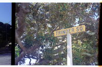
 Trinder Square.
 -
 Trinder Square.
 -
 Untitled image.
 -
 Untitled image.
 -
 Afternoon sunset.
 -
 Afternoon sunset.
 -
 Untitled image.
 -
 Untitled image.
 -
 Target Kloof road centrally with Settler's Park Reserve in valley bottom in right centre of photo.
 -
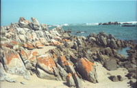 Red Lichen on rocks. Typical of the dry rocks along this coast.
 -
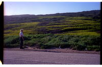
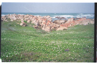 Full-flowering spread of Osteospermum fruticosum daisies, also known as Lagoon Daisies, or Rankmargriet. After a good winter followed by a good spring. Many such patches occurred in similar situations along the coast here.
 -
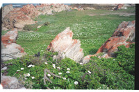 Spread of Osteospermum fruticosum daisies. One of many such carpets locally. After good winter season.
 -
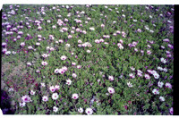 Close-up of Osteospermum fruticosum daisies showing density within a much larger patch.
 -
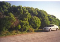 Very tall growth of Rooikrans, A cyclops only 100m from the sea. Compare with other photos of heavily wind-cut rooikrans only 1.5km east of Willows but also 100m from the sea. Why the difference?
 -
 Heavily windcut rooikrans, A cyclops 100m from the sea. Compare with tall rooikrans at The Willows 1.5km west of Noordhoek, also only 100m from the sea.
 -
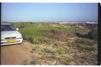 Windcut rooikrans, A cyclops 100m from the sea. Compare with tall rooikrans 1.5 km to west at The Willows, also 100m from the sea. Why the difference?
 -
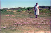
 Australian wattle kept low-cut by force of off-sea gales, a feature of this part of the rocky coastline. Belt of indigenous low-cut vegetation dark-green at edge of road beyond figure.
 -
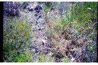
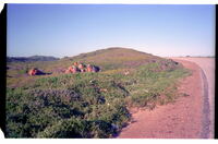 Image of veld.
 -
 A mallow Hibiscus erineum in dune vegetation.
 -
 Fine spread of Gynandriris cetacea on short grassy parking area. Others nearby.
 -
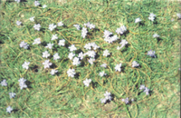 Cluster of Gynandriris cetacea. Part of a much larger group on short grassy parking area.
 -
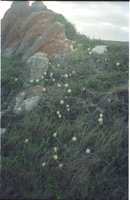 Patch of about 58 Haemanthus albiflos in an aggregation seldom seen in such numbers. Likely to be disturbed by human development.