-
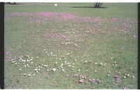
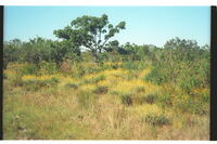 Van Staden's Wild Flower Reserve, Port Elizabeth
 Patch of Helichrysum anomalum.
-
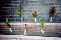 Van Staden's Wild Flower Reserve, Port Elizabeth
 Display of wild flowers, labelled in special display-hut on reserve.
-
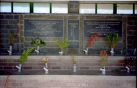 Van Staden's Wild Flower Reserve, Port Elizabeth
 Display of labelled wild flowers for benefit of the public. Plaques indicate display-huts commemoration of services of Mr. Frank R. Long, botanist & horticulturist at Port Elizabeth. Central logo depicts Cyrthanthus stadensis growing in the reserve .
-
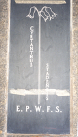 Van Staden's Wild Flower Reserve, Port Elizabeth
 Close-up of Cyrthanthus stadensis logo in special wild flower display hut on the reserve. EPWFS stands for Eastern Province Wild Flower Society who erected the hut in memory of Frank Reginald Long, botanist & horticulturist in Port Elizabeth.
-
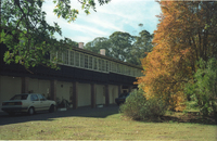 Van Staden's Wild Flower Reserve, Port Elizabeth
 Van Staden's Wild Flower Reserve, Port Elizabeth.
-
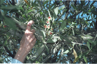 Van Staden's Wild Flower Reserve, Port Elizabeth
 Flowering of Sterculia alexandri with the red/brown centres.
-
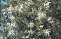 Van Staden's Wild Flower Reserve, Port Elizabeth
 Good flowering of Tarconanthus camphoratus.
-
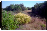 Van Staden's Wild Flower Reserve, Port Elizabeth
 Attractive leafiness of a Leucodendron species.
-
 Vegetation on the False Island at Kwaaihoek, Alexandria
 With replica of cross planted there in 1488 by Bartholomeu Dias. The scrub vegetation is dense, short and windblown, well-adapted to severe conditions there. Vegetation on the False Island at Kwaaihoek, Alexandria, 5 km west of Boesmans Mouth along the beach.
-
 Veld between Addo and Coerney
 A lone Spekboom standing in what must have been good Valley Bush Thicket in its heyday. Note the contrast of good bushiness in the far background. Note too, how the Spekboom has been eaten clean to the limits of a goats reach.
-
 Vergaderingskop, Hankey, Gamtoos Valley, Port Elizabeth
 Behind smoke the remains of Sarah Bartmann (ca.1789-1815) were reintered on 9/8/2002. The kop so-called because the earliest Hankey settlers held public meetings there.
-
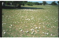 Verge of Strandfontein Road, Summerstrand, Port Elizabeth
 Dominant stand of the white form of Oxalis imbricata. A few of the pink form were out of the picture.
-
 Verge of Stranfontein Road & Maritz Street, Summerstrand, Port Elizabeth
 Mixed Oxalis imbricata with pink predominating.
-
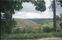
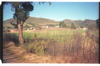 View across to Matt Zondagh Landgoed (per noticeboard there) at Avontuur, Langkloof, Uniondale
 View across to Matt Zondagh Landgoed (per noticeboard there) at Avontuur, Langkloof, Uniondale
-
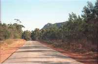
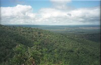
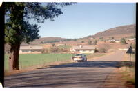 View at Avontuur adjacent to Matt Zondagh Landgoed
 View at Avontuur adjacent to Matt Zondagh Landgoed. The road leads south through the gap in the background hills via Prince Alfred's Pass to Knysna and Plettenberg Bay.
-
 View at western end of Grassridge, Uitenhage
 With light patch of Aloe africana. Veld ungrazed after good rains rains.
-
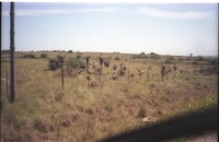
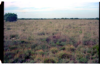 View eastwards across Grassridge between Coega & Addo towards Tankatara
 Well grassed area in tufts.
-
 View from near Fitches' Corner
 View of Lady's Slipper Rock on Witteklip Mt., Vanstadensberg, 38km west PE central.
-
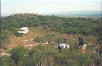 View from slope of eastern of the 3 Coega Kops northward to the northern kop, distance of about 150m
 William Massyn & Helen Vanderplank botanising. Groot Winterhoek Mts. In the misty far distance.
-
 View from St. Alban's Prison and Fitches Corner
 View of Lady's Slipper Rock on Witteklip Mt., Vanstadensberg, 38km west PE central.
-
 View from St. Alban's Prison gate at eastern end of the Van Stadensberg range, 38km west Port Elizabeth central.
 Distant view of Witteklip Mt.
-
 View from Suurberg Inn at the top of Suurberg Pass looking north towards the Rietberg ridge
 View from Suurberg Inn at the top of Suurberg Pass looking north towards the Rietberg ridge now known as the Suurberg.
-
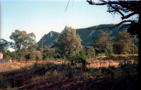
 View from the Suurberg pass looking south towards Coerney
 View from the Suurberg Pass looking south towards Coerney in right distance and the Addo Bush in left distance.
-
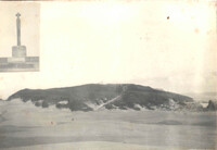
 View from the west of Table Hill on 'Table Farm', 11km NW of Grahamstown and in the Noutoe River valley which runs into the New Year's River out of picture to the left
 This valley of Noutoe during the 1700's was a famous outspan place and later farming area for the first Dutch settlers.
-
 View from the west of Table Hill on 'Table Farm', 11km NW of Grahamstown and in the Noutoe River valley which runs into the New Year's River out of picture to the left
 The Noutoe River breaks through the bush-dotted hills on the horizon to the far right centre. This valley was used during the1700's as the main outspan to the east before entering the Great Fish River valley. The 'Grosvenor' rescue mission of 1783, with its 300 personnel and waggons etc, camped here for a fortnight. Dutch farmers settled here and were granted land in 1783.