-
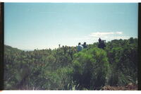
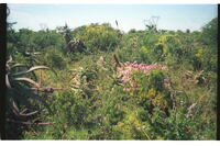 The Swartkops River valley at Redhouse
 Typical scrub-bushveld here & elsewhere in the vicinity. Soon to be destroyed under urban development. Note the variey of close-packed plant-life. Photo taken in a good season.
-
 Thompson Street, off High Street, Grahamstown
 Aloe arborescensin flower
-
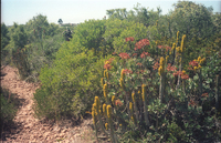
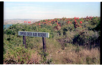
 Tipper's Creek Aloe Reserve, Amsterdamhoek, Port Elizabeth
 Note density of flowering Aloe pluridens in background. Flowering almost over.
-
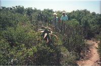
 Tipper's Creek Aloe Reserve, Amsterdamhoek, Swartkops River mouth, Port Elizabeth
 Density of Valley Bush. Dr Noel Urton & Helen Vanderplank in picture.
-
 Tipper's Creek Aloe Reserve, Amsterdamhoek, Swartkops River mouth, Port Elizabeth
 Showing extreme density of that type of valley bush with Euphorbia ledienii & Cotyledon velutina flowering in close association. The tall dark 'blemish' on the horizon in the mid-left part of the photograph is a tall tree among houses in Bluewater Bay Suburb.
-
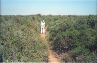
 Tipper's Creek Aloe Reserve, Amsterdamhoek, Swartkops River mouth, Port Elizabeth
 Density & height of Valley Bush is shown against two people in picture, Dr. Noel Urton & Helen Vanderplank.
-
 Tipper's Creek Aloe Reserve, Amsterdamhoek, Swartkops River, Port Elizabeth
 Aloe africana.
-
 Tipper's Creek Aloe Reserve, Amsterdamhoek, Swartkops River, Port Elizabeth
 Field of Aloe africana.
-
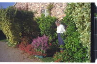
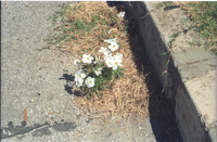 Tipper's Creek Road, Bluewater Bay, Amsterdamhoek, Swartkops mouth
 Single patch of Oxalis smithiana thriving well in a narrow crack in gutter between tarred road and kerb. Inflorescences esp. large and healthy dispite hard conditions.
-
 Top of Coega Kop, Port Elizabeth
 Aloe striata in seedpod in lefthand corner.
-
 Top of Coega Kop, Port Elizabeth, looking SE
 Aloe striata in flower.
-
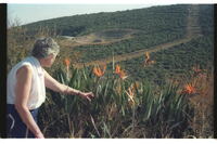 Top of Ecca Pass, NE Grahamstown
 Fine patch of Strelitzia reginae at roadside. Typical Ecca bushveld in distance, spoilt by hideous road-quarry and waterpipeline cut through the dense bush. MJ Collins.
-
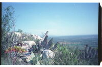
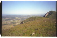
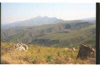 Top of Elands River Escarpment. From Uitenhage district into Humansdorp District
 Looking west into Gamtoos River Valley. Antoniesberg in distance, 873m above sea level (asl).
-
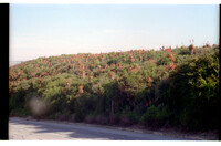
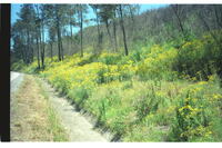 Top of Howison's Poort, 4 km west of Grahamstown
 Dense stand of Senecio weed growth after a burn. Had a good preceding season.
-
 Top of southern slope of Witteklip Mt., Port Elizabeth
 Showing east face of Lady's Slipper Rock, its heel and sole facing skyward.
-
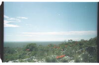
 Top of southern slope of Witteklip Mt., Port Elizabeth. Looking east across the plain towards Port Elizabeth
 The narrow strip immediately below the mountain from Van Staden's River to about Greenbushes is known to local Xhosas as eMduluswa which may have something to do with its proximity to the Lady's Slipper Rock's leaning attitude, about 400m behind the photographer.
-
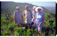
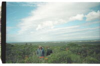 Top of the south-eastern kop at Coega Kops, Port Elizabeth
 The standing figures show the depth of the vegetation, the low ground to the south towards Algoa Bay soon to be built upon.
-
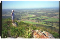
 Top of Witteklip Mt., Port Elizabeth
 The Lady's Slipper Rock can be seen in the distance. Top of Witteklip Mt., PE. Looking westwards across the Van Staden's River to Thornhill (Galgenbosch) country with St. Francis Bay in the distance.
-
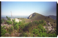 Top of Witteklip Mt., Port Elizabeth
 Showing east face of Lady's Slipper Rock, its heel and sole facing skyward.
-
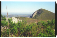 Top of Witteklip Mt., Port Elizabeth
 Southern Slope with Lady's Slipper Rock showing up well with heel & sole feature clearly exposed. In the distance Thornhill country once known as Galgenbosch leading to the Gamtoos River.
-
 Top of Witteklip Mt., Port Elizabeth
 Top of Witteklip Mt.
-
 Top of Witteklip Mt., Port Elizabeth
 Top of Witteklip Mt.
-
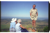
 Top of Witteklip Mt., Port Elizabeth
 With TV Crew (Mike Vincent) in proteaveld.
-
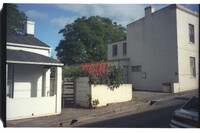
 Trinder Square
 Trinder Square.
-
 Trinder Square
 Trinder Square.