-
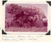 Sneezewood flower
 Caption "Sneezewood flower. Aug. 1958. Buffels Pan, East London."
-
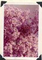 Sneezewood flower
 Caption "Sneezewood flower. Aug. 1958. Buffels Pan, East London."
-
 South face of Highlands Mountain, 22km west of Grahamstown, 2nd highest point in the Albany district
 With Carl's Rust farmstead and outbuildings at base. The outline of the so-called AFRICA BUSH is to the left of the mountainside. Protea cynaroides once grew here before extermination by burning to bring grazing to sheep.
-
 South face of Highlands Mountain, 22km west of Grahamstown, 2nd highest point in the Albany district
 Picture taken from the north with 'Taken Farm' homestead etc. behind the trees. 'Table Hill' is out of picture to the left. 'Noutoe', the origional name for 'Table Farm' was an important outspan place for waggoners to the east in the early 1700's, and later was a farming area from 1784.
-
 South face of Kareedouwberge near Clarkson, Humansdorp near Thunberg and Swellengrebel
 Near where Thunberg and Swellengrebel were shown Encephalartos caffra in the 1770's by Jacob Kok of Seekoei River.
-
 South of University of Port Elizabeth
 Result of widespread fires. A fairly clean burn here but patchy elsewhere.
-
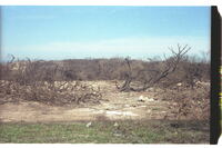
 South of University of Port Elizabeth
 Complete burn of veld.
-
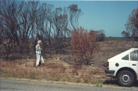
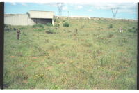
 South of University of Port Elizabeth but not on the campus itself
 Recent devastation by fire on an extensive scale.
-
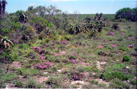
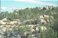 South slope of the northmost of the three Coega Kops, Port Elizabeth
 Several clumps of Euphorbia polygona, E. mauritanica, and a single E. ledienii. A few flowering Aloe striata, Coral aloe, Orthopterum coegana grows in this habitat.
-
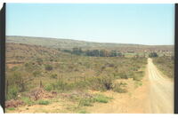
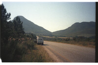 Southern approach to Kareedouw Pass from Tsitsikamma
 Road seen winding up to the nek into Langkloof beyond.
-
 Southern outskirt of Redhouse Village, Swartkops River valley, Port Elizabeth
 Typical grassveld, with patches of dense thorny scrub-bush growing nearby. Plants of yellow Alectra capensis visible. Swartkops-Uitenhage road in background passing over railway sideline to factory sites beyond. This area due for destruction under urban development.
-
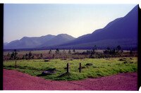
 Southern scarp of Gamtoos River, 8km east of Hankey
 River course at base.
-
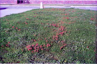 Southgate, Shopping Centre, Summerstrand, Port Elizabeth
 Massed Tritonia securigera on lawn. Brighton Drive in background.
-
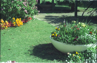
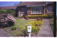 Spindless garden
 Flowers in garden.
-
 St. Georges Park Cemetary
 St. Georges Park Cemetary.
-
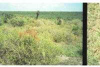
 St. Georges Strand between the Swartkops and Coega Rivers
 Stretch of open veld surrounded by dense Valley Bush. Fine place for wild flowers, soon to be covered by building development.
-
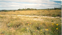
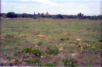
 St. Georges Strand, Port Elizabeth
 Patches of Sutera microphylla in open spaces between scrubby bushclumps. Likely to be replaced by housing.
-
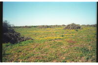
 St. Georges Strand, Port Elizabeth
 Cleared grasslands from dense bush with good spread of flowering Gazania krebsii. Likely to be replaced by housing.
-
 St. Georges Strand, Port Elizabeth
 Yellow-flowering Cineraria lobata. En mass as pioneer after dense bushveld cleared for housing estate. Note line of original bush cover in background. Mesembryanthemum cover had also come in.
-
 St. Georges Strand, Port Elizabeth north of Swartkops River mouth
 Cleared ground with Cotyledon adscendens coming up through a shrub. The darkness in the distance behind the aloe gives an idea of the density of local bushveld before clearance took place, a feature of this whole flat country between the Swartkops and Coega Rivers.
-
 Start of Robinson Trail into the Mountains at Loerie Reserve, Port Elizabeth
 Approach walk through overhanging Acacia karroo trees to the overnight-hut.
-
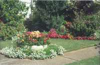
 Stephen's garden
 Flowers in garden.
-
 Stephen's garden
 Flowers in garden.
-
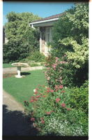 Stephen's garden, Port Elizabeth
 Stephen's garden.
-
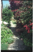 Stephen's garden, Port Elizabeth
 Stephen's garden.