Skip to main content
Pre 1910 Maps
Items
-
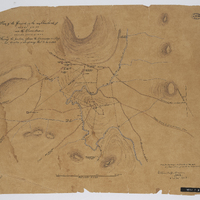 Plan of the ground in the neighbourhood of Block Drift near the Chumie River in Kaffirland : shewing the position whereon the commander in chief has directed a temporary post to be erected.
-
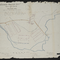
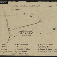 Free Church mission and Fort Hare : plan of the location and buildings
-
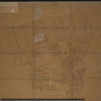 Sketch of Fort Beaufort : shewing private property ...
-
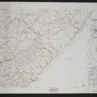 Transkei,Imperial map of the Cape Colony
-
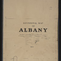 Divisional map of Albany
-
 General plan of the triangulation of the southern part of the Cape Colony 1859.1862
-
 General plan of East London harbour, South Africa
-
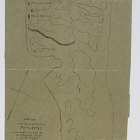
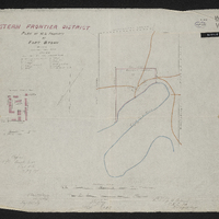
 Plan of Fort Natal : shewing the position occupied by the troops marked A
-
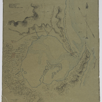
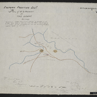
 Sketch of the point of land at Port Natal at present occupied by Her Majestry's troops
-
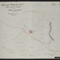
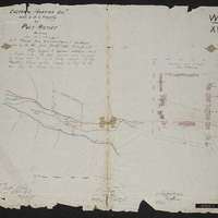 Eastern Frontier Dist. plan of W.D. property at Port Retief,Eastern Frontier District plan of War Department property at Port Retief
-
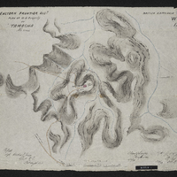 Eastern Frontier Dist. plan of W.D. property at Tamacha,Eastern Frontier District plan of War Department property at Tamacha
-
 Eastern Frontier Dist. plan of W.D. property at Fort Brown,Eastern Frontier District plan of War Department property at Fort Brown
-
 Eastern Frontier Dist. plan of W.D. property at Keiskamma Hoek,Eastern Frontier District plan of War Department property at Keiskamma Hoek
-
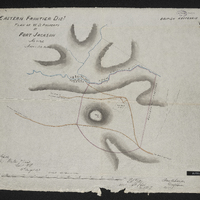 Eastern Frontier Dist. plan of W.D. property at Fort Jackson,Eastern Frontier District plan of War Department property at Fort Jackson
-
 Eastern Frontier Dist. plan of W.D. property at Windvogelberg,Eastern Frontier District plan of War Department property at Windvogelberg
-
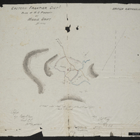 Eastern Frontier Dist. plan of W.D. property at Middle Drift,Eastern Frontier District plan of War Department property at Middle Drift
-
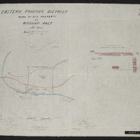 Eastern Frontier Dist. plan of W.D. property at Koonap Post,Eastern Frontier District plan of War Department property at Koonap Post
-
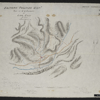 Eastern Frontier Dist. plan of W.D. property at Line Drift,Eastern Frontier District plan of War Department property at Line Drift
-
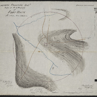 Eastern Frontier Dist. plan of W.D. property at Fort White,Eastern Frontier District plan of War Department property at Fort White
-
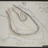 Eastern Frontier Dist. plan of W.D. property at Eland's Post,Eastern Frontier District plan of War Department property at Eland's Post
-
 Eastern Frontier Dist. plan of W.D. property at the Dohne,Eastern Frontier District plan of War Department property at the Dohne
-
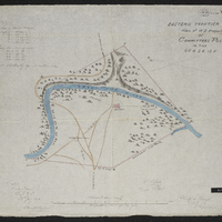 Eastern Frontier Dist. plan of W.D. property at Committees Post,Eastern Frontier District plan of War Department property at Committees Post
-
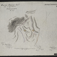
 Eastern Frontier Dist. plan of W.D. property at Fort Chumie,Eastern Frontier District plan of War Department property at Fort Chumie
-
 Cape of Good Hope Command Eastern Frontier Division - Cawood's Post: plan of War Department property around old post
-
 Map of the country from Algoa Bay to the Great Kei River, Cape of Good Hope : being the eastern frontier and the country of the adjacent kaffirs compiled under the direction of Lieut. Colonel Piper, comg. Royal Engr., from the original surveys in the Royal Engineer Office, Cape Town, and other documents furnished by the Surveyor General's Department.