Skip to main content
Pre 1910 Maps
Items
-
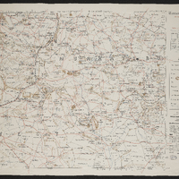
 Missionary map of the Queenstown district showing Methodist, Anglican, Moravian, United Presbyterian and Free Church of Scotland stations
-
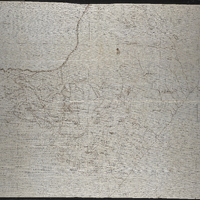
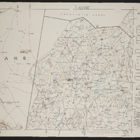
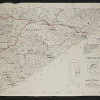
 Topographical map of the division of Albany
-
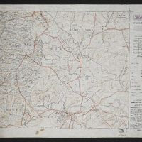
 Outline maps of the territory between the Kei and Bashee Rivers
-
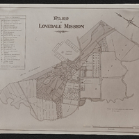 Lovedale,Plan of Lovedale mission 1902,South Africa 1:50000 sheet
-
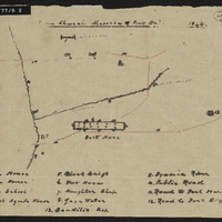
 Survey of a portion of the Kat River Settlement shewing the colonial boundary from Fort Beaufort to the Kat Berg, the military post at Fort Armstrong, Elands [Post], Mancasana and the abandoned posts at Echardts and Warden's.
-
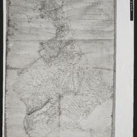
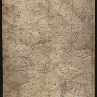 Transvaal
-
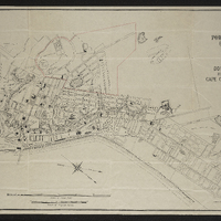 Plan of Port Elizabeth (Cape Colony)
-
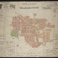 Plan of the city of Grahamstown
-
 Sketch map of Natal No. 1
-
 Map of the district of Matatliela
-
 Murraysburg,Imperial map of South Africa : Murraysburg
-
 Salt pan,Imperial map of South Africa : Salt Pan
-
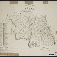
 Maclear,Imperial map of South Africa : Maclear
-
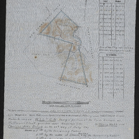 Diagram of the farm Wilton, being a portion of the farm known as Hoffman's Kloof
-
 Albany district farms, 1818-1874
-
 Carel's Rust Farm
-
 Melville Park Farm
-
 Butler's party
-
 Spion Kop : area of operations Jan 17th to 26th 1900
-
 King William's Town,cartographic
-
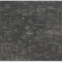 Grahamstown and surrounding farms
-
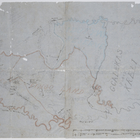
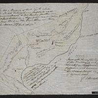 Sketch of the lands, the property of the Free Church and Charles Stretch
-
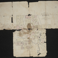
 Plan of Lovedale
-
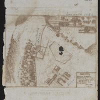
 Free Church mission and Fort Hare : plan of the location and buildings
-
 Free Church mission and Fort Hare : plan of the location and buildings