Skip to main content
The Development of Settler Towns
Items
-
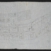
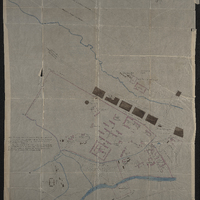 Eastern Frontier District : King William's Town : general plan of W.D. property,Eastern Frontier District : King William's Town : general plan of War Department property
-
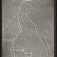
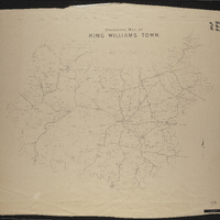 Divisional map of King William's Town
-
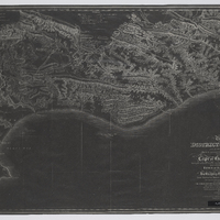
 General plan of East London harbour, South Africa
-
 Cape of Good Hope Command Eastern Frontier Division - Cawood's Post: plan of War Department property around old post
-
 The district of Albany, formerly t'Zuureveld
-
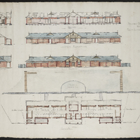
 Proposed buildings on Block no 2968 Port Alfred for F.H. Schoeder, Esqr.
-
 Proposed bathing Pavilion for Port Alfred Municipality
-
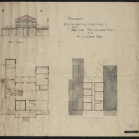 Proposed extensions and alterations to Sea View Port Alfred East for A. Larsen Esq.
-
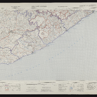
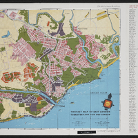 Tourist map of East London, Toeristekaart van Oos-London
-
 3326AC Alicedale, Alicdle 3326AC, Topo-cadastral series, Topo-kadastrale reeks, South Africa 1:50000 sheet, Suid-Afrika 1:50000 vel
-
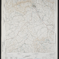
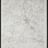 3227CD King William's Town, King William's Town 3227CD, South Africa 1:50000 sheet, Suid Afrika 1:50000 vel
-
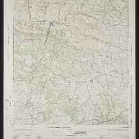
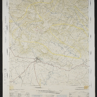
 3227AC Cathcart, South Africa 1:50000 sheet
-
 3226DD Alice, Alice 3226DD, Topo-cadastral series, Topo-kadastrale reeks
-
 3226CA Bedford, South Africa 1:50000 sheet
-
 Palingkloof 3226AA, Topo-cadastral series, Topo-kadastrale reeks, South Africa 1:50000 sheet, Suid-Afrika 1:50000 vel
-
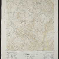
 3126 Queenstown, Queenstown 3126, Topo-cadastral series, Topo-kadastrale reeks
-
 East London 3326, 3326 East London, Topo-cadastral series, Topo-kadastrale reeks
-
 Lovedale, Alice, South Africa 1:50000 sheet
-
 A general plan of Cradock
-
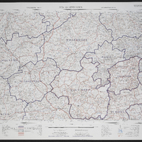
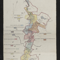 Map of the Great Fish River Irrigation Board (as per government proclamation no. 63 of 1920 : showing the areas under minor boards and private schemes)
-
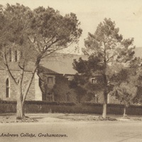 Postcard of Upper House, St Andrews College, Grahamstown
-
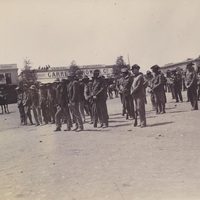 Cradock: a view of the sentencing of rebels during the South African War, 1899-1902
-
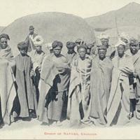 Postcard - group of natives, Cradock, 1893
-
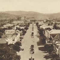 High Street - Grahamstown - from the Cathedral spire
-
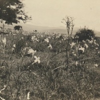 Cradock: Commonage scenes with tulips