Skip to main content
The Frontier Wars
Items
-
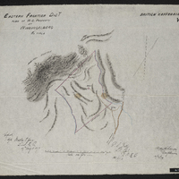
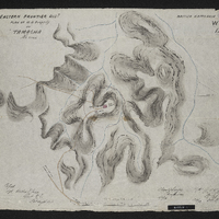 Eastern Frontier Dist. plan of W.D. property at Tamacha,Eastern Frontier District plan of War Department property at Tamacha
-
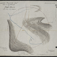
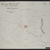
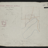 Eastern Frontier Dist. plan of W.D. property at Fort Brown,Eastern Frontier District plan of War Department property at Fort Brown
-
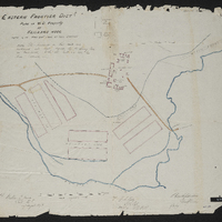 Eastern Frontier Dist. plan of W.D. property at Keiskamma Hoek,Eastern Frontier District plan of War Department property at Keiskamma Hoek
-
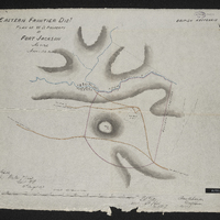 Eastern Frontier Dist. plan of W.D. property at Fort Jackson,Eastern Frontier District plan of War Department property at Fort Jackson
-
 Eastern Frontier Dist. plan of W.D. property at Windvogelberg,Eastern Frontier District plan of War Department property at Windvogelberg
-
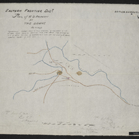
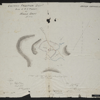 Eastern Frontier Dist. plan of W.D. property at Middle Drift,Eastern Frontier District plan of War Department property at Middle Drift
-
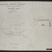 Eastern Frontier Dist. plan of W.D. property at Koonap Post,Eastern Frontier District plan of War Department property at Koonap Post
-
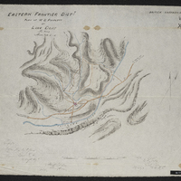 Eastern Frontier Dist. plan of W.D. property at Line Drift,Eastern Frontier District plan of War Department property at Line Drift
-
 Eastern Frontier Dist. plan of W.D. property at Fort White,Eastern Frontier District plan of War Department property at Fort White
-
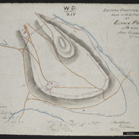 Eastern Frontier Dist. plan of W.D. property at Eland's Post,Eastern Frontier District plan of War Department property at Eland's Post
-
 Eastern Frontier Dist. plan of W.D. property at the Dohne,Eastern Frontier District plan of War Department property at the Dohne
-
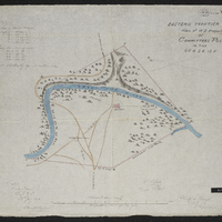 Eastern Frontier Dist. plan of W.D. property at Committees Post,Eastern Frontier District plan of War Department property at Committees Post
-
 Eastern Frontier Dist. plan of W.D. property at Fort Chumie,Eastern Frontier District plan of War Department property at Fort Chumie
-
 Map of the country from Algoa Bay to the Great Kei River, Cape of Good Hope : being the eastern frontier and the country of the adjacent kaffirs compiled under the direction of Lieut. Colonel Piper, comg. Royal Engr., from the original surveys in the Royal Engineer Office, Cape Town, and other documents furnished by the Surveyor General's Department.
-
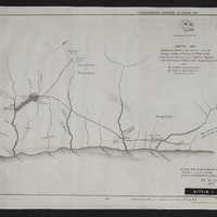 Sketch map shewing the route of the mission under the change of Captain Delancy, 75th Regt. to the chiefs Creli - the successor to Hintza - Vadana of the Tambookies and Faku of the Amapondas in 1836 - also the grant (coloured green) by Crieli to the British
-
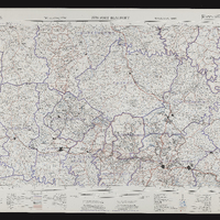
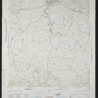 Fort Beaufort 3226DC, 3226DC Fort Beaufort, South Africa 1:50000 topo-cadastral sheet, Suid Afrika 1:50000 topo-kadastrale vel
-
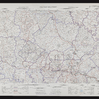 Fort Beaufort 3226, 3226 Fort Beaufort, Topo-cadastral series, Topo-kadastrale reeks
-
 Fort Beaufort 3226, 3226 Fort Beaufort, South Africa 1:25000 topo-cadastral sheet, Suid Afrika 1:25000 topo-kadastrale vel
-
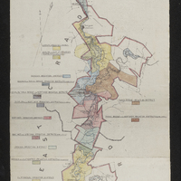 Map of the Great Fish River Irrigation Board (as per government proclamation no. 63 of 1920 : showing the areas under minor boards and private schemes)
-
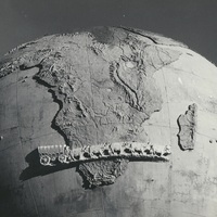
 Closeup view of the Karel Landman Monument
-
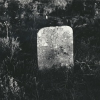 A soldier's grave at Fort Wiltshire (Willshire)
-
 Closeup view of the Karel Landman Monument
-
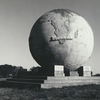 View of the Karel Landman Monument
-
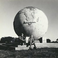 View of the Karel Landman Monument with F G Butler and Ken Robinson seated on the steps
-
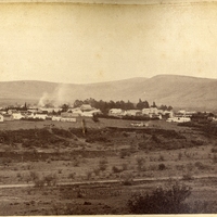 Fort Beaufort